MyTopo
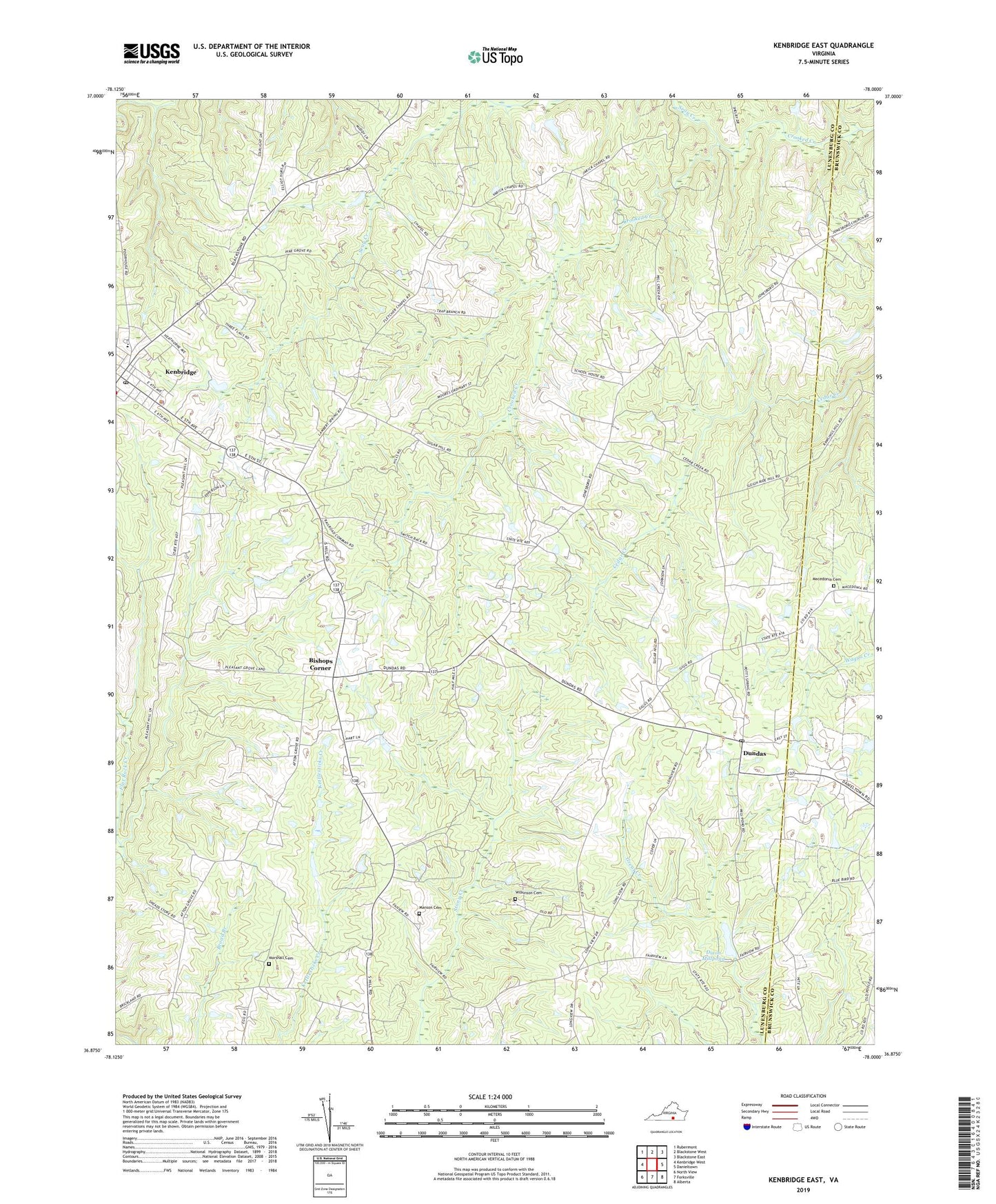
Kenbridge East Virginia US Topo Map
Couldn't load pickup availability
2022 topographic map quadrangle Kenbridge East in the state of Virginia. Scale: 1:24000. Based on the newly updated USGS 7.5' US Topo map series, this map is in the following counties: Lunenburg, Brunswick. The map contains contour data, water features, and other items you are used to seeing on USGS maps, but also has updated roads and other features. This is the next generation of topographic maps. Printed on high-quality waterproof paper with UV fade-resistant inks.
Quads adjacent to this one:
West: Kenbridge West
Northwest: Rubermont
North: Blackstone West
Northeast: Blackstone East
East: Danieltown
Southeast: Alberta
South: Forksville
Southwest: North View
This map covers the same area as the classic USGS quad with code o36078h1.
Contains the following named places: Asbury School, Bishops Corner, Cedar Creek Church, Dixon Millpond, Dixons Dam, Dundas, Dundas Post Office, Fletchers Chapel, Friendship Church, Gulifield Church, Hounds Creek District, Kenbridge Baptist Church, Kenbridge Elementary School, Kenbridge Emergency Squad, Kenbridge Police Department, Kenbridge Post Office, Kenbridge United Methodist Church, Lunenburg Country Club, Macedonia Cemetery, Macedonia Church, Manson Cemetery, Marshall Cemetery, Oak Grove Church, Perserverance Church, Providence Church, Rosebud Church, Saint Marks Church, Seay Creek, Starlight Church, Varicks Chapel, Wilkinson Cemetery