MyTopo
Gladstone Virginia US Topo Map
Couldn't load pickup availability
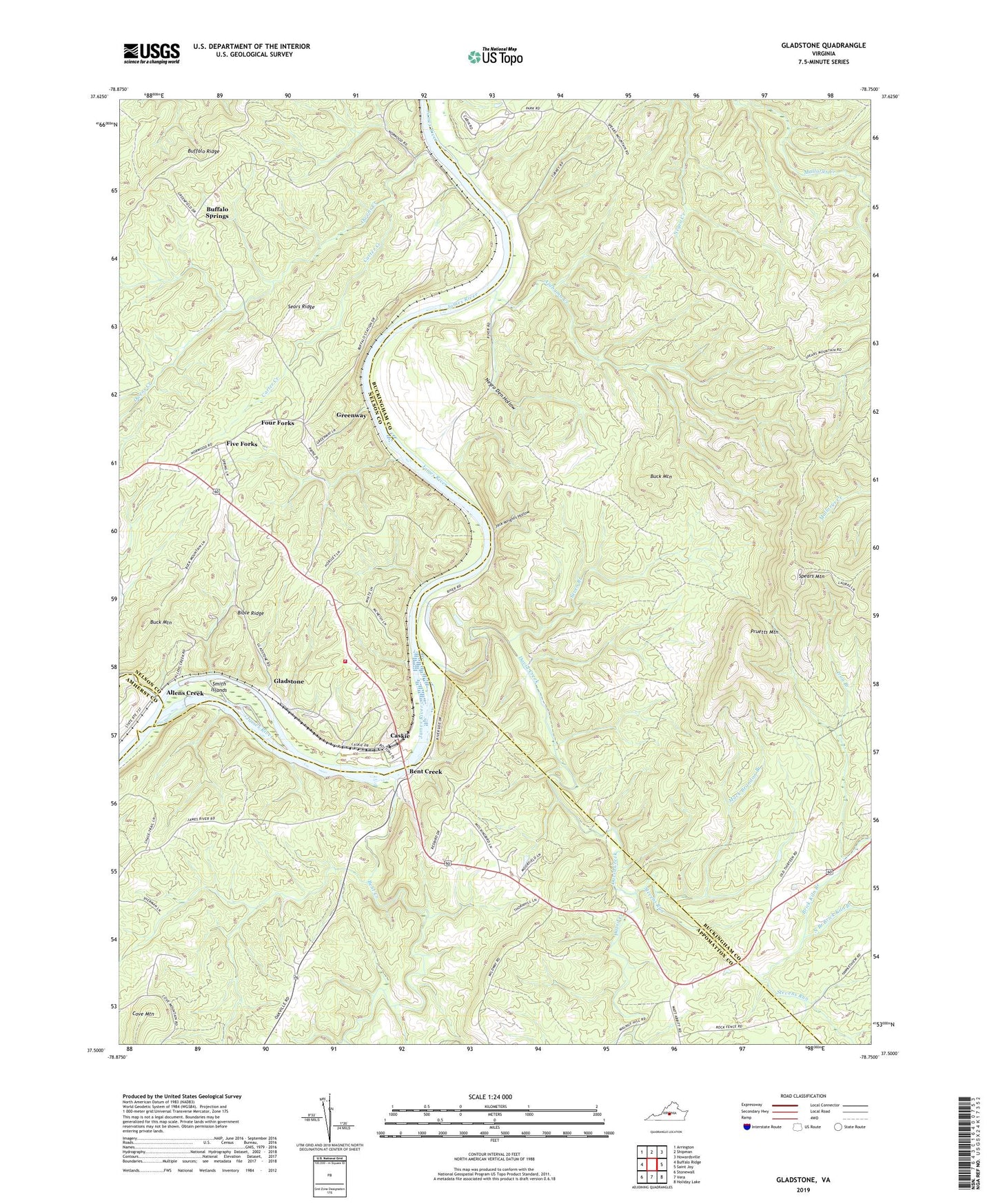
2019 topographic map quadrangle Gladstone in the state of Virginia. Scale: 1:24000. Based on the newly updated USGS 7.5' US Topo map series, this map is in the following counties: Buckingham, Nelson, Appomattox, Amherst. The map contains contour data, water features, and other items you are used to seeing on USGS maps, but also has updated roads and other features. This is the next generation of topographic maps. Printed on high-quality waterproof paper with UV fade-resistant inks.
Quads adjacent to this one:
West: Buffalo Ridge
Northwest: Arrington
North: Shipman
Northeast: Howardsville
East: Saint Joy
Southeast: Holiday Lake
South: Vera
Southwest: Stonewall
Contains the following named places: Alabama Creek, Allens Creek, Bent Creek, Bible Ridge, Brick Kiln Branch, Buck Mountain, Buffalo Springs, Buffalo Station, Carter Creek, Caskie, Cove Mountain, David Creek, Eldridge Corner, Five Forks, Four Forks, Gladstone, Gladstone Rescue Squad, Gladstone School, Gladstone Volunteer Fire Department, Greenway, Iron Branch, Jack Wrights Hollow, Mack Brandon Branch, Maple Grove Baptist Church, Migginsons Ferry, Mineral Springs Church, Negro Den Hollow, North Branch Brick Kiln Branch, Owens Creek, Pruetts Mountain, Sears Ridge, Second Mineral Springs Church, Seven Branch, Smith Islands, Spears Mountain, Stevens Run, Tower Hill, ZIP Code: 24553