MyTopo
Shipman Virginia US Topo Map
Couldn't load pickup availability
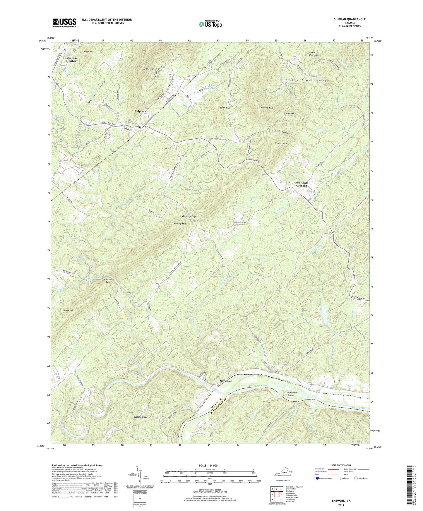
2022 topographic map quadrangle Shipman in the state of Virginia. Scale: 1:24000. Based on the newly updated USGS 7.5' US Topo map series, this map is in the following counties: Nelson, Buckingham. The map contains contour data, water features, and other items you are used to seeing on USGS maps, but also has updated roads and other features. This is the next generation of topographic maps. Printed on high-quality waterproof paper with UV fade-resistant inks.
Quads adjacent to this one:
West: Arrington
Northwest: Horseshoe Mountain
North: Lovingston
Northeast: Schuyler
East: Howardsville
Southeast: Saint Joy
South: Gladstone
Southwest: Buffalo Ridge
This map covers the same area as the classic USGS quad with code o37078f7.
Contains the following named places: Bethany Church, Bethel Church, Bobs Creek, Canada Gap, Christ Church, Coon Hollow, Cunninghams Island, Davis Pond, Dillard Creek, Edge Hill, Edwards Branch, Fairmount Church, Findlay Mountain, Gleasons Gap, Gordon Crossing, Hebron Church, High Peak, Joe Creek, Lakeview Heights, Little Joe Creek, Little Piney Mountain, Lovingston District, Mallorys Creek, Meadow Creek, Montreal Church, Negro Creek, Nero Creek, Norwood, Payne Pond, Peavine Mountain, Piney Mountain, Pleasant Grove Baptist Church, Purvis Hollow, Red Apple Orchard, Rucker Run, Ryan Elementary School, Saint Johns Church, Saint Marys Church, Sally Powell Hollow, Shipman, Shipman Census Designated Place, Shipman Post Office, South District, Thomas Mountain, Tye River, Union Hill Creek, Variety Mills, Welsh Mountain, ZIP Codes: 22971, 24581