MyTopo
Arrington Virginia US Topo Map
Couldn't load pickup availability
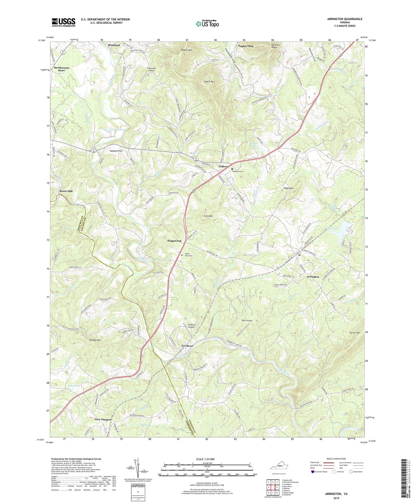
2022 topographic map quadrangle Arrington in the state of Virginia. Scale: 1:24000. Based on the newly updated USGS 7.5' US Topo map series, this map is in the following counties: Nelson, Amherst. The map contains contour data, water features, and other items you are used to seeing on USGS maps, but also has updated roads and other features. This is the next generation of topographic maps. Printed on high-quality waterproof paper with UV fade-resistant inks.
Quads adjacent to this one:
West: Piney River
Northwest: Massies Mill
North: Horseshoe Mountain
Northeast: Lovingston
East: Shipman
Southeast: Gladstone
South: Buffalo Ridge
Southwest: Amherst
This map covers the same area as the classic USGS quad with code o37078f8.
Contains the following named places: Allen Creek, Arrington, Arrington Census Designated Place, Arrington Post Office, Black Creek, Brown Creek, Bryant Mountain, Cabell Mountain, Calvary Church, Camp Creek, Centenary Church, Colleen, Crits Mountain, Diggs Mountain, Flatwoods Airport, Freshwater Cove, Geddes Mountain, Hat Creek, Hendersons Store, Hubbard Hill, Jennys Creek, Jones Creek, Jones Pond, Kingswood, Little Zion Church, Long Branch, Naked Creek, Nelson County High School, Nelson County Rescue Squad Station 2, Nelson Dam, Nelson Lake, Nelson Middle School, New Glasgow, New Mount Church, Oak Grove Church, Oak Ridge, Pine Hill Church, Piney River, Poplar Flat Baptist Church, Poplar Flats, Rose Union Church, Roseland, Roses Mill, Saint Stephens Church, Saunders Pond, Starr Airport, Stevens Cove, Stevens Lake, Stevens Lake Dam, Town Creek, Trinity Church, Turner Mountain, Tye River, Tye River Airport, Tye River Elementary School, Watts Dam, White Rock Cemetery, White Rock Church, Woodland Cemetery, Woodland Church, ZIP Codes: 22922, 22964