MyTopo
Gressitt Virginia US Topo Map
Couldn't load pickup availability
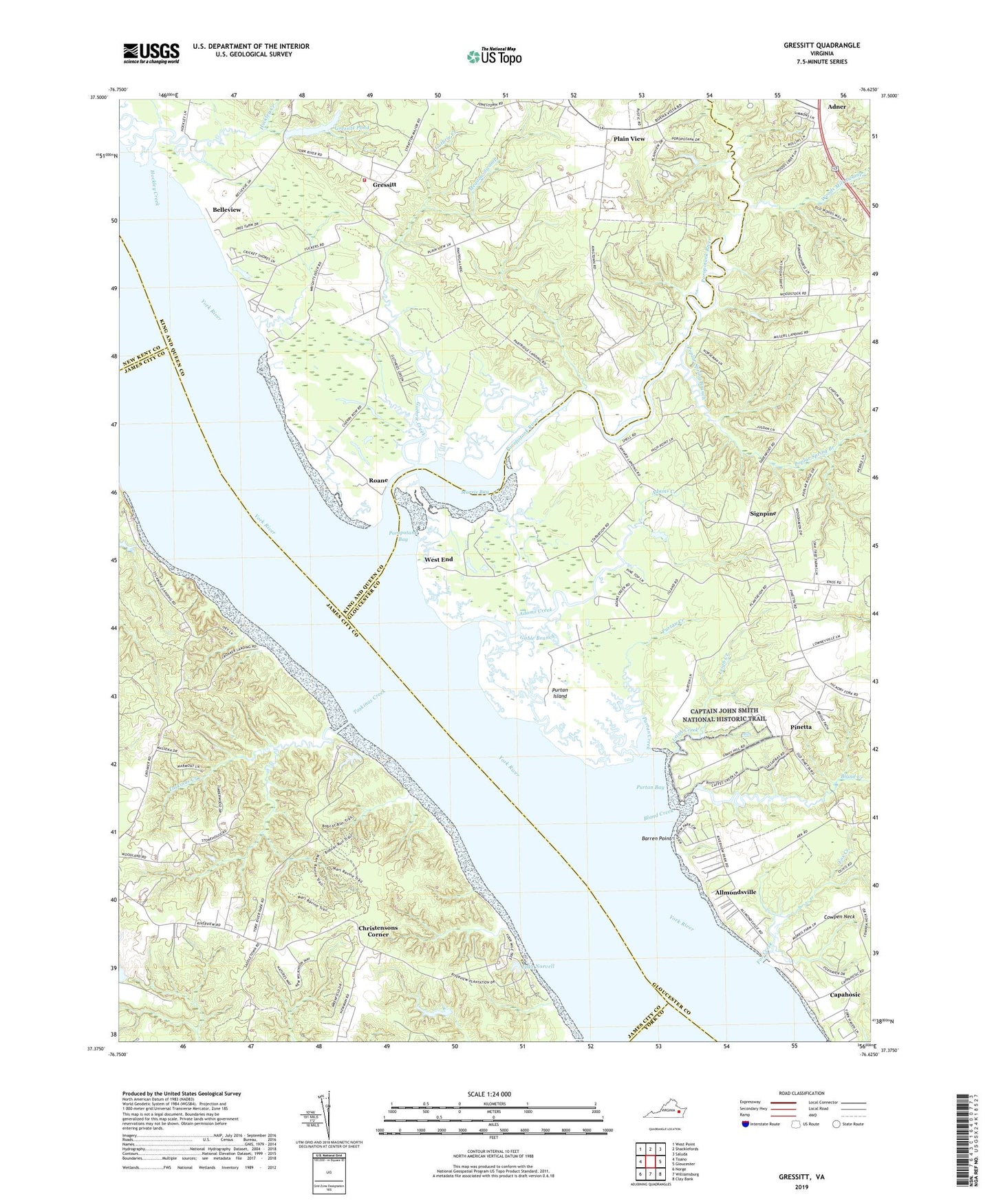
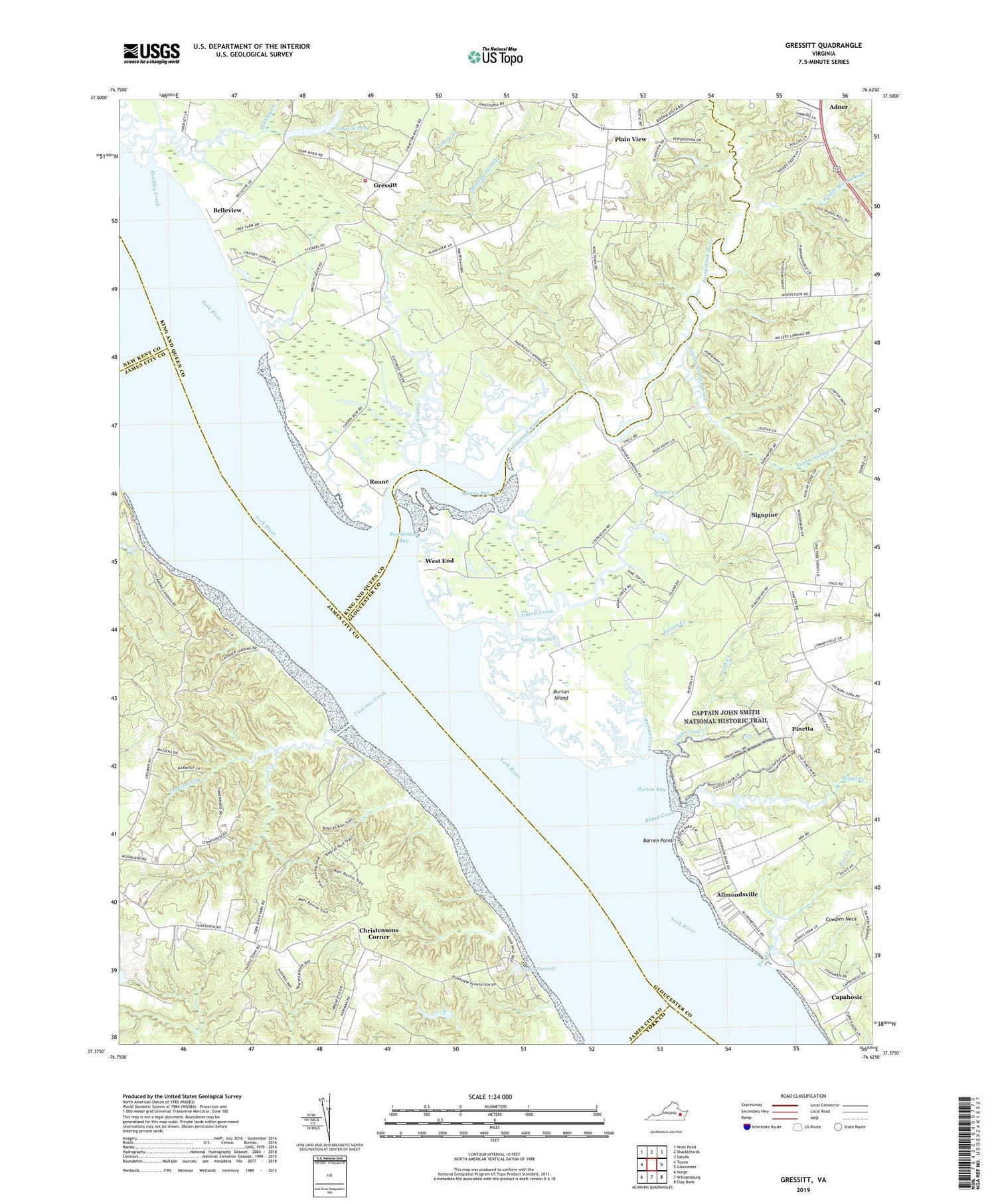
2019 topographic map quadrangle Gressitt in the state of Virginia. Scale: 1:24000. Based on the newly updated USGS 7.5' US Topo map series, this map is in the following counties: Gloucester, King and Queen, James City, New Kent, York. The map contains contour data, water features, and other items you are used to seeing on USGS maps, but also has updated roads and other features. This is the next generation of topographic maps. Printed on high-quality waterproof paper with UV fade-resistant inks.
Quads adjacent to this one:
West: Toano
Northwest: West Point
North: Shacklefords
Northeast: Saluda
East: Gloucester
Southeast: Clay Bank
South: Williamsburg
Southwest: Norge
Contains the following named places: Adams Creek, Adner, Allmonds Wharf, Allmondsville, Barren Point, Bell Rock Lighthouse, Belleview, Bland Creek, Capahosic, Capahosic Landing, Captain John Smith National Historic Trail, Christensons Corner, Cowpen Neck, Croaker Landing, Croaker Landing Boat Ramp, Fox Creek, Gable Branch, Gressitt, Gressitt Pond, Gressitts Dam, Guthrie Creek, Haywood Landing, Hockley Creek, Indian Creek, Lake Norvell, Laurelwoods Estates Mobile Home Park, Leigh Creek, Lower King and Queen Volunteer Fire Department - Grassit Station, Meadow Swamp, Miller Landing, Millers Landing Boat Ramp, Morning Glory Church, Morris Bay, Mount Folly, Partridge Landing, Pinetta, Plain View, Poplar Spring Branch, Poropotank Bay, Poropotank River, Purtan Bay, Purtan Creek, Purtan Island, Red Bank Landing, Roane, Shacklefords Chapel, Signpine, Sycamore Landing, Tanyard Landing, Tanyard Landing Boat Ramp, Taskinas Creek, Tradition Golf Club at Kiskiack, Tuckers Marina, Violet Bank, West End, Woods Mill Swamp, York River State Park