MyTopo
Haynesville Virginia US Topo Map
Couldn't load pickup availability
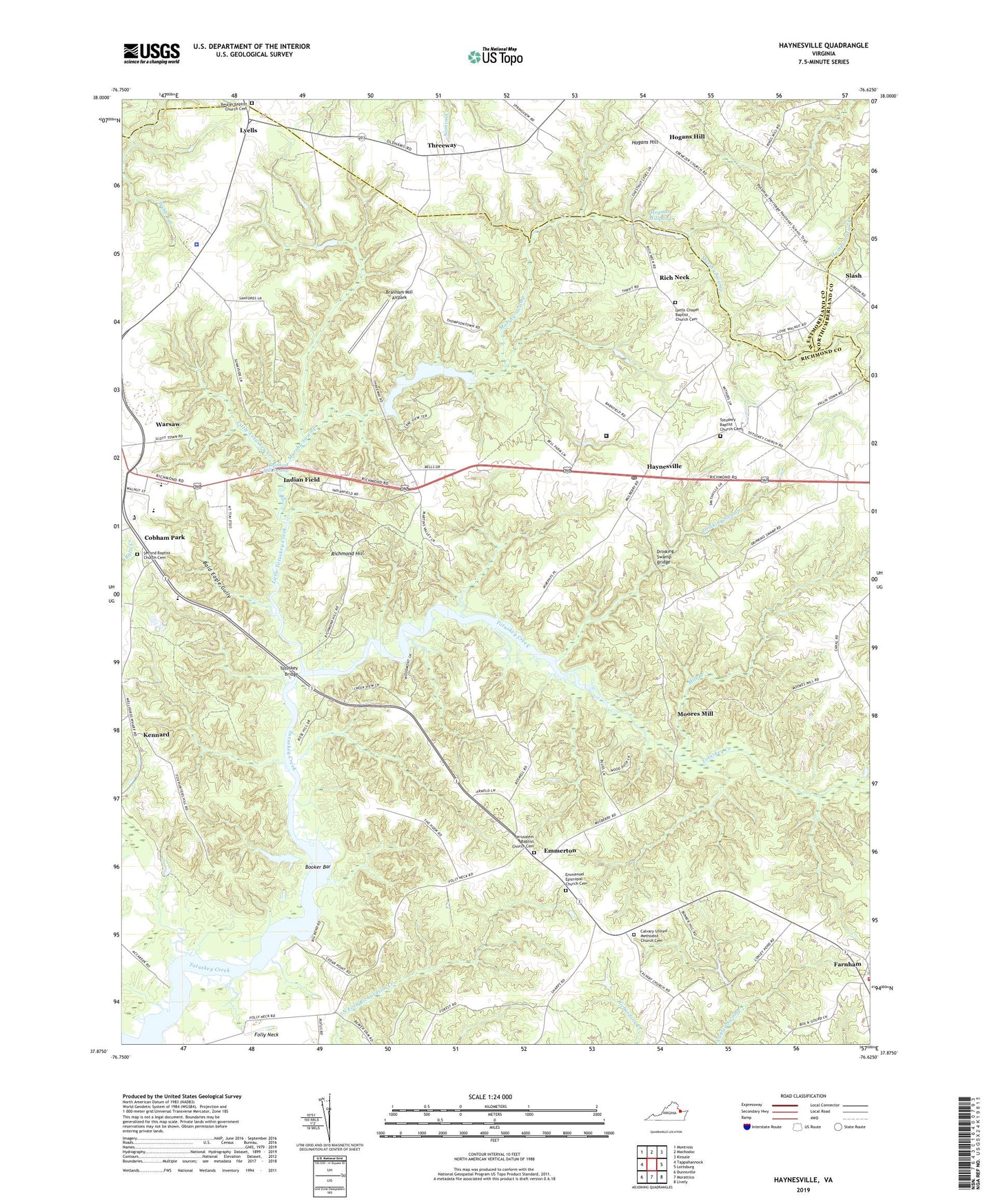
2019 topographic map quadrangle Haynesville in the state of Virginia. Scale: 1:24000. Based on the newly updated USGS 7.5' US Topo map series, this map is in the following counties: Richmond, Westmoreland, Northumberland. The map contains contour data, water features, and other items you are used to seeing on USGS maps, but also has updated roads and other features. This is the next generation of topographic maps. Printed on high-quality waterproof paper with UV fade-resistant inks.
Quads adjacent to this one:
West: Tappahannock
Northwest: Montross
North: Machodoc
Northeast: Kinsale
East: Lottsburg
Southeast: Lively
South: Morattico
Southwest: Dunnsville
Contains the following named places: Bald Eagle Gully, Belle Ville, Beulah Baptist Church Cemetery, Beulah Church, Bladensfield Plantation, Booker Bar, Branham Mill Airpark, Branham Mill Swamp, Calvary Church, Calvary United Methodist Church Cemetery, Cedar Point Landing, Church of God of Warsaw, Cobham Park, Cobham Park Baptist Church, Cobham Park School, Deep Landing, District 1, District 2, Drinking Swamp, Drinking Swamp Bridge, Emmanuel Episcopal Church, Emmanuel Episcopal Church Cemetery, Emmerton, Farnham Church, Folly Neck, Folly School, Gardy Mill, Gardys Millpond, Garlands Dam, Garlands Mill, Garlands Millpond, Good Shepherd Mission, Haynesville, Haynesville Correctional Center, Haynesville Correctional Center Unit 17, Haynesville Post Office, Haynesville School, Hogans Hill, Hogans Mill Dam, Hogans Millpond, Indian Field, Jerusalem Baptist Church Cemetery, Jerusalem Church, Kennard, Little Totuskey Creek, Lyells, Lyells Chapel, Lyells Chapel Baptist Church Cemetery, Marshy Swamp, Mill Branch, Moores Mill, Mulberry Church, North Bend Landing, Northern Neck Vocational Technical Center, Phillips Landing, Rappahannock High School, Rich Neck, Richmond County, Richmond County Elementary School, Richmond County Intermediate School, Richmond County Rescue Squad, Richmond County Volunteer Fire Department Station 2, Richmond Hill, Richmond Hill Plantation, School Landing, Second Baptist Church Cemetery, Shipyard Landing, Slash, State Prison Camp Number 17, Threeway, Totuskey Baptist Church Cemetery, Totuskey Bridge, Totuskey Church, Totuskey Ferry, Town of Warsaw Aerated Lagoons, Virginia State Police Division 1 Area 2 Office, Wilberts Corner, Yellowbank Landing