MyTopo
Morattico Virginia US Topo Map
Couldn't load pickup availability
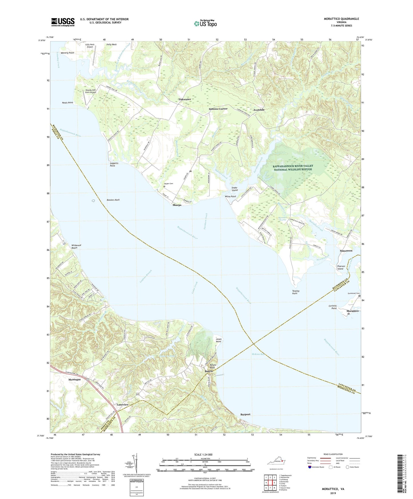
2022 topographic map quadrangle Morattico in the state of Virginia. Scale: 1:24000. Based on the newly updated USGS 7.5' US Topo map series, this map is in the following counties: Richmond, Essex, Middlesex, Lancaster. The map contains contour data, water features, and other items you are used to seeing on USGS maps, but also has updated roads and other features. This is the next generation of topographic maps. Printed on high-quality waterproof paper with UV fade-resistant inks.
Quads adjacent to this one:
West: Dunnsville
Northwest: Tappahannock
North: Haynesville
Northeast: Lottsburg
East: Lively
Southeast: Urbanna
South: Church View
Southwest: Truhart
This map covers the same area as the classic USGS quad with code o37076g6.
Contains the following named places: Bayport, Bowlers Ferry, Bowlers Rock, Bowlers Rock Lighthouse, Butylo, Butylo Bluff, Canoe House Landing, Cedar Creek, Cedar Creek Dam, Cedar Creek Lower Dam, Cedar Creek Pond, Conley Swamp, Curletts Point, Ebenezer Church, Ebenezer School, Emmanuel Cemetery, Emmanuel Church, Farnham Creek, Folly Neck Airport, Garretts Landing, Garrett's Marina, Hatters Creek, Ivondale, Jones Point, Lancaster Creek, Laneview, Laton Swamp, Layton Landing, Laytons Branch, Mark Haven Beach, Marshall Dam, Masons Mill Swamp, McKans Bay, Milden Cemetery, Milden Presbyterian Church, Mill Branch, Montague, Morattico, Morattico Creek, Morattico Post Office, Morattico Swamp, Myrtle Swamp, Neals Point, Nimcock, North Fork Richardson Creek, Oakley Landing, Pearson Island, Perch Creek, Richardson Creek, School Number 5, Shandy Hall Farm, Shandy Hall Farm Airport, Sharps, Sharps Post Office, Simons Corner, Simonson, Snake Island, Suggetts Point, Tarpley Point, Tidewater, Totuskey Creek, Waverly Point, Whelan's Marina, Whelan's Marina Campground, Whilans Marina, Wildwood Beach, Wilna Point, ZIP Codes: 22504, 22548