MyTopo
Montross Virginia US Topo Map
Couldn't load pickup availability
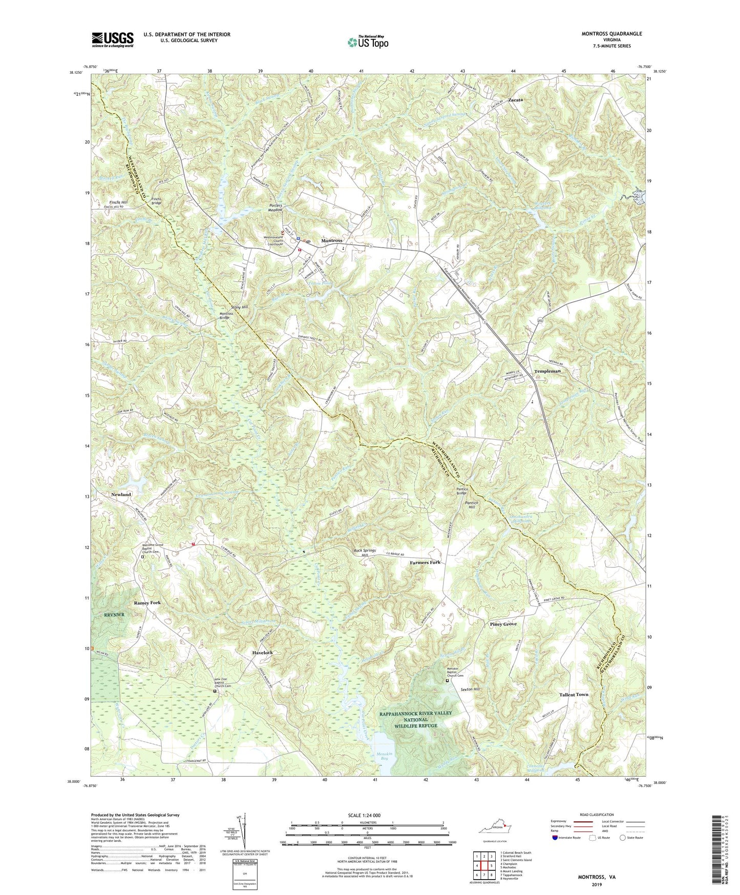
2022 topographic map quadrangle Montross in the state of Virginia. Scale: 1:24000. Based on the newly updated USGS 7.5' US Topo map series, this map is in the following counties: Westmoreland, Richmond. The map contains contour data, water features, and other items you are used to seeing on USGS maps, but also has updated roads and other features. This is the next generation of topographic maps. Printed on high-quality waterproof paper with UV fade-resistant inks.
Quads adjacent to this one:
West: Champlain
Northwest: Colonial Beach South
North: Stratford Hall
Northeast: Saint Clements Island
East: Machodoc
Southeast: Haynesville
South: Tappahannock
Southwest: Mount Landing
This map covers the same area as the classic USGS quad with code o38076a7.
Contains the following named places: Abundant Life Christian Ministries, Andrew Chapel United Methodist Church, Bailey Swamp, Belfield Creek, Black Swamp, Bowen Swamp, Bumbers Branch, Canal Swamp, Chandlers Mill Dam, Chandlers Mill Run, Chandlers Millpond, Connellee Mill, Connellee Millpond, County Line Fork, Crookhorn Branch, Crusenberry Meadow, Davis Branch, District 5, East End, East End Church, Farmers Fork, Finchs Branch, Finchs Bridge, Finchs Hill, Galilee Church, Germans Corner, Grandmammy Swamp, Hall Branch, Havelock, Johnson High School, Jones Branch, Kenna Swamp, Lawrence Swamp, Lebanon Church, Lyell Branch, Meadow Farm, Menokin Baptist Church Cemetery, Menokin Bay, Menokin Church, Menokin Farm, Menokin Landing, Menokin Mill, Menokin Millpond, Mitchell Run, Montross, Montross Branch Central Rappahannock Regional Library, Montross Bridge, Montross District, Montross Middle School, Montross Police Department, Montross Post Office, Montross Rescue Squad Station 3, Montross Town Hall, Montross Volunteer Rescue Squad Station 3, Nanny Sanford Swamp, New Zion Baptist Church Cemetery, New Zion Church, Newland, Newland School, Nomini Baptist Church, Nomini School, Northern Neck Historical Society Research Library, Omohundra Millpond, Omohundra Millpond Dam, Omohundra Run, Omohundro Mill, Pantico Bridge, Pantico Hill, Pantico Run, Parker Run, Piney Grove, Piney Grove School, Poorhouse Swamp, Porridge Pot, Porters Meadow, Ramey Fork, Reeds Swamp, Richmond County Volunteer Fire Department Station 3, Rock Springs Hill, Ruin Branch, Saint James Episcopal Church, Scates Branch, Scates Millstream, Sexton Hill, Sexton Hill Branch, Siloam Church, Sisson Run, Springfield Branch, Stony Hill, Synder Swamp, Tallent Town, Templeman, The Big Swamp, The Gladys H Oberle School Montross Campus, Town of Montross, Travis Dam, Travis Pond, Washington and Lee High School, Weavers Dam, Weavers Mill, Weavers Millpond, Webb Run, Welcome Grove Baptist Church Cemetery, Welcome Grove Church, Westmoreland County, Westmoreland County Courthouse, Westmoreland County Montross Transfer Station, Westmoreland County Museum, Westmoreland County Sheriff's Office, Westmoreland Volunteer Fire Department Engine Company 2, Woodville Creek, Woodville Farm, Zacata, Zacata School, ZIP Code: 22520