MyTopo
Hillsville Virginia US Topo Map
Couldn't load pickup availability
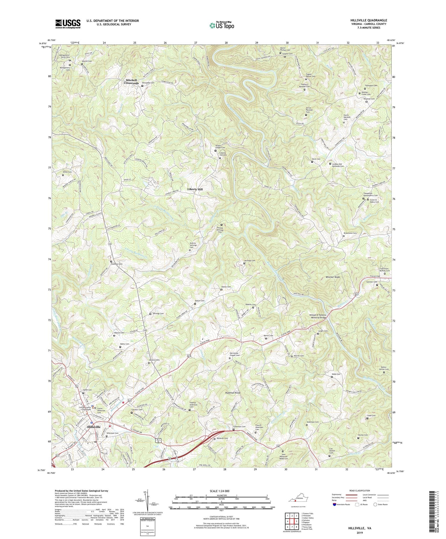
2022 topographic map quadrangle Hillsville in the state of Virginia. Scale: 1:24000. Based on the newly updated USGS 7.5' US Topo map series, this map is in the following counties: Carroll. The map contains contour data, water features, and other items you are used to seeing on USGS maps, but also has updated roads and other features. This is the next generation of topographic maps. Printed on high-quality waterproof paper with UV fade-resistant inks.
Quads adjacent to this one:
West: Sylvatus
Northwest: Fosters Falls
North: Hiwassee
Northeast: Indian Valley
East: Dugspur
Southeast: Laurel Fork
South: Fancy Gap
Southwest: Woodlawn
This map covers the same area as the classic USGS quad with code o36080g6.
Contains the following named places: Alderman Cemetery, Alfred Marshall Cemetery, Allison Chapel, Allison Chapel Cemetery, Andrew Jennings Cemetery, Beaverdam Creek, Bethel Church, Bobbitt Cemetery, Bobbitt Creek, Branscome Cemetery, Buckhorn Creek, Burks Fork, Camp Virginian, Can Horton Cemetery, Carroll County Fire and Rescue, Carroll County High School, Carroll County Intermediate School, Carroll County Sheriff's Office, Carter-Wilkerson Cemetery, Church Alderman Cemetery, Collier School, Dalton Cemetery, Dalton-Horton Cemetery, Davis Cemetery, DeHaven Cemetery, Dinwiddie Cemetery, Dinwiddie Church, Easrly Marshall Cemetery, Fairview Church, Freemont Cemetery, Freemont Church, Fugate Dalton Cemetery, Gallimore-McPeak Cemetery, Gardner Cemetery, Gilmer Chapel, Goad Cemetery, Goad Church, Goad School, Grassy Creek, Grassy Creek Church, Green B Mabry Cemetery, Harmony Grove Church, Hillsville, Hillsville Elementary School, Hillsville Police Department, Hillsville Post Office, Hillsville Volunteer Fire Department, Horton Cemetery, Huffman Knob, Island Creek, Island Creek Church, Jennings Cemetery, John Patterson Webb Cemetery, Largen Cemetery, Liberty Hill, Liberty Hill Cemetery, Liberty Hill Church, Lindsey-Old Bethesda Cemetery, Little Snake Creek, Longshoal, Longshoal Lookout Tower, Mabry Cemetery, Mabry Crossroads, Martin Cemetery, Martin Phillips Cemetery, Mitchell Crossroads, Montgomery - Smith Cemetery, Montgomery Family Cemetery, New Hope Church, Newman Cemetery, North Cemetery, North Prong Buckhorn Creek, Ocala, Old Gilmer Chapel Cemetery, Panther Creek Cemetery, Panther Creek Church, Pine Creek, Pine Creek District, Road Creek, Shockley Cemetery, South Prong Buckhorn Creek, Star, Sutphin Cemetery, Theophilus Quesenberry Cemetery, Thomas Alderman Cemetery, Thomas E Marshall Cemetery, Thomas Jennings Cemetery, Thompson Cemetery, Town of Hillsville, Watson Cemetery, Webb Cemetery, Westside Church, WHHV-AM (Hillsville), White Cemetery, Wilkinson Cemetery, William D Tomkins Memorial Bridge, Witcher Knob, Worrell Cemetery, ZIP Code: 24343