MyTopo
Indian Valley Virginia US Topo Map
Couldn't load pickup availability
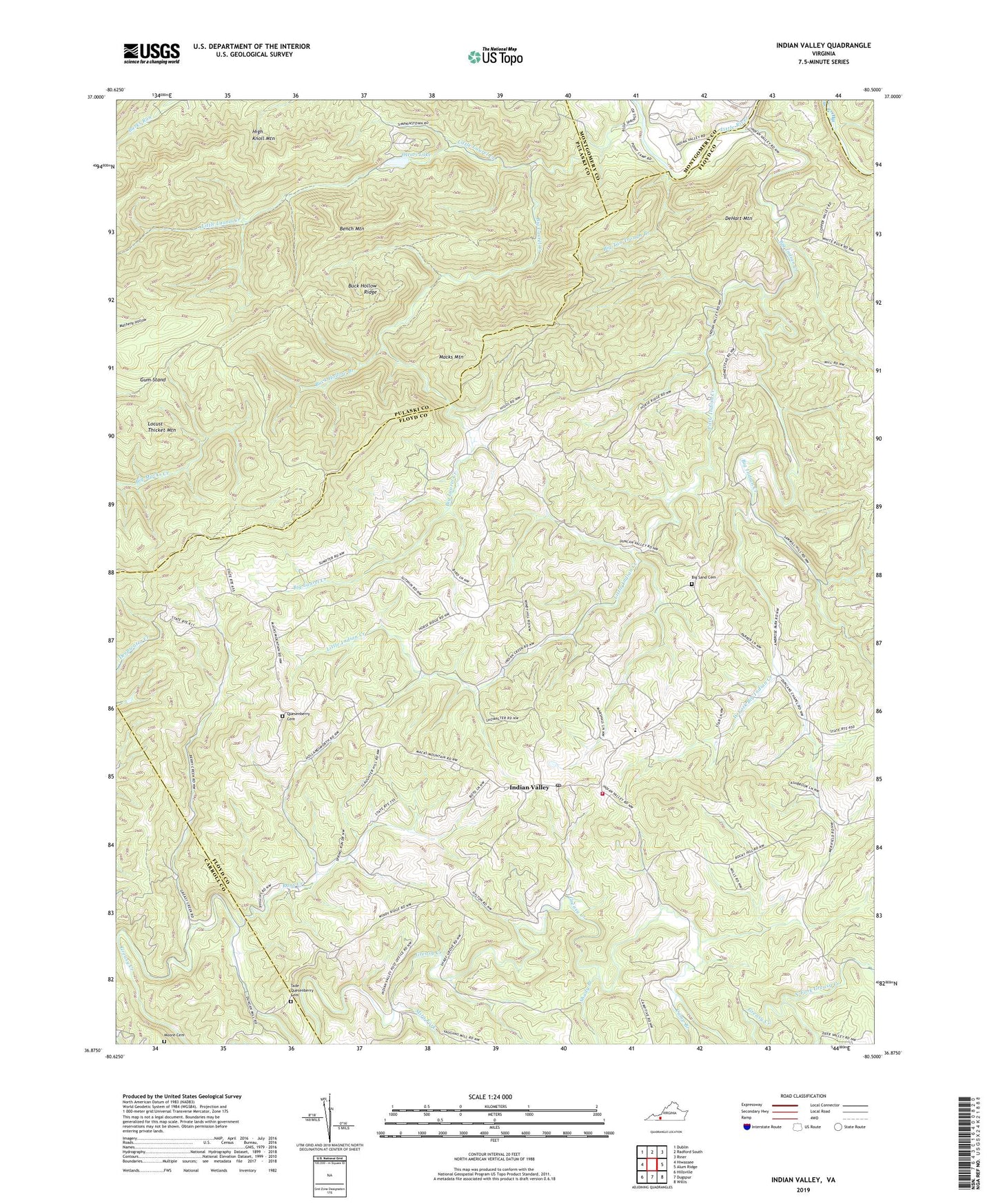
2022 topographic map quadrangle Indian Valley in the state of Virginia. Scale: 1:24000. Based on the newly updated USGS 7.5' US Topo map series, this map is in the following counties: Floyd, Pulaski, Carroll, Montgomery. The map contains contour data, water features, and other items you are used to seeing on USGS maps, but also has updated roads and other features. This is the next generation of topographic maps. Printed on high-quality waterproof paper with UV fade-resistant inks.
Quads adjacent to this one:
West: Hiwassee
Northwest: Dublin
North: Radford South
Northeast: Riner
East: Alum Ridge
Southeast: Willis
South: Dugspur
Southwest: Hillsville
This map covers the same area as the classic USGS quad with code o36080h5.
Contains the following named places: Barrys Creek, Bench Mountain, Bethel Chapel, Big Indian Creek, Big Laurel Creek, Big Sand Cemetery, Big Tan Trough Branch, Buck Hollow Branch, Buck Hollow Ridge, Camp Branch, Campsites, Christian Mission, Copper Valley, Copper Valley Church, DeHart Mountain, Fire Trail, Floyd County Life Saving and First Aid Squad Station 4, Floyd County Volunteer Fire Department 4, Greasy Creek, Gum Stand, Indian Creek Church, Indian Valley, Indian Valley Church, Indian Valley District, Indian Valley Elementary School, Indian Valley Post Office, Little Indian Creek, Little Laurel Creek, Mira Fork, Mitchell Chapel, Moore Cemetery, North Fork Greasy Creek, Ottari Lake, Ottari Scout Camp Number Two Dam, Quesenberry Cemetery, Rans Creek, Shady Branch, Tade Quesenberry Cemetery, Union Church, West Fork Big Indian Creek, ZIP Code: 24105