MyTopo
Hurley Virginia US Topo Map
Couldn't load pickup availability
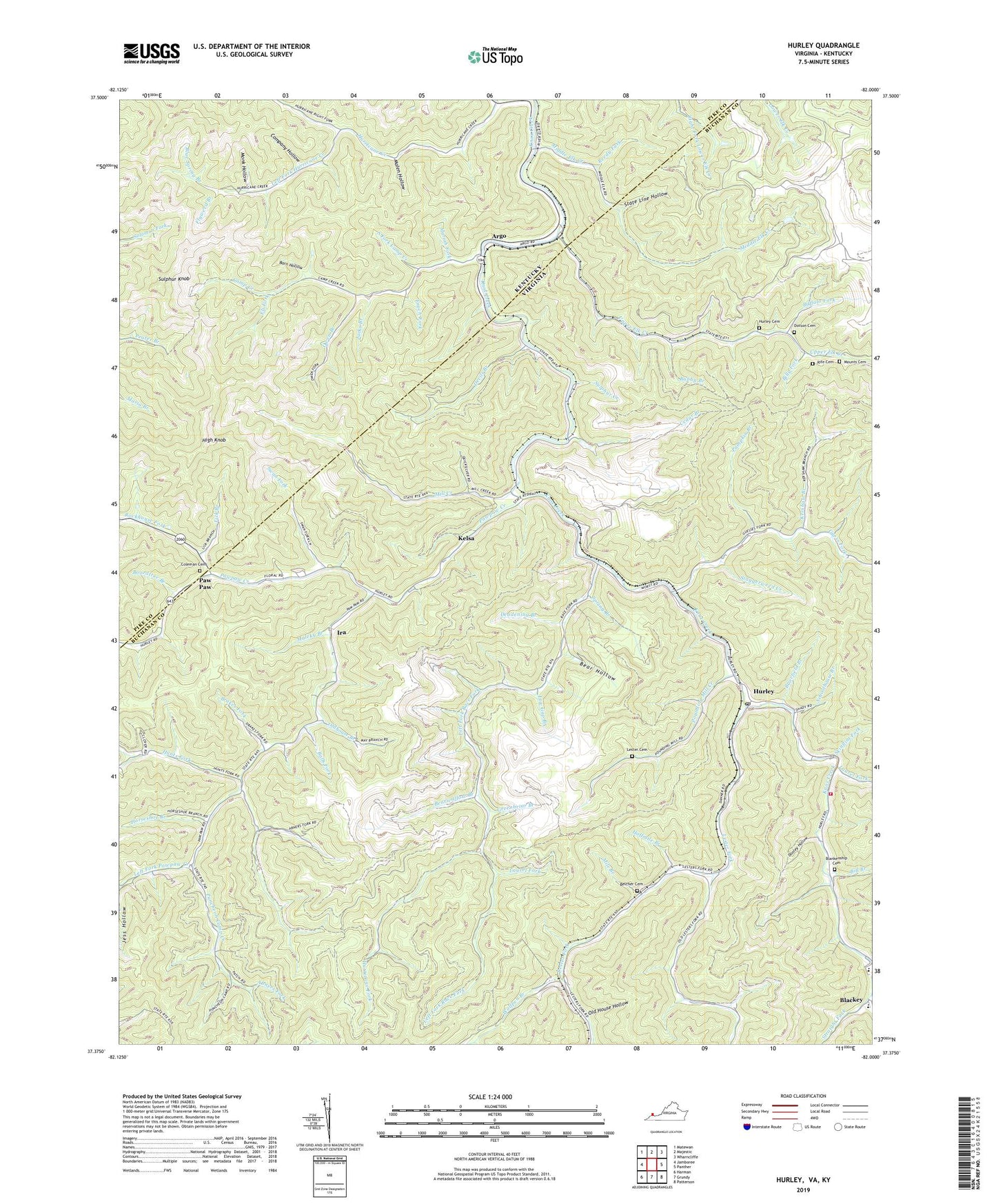
2019 topographic map quadrangle Hurley in the states of Virginia, Kentucky. Scale: 1:24000. Based on the newly updated USGS 7.5' US Topo map series, this map is in the following counties: Buchanan, Pike. The map contains contour data, water features, and other items you are used to seeing on USGS maps, but also has updated roads and other features. This is the next generation of topographic maps. Printed on high-quality waterproof paper with UV fade-resistant inks.
Quads adjacent to this one:
West: Jamboree
Northwest: Matewan
Northeast: Wharncliffe
East: Panther
Southeast: Patterson
South: Grundy
Southwest: Harman
Contains the following named places: Abners Fork, Argo, Argo Post Office, Balls Fork, Barn Hollow, Bay Branch, Bear Hollow, Bearwallow Branch, Belcher Cemetery, Bethany Church, Bill Branch, Bill Siding, Billy Fork, Blankenship Cemetery, Blue Spring Branch, Boardtree Branch, Brakes Fork, Brierfield Branch, Bubby Branch, Buffalo Fork, Burke Siding, Calfpen Hollow, Camp Creek, Camp Creek School, Cedar Branch, Coleman Cemetery, Company Hollow, Deadening Branch, Devils Branch, Dooley Hollow, Dotson Cemetery, Eli Fork, Elk Creek Church, Elk School, Enoch Fork, Flyweed Branch, Greenbriar Branch, Guess Fork, Halfmile Branch, Halls Branch, High Knob, Horse Branch, Horseshoe Branch, Hunts Fork, Hurley, Hurley Cemetery, Hurley Elementary - Middle School, Hurley High School, Hurley Post Office, Hurley School, Hurricane, Hurricane Fork, Hurricane School, Ira, Ira School, Jacks Branch, Kelsa, Kershaw Branch, Knox Creek Volunteer Fire Department, Knox District, Laurel Fork, Left Fork Hurricane Creek, Left Fork Pawpaw Creek, Left Fork Race Fork, Lester Cemetery, Lester Fork, Lester Fork School, Lick Branch, Low Gap Branch, Maleky Branch, Malen Hollow, Mariah Fork, Middle Elk Creek, Mile Branch, Mill Creek, Monk Hollow, Mounts Cemetery, North Fork Left Fork Hurricane Creek, Old House Hollow, Oldhouse Branch, Owen Branch, Paw Paw, Paw Paw Post Office, Pawpaw Creek, Pawpaw School, Phelps Division, Pounding Mill Creek, Preston Branch, Pumpkin Branch, Puncheon Branch, Puncheon Camp Creek, Reedy Fork, Rife Cemetery, Right Fork Hurricane Creek, Rockhouse Fork, Schoolhouse Branch, Shepardmen Church, Skinflint Fork, South Fork Camp Creek, Spring Branch, Sprout Branch, Staggerweed Creek, State Line Hollow, Sulphur Creek, Sulphur Knob, Swan Fork, Upper Elk Creek, Virginia Energy Dam, Wolfpen Branch, ZIP Codes: 24620, 41568