MyTopo
Harman Virginia US Topo Map
Couldn't load pickup availability
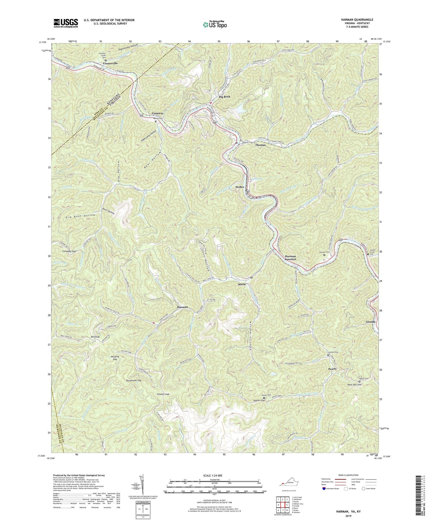
2022 topographic map quadrangle Harman in the states of Virginia, Kentucky. Scale: 1:24000. Based on the newly updated USGS 7.5' US Topo map series, this map is in the following counties: Buchanan, Pike, Dickenson. The map contains contour data, water features, and other items you are used to seeing on USGS maps, but also has updated roads and other features. This is the next generation of topographic maps. Printed on high-quality waterproof paper with UV fade-resistant inks.
Quads adjacent to this one:
West: Elkhorn City
Northwest: Lick Creek
North: Jamboree
Northeast: Hurley
East: Grundy
Southeast: Vansant
South: Prater
Southwest: Haysi
This map covers the same area as the classic USGS quad with code o37082c2.
Contains the following named places: Artia, Bear Hollow, Beech Branch, Belcher Branch, Benns Branch, Bethlehem Church, Big Branch, Big Log Branch, Big Rock, Big Rock Census Designated Place, Big Rock Elementary School, Big Rock Post Office, Big Rock Volunteer Fire Department, Bill Deel Branch, Bluff School, Buckeye Branch, Bull Creek, Bull Creek Church, Bull Creek School, Bull Gap, Burnt Poplar Fork, Camp Branch, Canaway Creek, Caney Fork, Caney Island Branch, Cantrell Cemetery, Cedar Grove School, Conaway, Conaway Creek, Conaway Gap, Conoway School, Convict Hollow, Cove Hollow, Deel Fork, Ditch Hollow, Dog Fork, Dry Hollow, Elijah Branch, Elm Root Hollow, Hackney Creek, Hackney Creek Cemetery, Harman, Harman Elementary School, Harman Junction, Harman Mining Corporation Dam, Harman Mining Corporation Pond, Harman Volunteer Fire Department, Harper Branch, Home Creek, Home Creek School, Hoot Owl Gap, Huffman Fork, Issac Branch, Jacks Creek, Jess Fork, Jim Belcher Fork, Joe Branch, Knotty Poplar Fork, Left Branch Nanny Branch, Left Fork Bull Creek, Left Fork Home Creek, Lick Branch, Little Hackney Creek, Looney Creek, Looney Creek Cemetery, Looney Creek Church, Lynn Camp Creek, Maxie, Maxie Post Office, Mikes Branch, Nanny Branch, Owens Cemetery, Pearly, Pigeonroost Hollow, Poplar Creek, Poplar Creek Church, Poplar Creek School, Poplar Gap, Ramey Cemetery, Ratliff Cemetery, Right Fork Stiltner Creek, Riverview Elementary - Middle School, Rock Lick District, Rockhouse Gap, Rocklick Creek, Rocky Branch, Schoolhouse Branch, Six and Twentymile Creek, Star Branch Dam Number One, Starr Branch, State Line Branch, Steep Branch, Stewart Gap, Stiltner Cemetery, Stiltner Creek, Sugarcamp Hollow, Thomas, Tick Fork, Toonerville, United Coal Heliport, Watts Branch, Weller, Wellmore Heliport, Winding Gap, ZIP Codes: 24603, 24628