MyTopo
Wharncliffe West Virginia US Topo Map
Couldn't load pickup availability
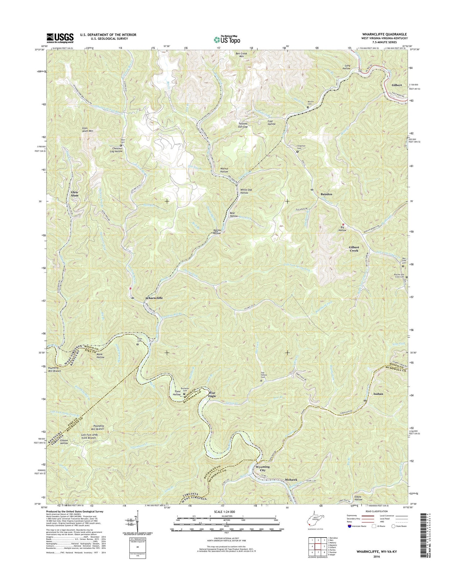
2023 topographic map quadrangle Wharncliffe in the states of West Virginia, Virginia, Kentucky. Scale: 1:24000. Based on the newly updated USGS 7.5' US Topo map series, this map is in the following counties: Mingo, Buchanan, McDowell, Pike. The map contains contour data, water features, and other items you are used to seeing on USGS maps, but also has updated roads and other features. This is the next generation of topographic maps. Printed on high-quality waterproof paper with UV fade-resistant inks.
Quads adjacent to this one:
Northwest: Barnabus
North: Man
Northeast: Mallory
East: Gilbert
Southeast: Iaeger
South: Panther
Southwest: Hurley
This map covers the same area as the classic USGS quad with code o37081e8.
Contains the following named places: Adams Fork, Alum Creek, Axe Branch, Baisden, Baisden Fork, Baisden Post Office, Baisden Volunteer Fire Department, Bear Branch, Bear Fork, Bear Hollow, Beech Fork, Ben Creek, Ben Creek Mountain, Ben Creek School, Big Branch, Big Fork, Big Hollow, Brushy Fork, Buchanan Cemetery, Buck Branch, Bull Creek, Chapman Cemetery, Chestnut Log Hollow, Cline Cemetery, Cline School, Coal Hollow, Elbow Hollow, Fourpole Creek, Gilbert Creek, Gilbert Creek Census Designated Place, Gilbert Elementary School, Glen Alum, Glen Alum Junction, Glen Alum Mountain, Greenbrier Creek, Hardy Union School, Hickory Gap Branch, Horsepen, Horsepen Creek, Isaban, Isaban Post Office, Laurel Fork, Left Fork Alum Creek, Left Fork Ben Creek, Left Fork Gilbert Creek, Left Fork Spring Fork, Lefthand Left Fork Ben Creek, Lick Branch, Long Branch, Long Hollow, Low Gap Branch, Lower Pete Branch, Mohawk, Mohawk Branch, Monk Hollow, Mounts Cemetery, Mudlick Branch, Mullens Branch, North Hollow, Old House Branch, Pickering Branch, Pound Mill Branch, Pounding Mill Branch, Rex Cline Cemetery, Right Fork Gilbert Creek, Righthand Fork, Ritchie and Cline Cemetery, Rough Branch, Sand Lick, Sims Fork, Skillet Creek, Spring Fork, Stafford District, Staggerweed Branch, Star Fork, Star Hollow Cemetery, Sycamore Fork, Toler Cemetery, Trent Hollow, Tunnel Branch, Turkey Creek, Twisted Gun Gap, Twisted Gun Golf Course, Walnut Hollow, War Eagle, Wharncliffe, Wharncliffe Church, Wharncliffe Post Office, Wharncliffe Station, Wharncliffe Volunteer Fire Department, White Oak Hollow, Wyoming City, ZIP Codes: 24846, 25608, 25651