MyTopo
Jamesville Virginia US Topo Map
Couldn't load pickup availability
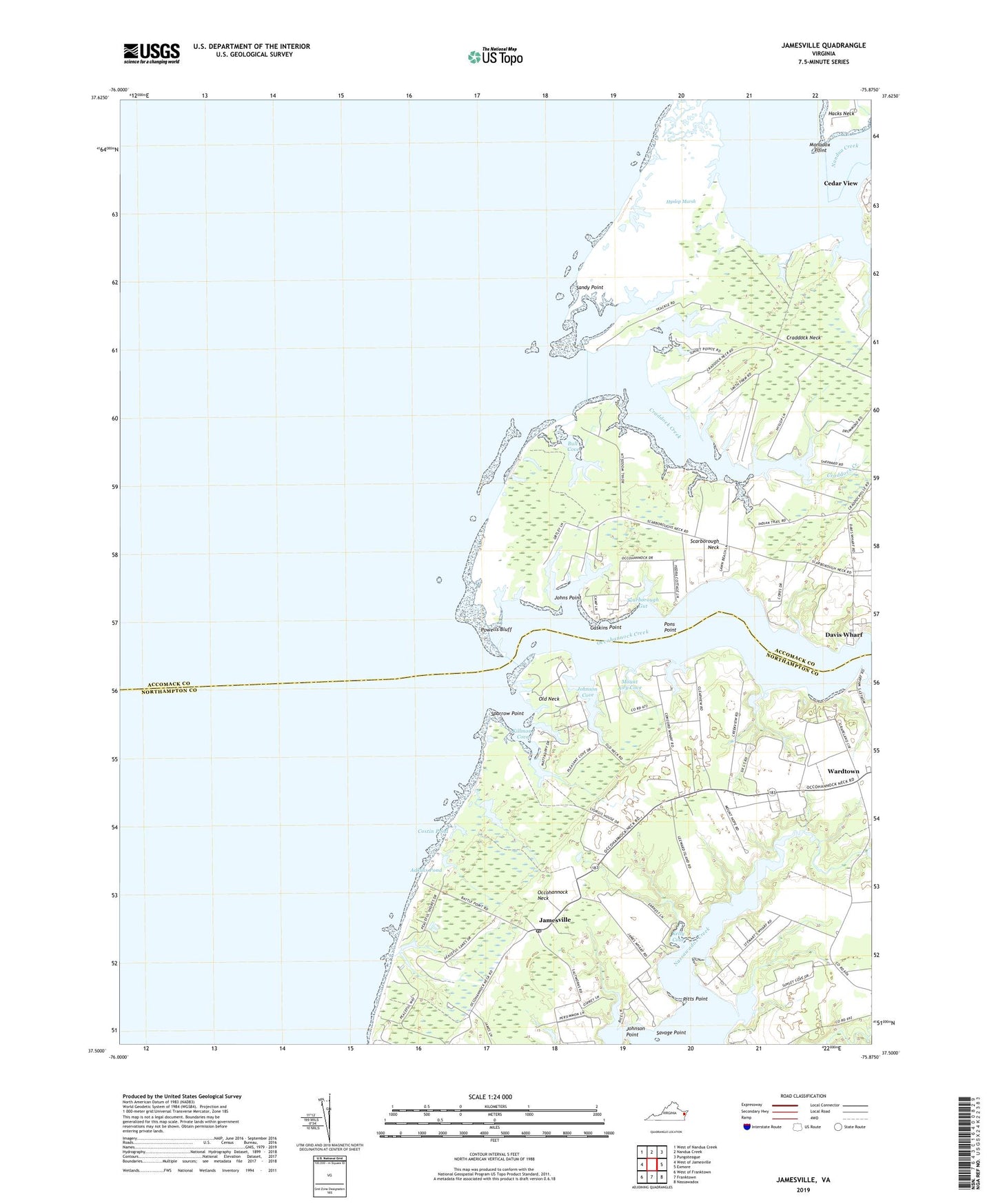
2019 topographic map quadrangle Jamesville in the state of Virginia. Scale: 1:24000. Based on the newly updated USGS 7.5' US Topo map series, this map is in the following counties: Northampton, Accomack. The map contains contour data, water features, and other items you are used to seeing on USGS maps, but also has updated roads and other features. This is the next generation of topographic maps. Printed on high-quality waterproof paper with UV fade-resistant inks.
Quads adjacent to this one:
West: West of Jamesville
Northwest: West of Nandua Creek
North: Nandua Creek
Northeast: Pungoteague
East: Exmore
Southeast: Nassawadox
South: Franktown
Southwest: West of Franktown
Contains the following named places: Back Creek, Bethel Church, Bethel United Methodist Church, Bull Cove, Cedar View, Chance Airport, Clearview, Cohoke Mill Dam, Concord Wharf, Concord Wharf School, Craddock Creek, Craddock Neck, Curratuck Creek, Davis Wharf, District 9, Fisher Cove, Gaskins Point, Hyslop Marsh, James Wharf, Jamesville, Jamesville Post Office, Johns Point, Johnson Cove, Johnson Point, Kelly Cove, Killmon Cove, Monadox Point, Morleys Wharf, Mount Airy Cove, Mount Zion Church, Occohannock Creek, Occohannock Neck, Old Neck, Old Neck Landing, Peaceful Beach, Peaceful Shores, Pitts Point, Pleasant Cove Village, Pons Point, Powells Bluff, Saint Marys Church, Sandy Point, Savage Point, Scarborough Gut, Scarborough Neck, Sparrow Point, Stewarts Landing, Tawes Creek, Wardtown, WKRE-AM (Jamesville), WKRE-FM (Exmore), ZIP Code: 23398