MyTopo
Madisonville Virginia US Topo Map
Couldn't load pickup availability
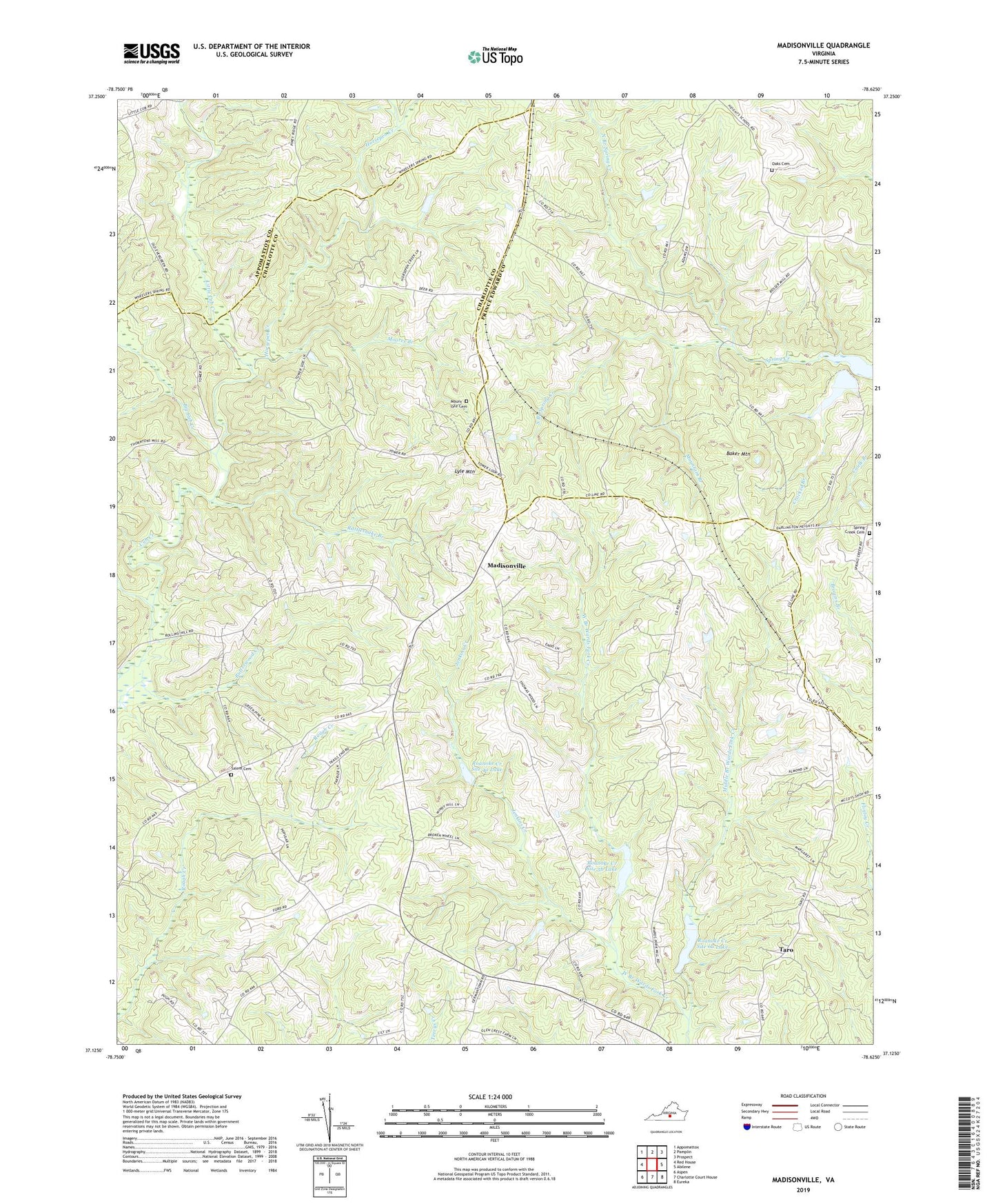
2022 topographic map quadrangle Madisonville in the state of Virginia. Scale: 1:24000. Based on the newly updated USGS 7.5' US Topo map series, this map is in the following counties: Charlotte, Prince Edward, Appomattox. The map contains contour data, water features, and other items you are used to seeing on USGS maps, but also has updated roads and other features. This is the next generation of topographic maps. Printed on high-quality waterproof paper with UV fade-resistant inks.
Quads adjacent to this one:
West: Red House
Northwest: Appomattox
North: Pamplin
Northeast: Prospect
East: Abilene
Southeast: Eureka
South: Charlotte Court House
Southwest: Aspen
This map covers the same area as the classic USGS quad with code o37078b6.
Contains the following named places: Alabama Church, Baker Mountain, Baker Mountain Mine, Big Cub Creek, Cetenary Church, Crocked Branch, Horsepen Creek, Industrial Waste Dam, Industrial Waste Pond, Jenkins Creek, Little Cub Creek, Lyle Mountain, Madison District, Madisonville, Madisonville Church, Maloney Siding, Moores Branch, Mount Lyle Cemetery, Mount Lyle Church, Mountain Branch, North Branch Spring Creek, Oak View Church, Oaks Cemetery, Rattlesnake Branch, Roanoke Creek Number 4a Dam, Roanoke Creek Number 5b Dam, Roanoke Creek Number 6a Dam, Roanoke Creek Site 4a Lake, Roanoke Creek Site 5b Lake, Roanoke Creek Site 6a Lake, Saint Andrews Church, Salem Cemetery, Salem Church, South Branch Spring Creek, Spring Creek Cemetery, Taro, Vincent Corner, Wards Fork Mill, Wells Dam, West Branch Wards Fork Creek, White Oak Grove Church, ZIP Code: 23934