
MyTopo
Nokesville Virginia US Topo Map
Couldn't load pickup availability
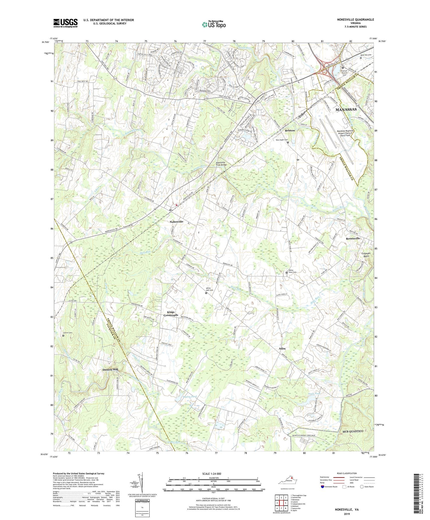
2019 topographic map quadrangle Nokesville in the state of Virginia. Scale: 1:24000. Based on the newly updated USGS 7.5' US Topo map series, this map is in the following counties: Prince William, Fauquier, Manassas (city). The map contains contour data, water features, and other items you are used to seeing on USGS maps, but also has updated roads and other features. This is the next generation of topographic maps. Printed on high-quality waterproof paper with UV fade-resistant inks.
Quads adjacent to this one:
West: Catlett
Northwest: Thoroughfare Gap
North: Gainesville
Northeast: Manassas
East: Independent Hill
Southeast: Joplin
South: Somerville
Southwest: Midland
Contains the following named places: Aden, Aden Field, AirCare 1 Base 1, Asbury Methodist Church, Bagley Dam, Bagley Pond, Brent Turf Acres, Brentsville District, Brentsville District High School, Bristow, Bristow Post Office, Camp Upshur, Cannon Branch, Cannon Branch Cemetery, Carriage Ford, Cedar Creek, Cedar Point Elementary School, Clover Hill, Colonial Acres, Colvin Cemetery, Colvin Farms, Daniels Mill, E H Marsteller Middle School, Engh Dam, Engh Pond, Gospel Chapel, Hatchers Memorial Church, Kettle Run, Kettle Wind Farm, King Richard Estates, Kings Crossroads, Lehigh Portland Park, Manassas Regional Airport/Harry P. Davis Field, Manassas West Industrial Park, New Hope Baptist Church, New Hope Cemetery, Nokesville, Nokesville Census Designated Place, Nokesville Church of the Brethren, Nokesville Community Park, Nokesville Elementary School, Nokesville Mini Library, Nokesville Neighborhood Library, Nokesville Post Office, Nokesville Truss Bridge, Nokesville United Methodist Church, Nokesville Volunteer Fire and Rescue Department Station 5, Nova Turf Farm, Oxfordshire, Prince William County Criminal Justice Academy, Rose Hill Cemetery, Rosemont, Saint James Church, Slate Run, Slate Run Farms, South Run, Thoroughbred Farms, Valley View Airport, Valley View Cemetery, Victory Baptist Church, Walnut Branch, Whipoorwill Springs Airport, White Hall Cemetery, Woodlawn Church, Woodlawn Farms, Yocum, ZIP Codes: 20136, 20181


