MyTopo
Joplin Virginia US Topo Map
Couldn't load pickup availability
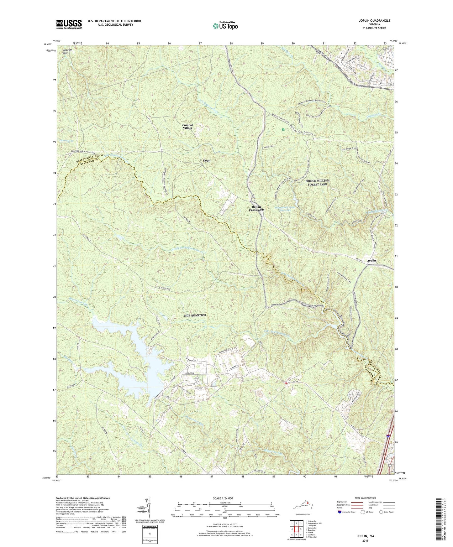
2022 topographic map quadrangle Joplin in the state of Virginia. Scale: 1:24000. Based on the newly updated USGS 7.5' US Topo map series, this map is in the following counties: Stafford, Prince William. The map contains contour data, water features, and other items you are used to seeing on USGS maps, but also has updated roads and other features. This is the next generation of topographic maps. Printed on high-quality waterproof paper with UV fade-resistant inks.
Quads adjacent to this one:
West: Somerville
Northwest: Nokesville
North: Independent Hill
Northeast: Occoquan
East: Quantico
Southeast: Widewater
South: Stafford
Southwest: Storck
This map covers the same area as the classic USGS quad with code o38077e4.
Contains the following named places: Ashland Elementary School, Belfair Crossroads, Belle Fair Mill, Breckenridge Reservoir, Breckinridge Dam, Camp Barrett, Camp Five Dam, Chopawamsic, Chopawamsic Backcounty Area, Chopawamsic School, Chopawamsic Trail, Combat Village, Dumfries District, Farms to Forest Trail, Federal Bureau of Investigation Academy, Flat Run, Forest Hill School, Garrisons Corners, Happyland Camp Five Lake, Happyland Camp Number 5, Hayfield School, Hickory Ridge Trail, High Meadows Trail, Hillside Terrace, Joplin, Kopp, Krukrak, Little Mount Zion School, Lunga Dam, Lunga Reservoir, Mawavi Camp Number 2, Mawavi Historic District, Middle Branch Chopawamsic Creek, Missouri Mill, Mount, North Branch Chopawamsic Creek, Oak Ridge Campground, Oak Ridge Trail, Old Belle Fair, Old Chopawamsic Church, Prince William Forest Park, Quantico Fire and Emergency Services Station 33, Rock Hill District, Shacklet, South Branch Chopawamsic Creek, South Valley Trail, Staffords Store, Walmsley, ZIP Code: 22134