
MyTopo
North Bay Virginia US Topo Map
Couldn't load pickup availability
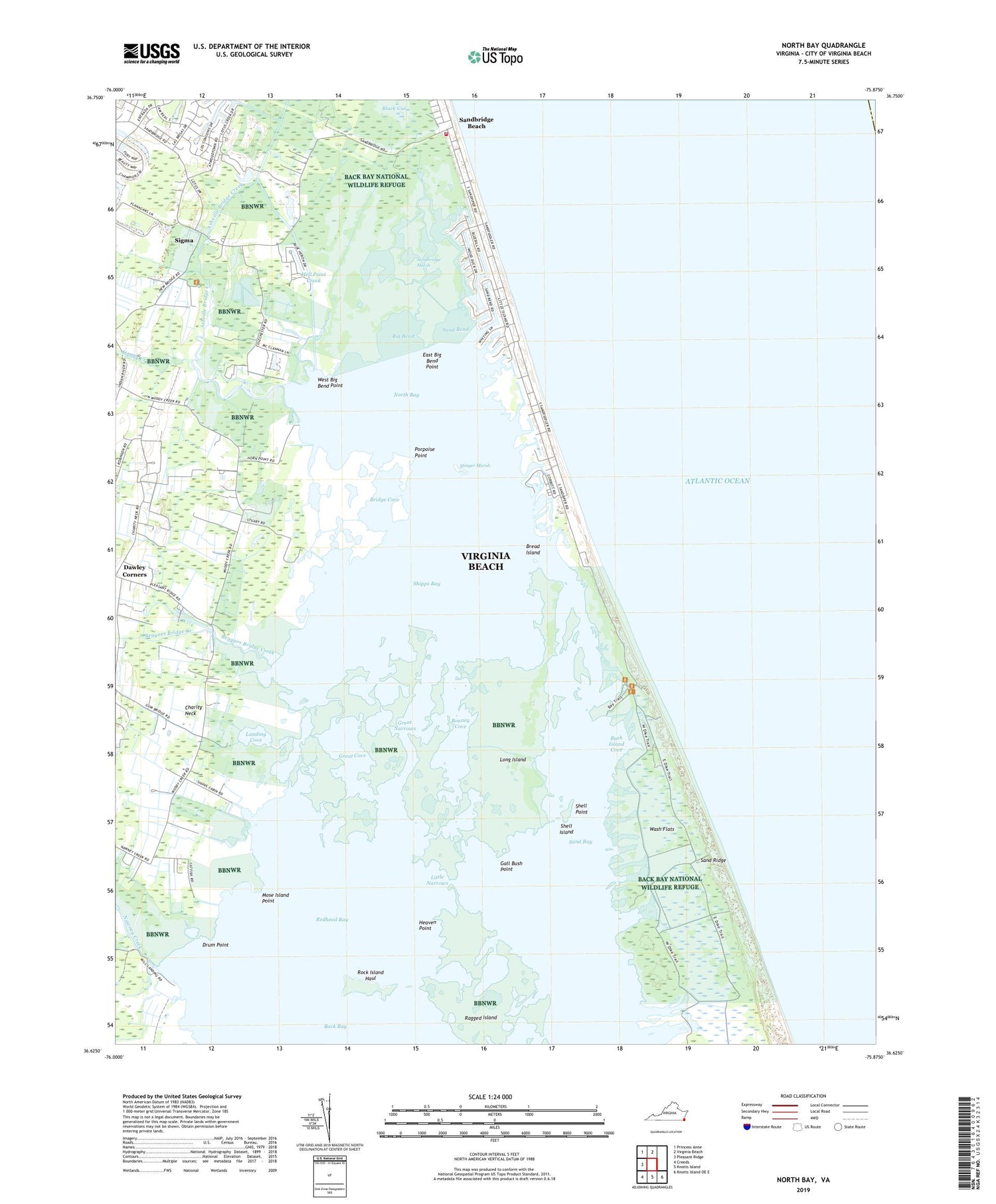
2019 topographic map quadrangle North Bay in the state of Virginia. Scale: 1:24000. Based on the newly updated USGS 7.5' US Topo map series, this map is in the following counties: Virginia Beach (city). The map contains contour data, water features, and other items you are used to seeing on USGS maps, but also has updated roads and other features. This is the next generation of topographic maps. Printed on high-quality waterproof paper with UV fade-resistant inks.
Quads adjacent to this one:
West: Pleasant Ridge
Northwest: Princess Anne
North: Virginia Beach
Southeast: Knotts Island OE E
South: Knotts Island
Southwest: Creeds
Contains the following named places: Ashville Bridge Creek, Back Bay Game Refuge Camp, Back Bay National Wildlife Refuge, Beggars Bridge Creek, Big Bend, Bonney Cove, Bread Island, Bridge Cove, Bush Island Cove, Charity Neck, Charity United Methodist Church, Drum Point, East Big Bend Point, Emmanuel Christian Church of God, Gall Bush Point, Great Cove, Great Narrows, Heaven Point, Hell Point Creek, Hells Point Golf Course, Hill Landing, Landing Cove, Little Narrows, Long Island, Mose Island Point, Muddy Creek, Nawney Creek, North Bay, Porpoise Point, Ragged Island, Redhead Bay, Rock Island Haul, Sand Bay, Sand Bend, Sandbridge Beach, Sandbridge Marsh, Sandbridge United Methodist Church, Sandbridge Volunteer Rescue Squad, Shell Island, Shell Point, Shipps Bay, Sigma, Stinger Marsh, Tabernacle United Methodist Church, Virginia Beach Fire Department Station 17 Sandbridge, Wash Flats, West Big Bend Point


