MyTopo
North View Virginia US Topo Map
Couldn't load pickup availability
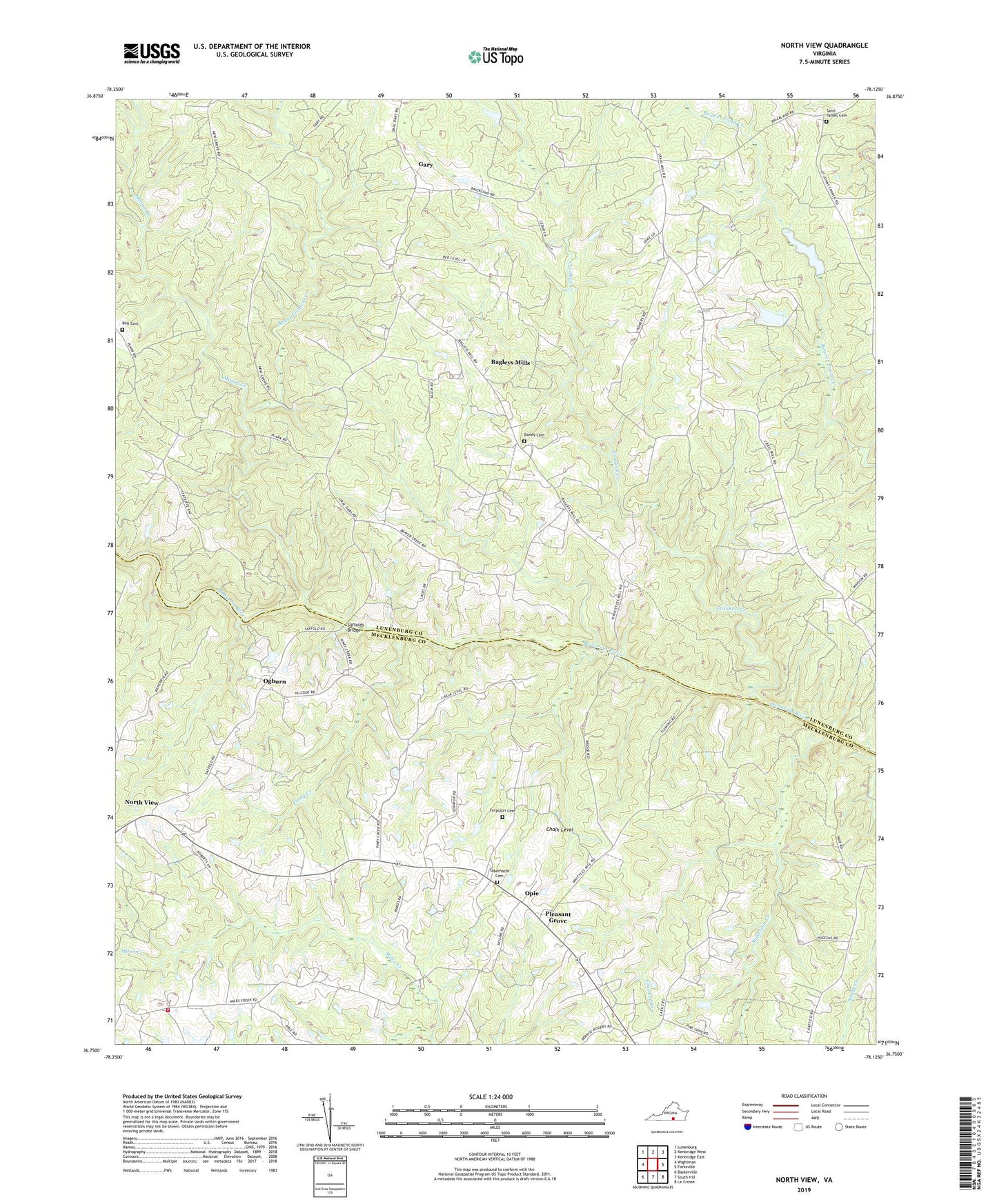
2019 topographic map quadrangle North View in the state of Virginia. Scale: 1:24000. Based on the newly updated USGS 7.5' US Topo map series, this map is in the following counties: Lunenburg, Mecklenburg. The map contains contour data, water features, and other items you are used to seeing on USGS maps, but also has updated roads and other features. This is the next generation of topographic maps. Printed on high-quality waterproof paper with UV fade-resistant inks.
Quads adjacent to this one:
West: Wightman
Northwest: Lunenburg
North: Kenbridge West
Northeast: Kenbridge East
East: Forksville
Southeast: La Crosse
South: South Hill
Southwest: Baskerville
Contains the following named places: Bagleys Mills, Bailey Cemetery, Bears Element Creek, Bell Cemetery, Buckhorn Volunteer Fire Department Company 2, Camp School, Chalk Level, Crooked Creek, Crowders Mill, Ferguson Cemetery, Flat Rock Church, Gary, Mason Creek, Mountain Creek, New Grove Church, New Grove School, North View, North View Church, North View School, Oakland Church, Ogburn, Opie, Piney Creek, Pleasant Grove, Red Level, Russell Corner, Saffolds Bridge, Saint James Cemetery, Saint Johns Church, Shiloh Church, Smyrna Church, Tabernacle Cemetery, Tabernacle Church, Whittles Dam, Whittles Grove Church, Whittles Grove School, Whittles Mill, Whittles Millpond, ZIP Code: 23970