MyTopo
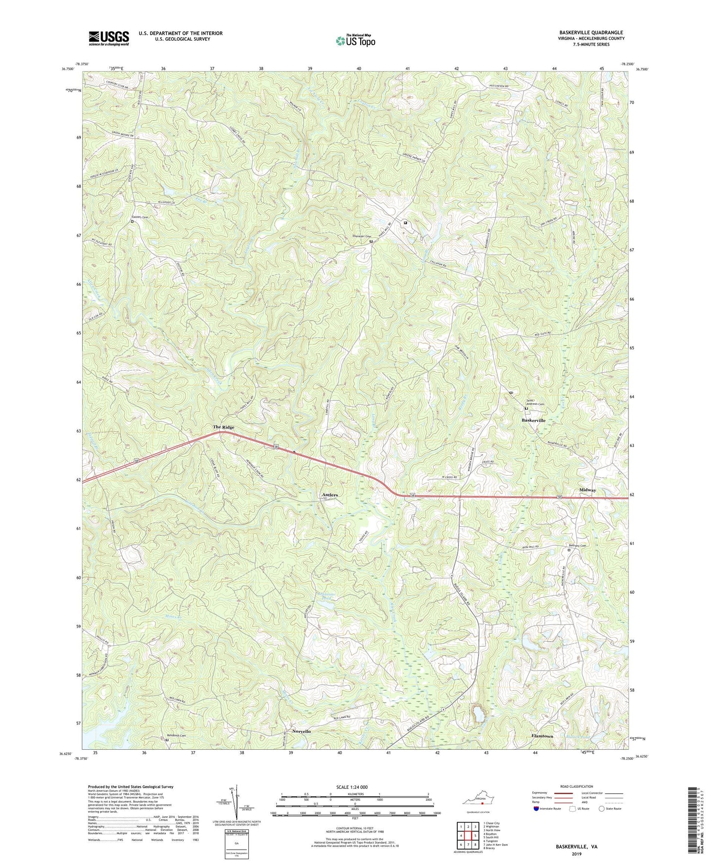
Baskerville Virginia US Topo Map
Couldn't load pickup availability
2022 topographic map quadrangle Baskerville in the state of Virginia. Scale: 1:24000. Based on the newly updated USGS 7.5' US Topo map series, this map is in the following counties: Mecklenburg. The map contains contour data, water features, and other items you are used to seeing on USGS maps, but also has updated roads and other features. This is the next generation of topographic maps. Printed on high-quality waterproof paper with UV fade-resistant inks.
Quads adjacent to this one:
West: Boydton
Northwest: Chase City
North: Wightman
Northeast: North View
East: South Hill
Southeast: Bracey
South: John H Kerr Dam
Southwest: Tungsten
This map covers the same area as the classic USGS quad with code o36078f3.
Contains the following named places: Antlers, Baskerville, Baskerville Census Designated Place, Baskerville Correctional Center, Baskerville Post Office, Bethany Baptist Church Cemetery, Bethany Church, Blalock Dam, Blalock Pond, Callahans Corner, Christ Church, Coleman Creek, District 6, Dunns Corner, Easter Church, Easters Cemetery, Easters School, Ebenezer Cemetery, Ebenezer Church, Ebenezer School, El Bethel Church, Elamtown, Farrar Sod Farm, Fox Branch, Gills, Gordon Corner, Grove Church, Johnsons Dam, Johnsons Pond, Kidwell Dam, Kidwell Pond, Layton Creek, Let Alone Creek, Long Branch, Mecklenburg Correctional Center, Mecklenburg County, Midway, Mines Creek, Muck Cross, Newmans, Norvello, Pole Branch, Red Gate, Reedy Branch, Rehoboth Cemetery, Rehoboth Church, Saint Andrews Cemetery, Saint Douglas Church, Saint Marks Church, Sawmill Branch, Sharon Church, Smith School, State Prison Camp Number 4, Stony Cross, Tapped Branch, The Ridge, Union Hill Church, Young School, ZIP Codes: 23915, 23917