MyTopo
Pamplin Virginia US Topo Map
Couldn't load pickup availability
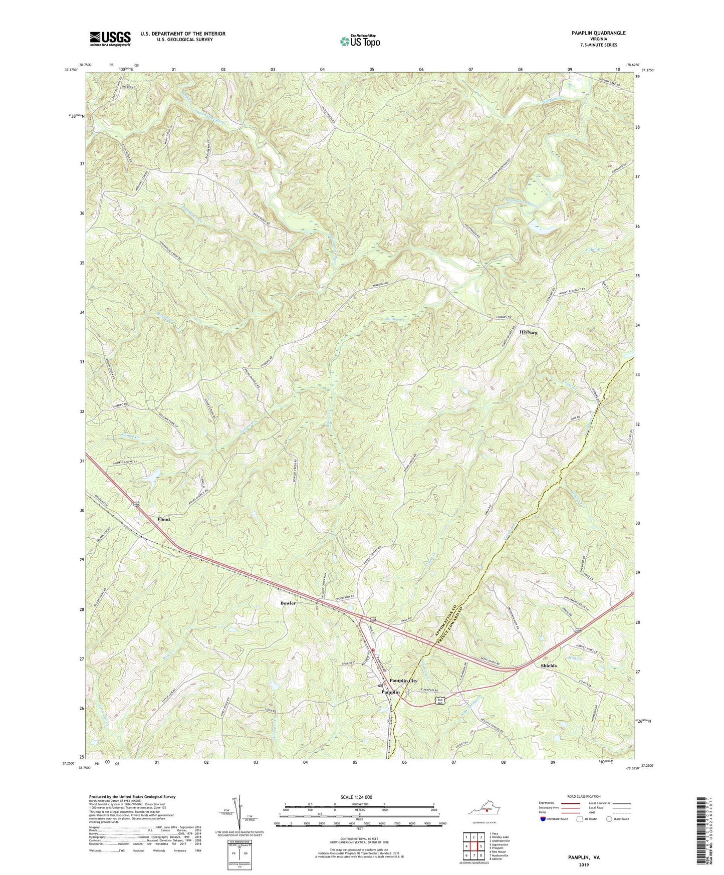
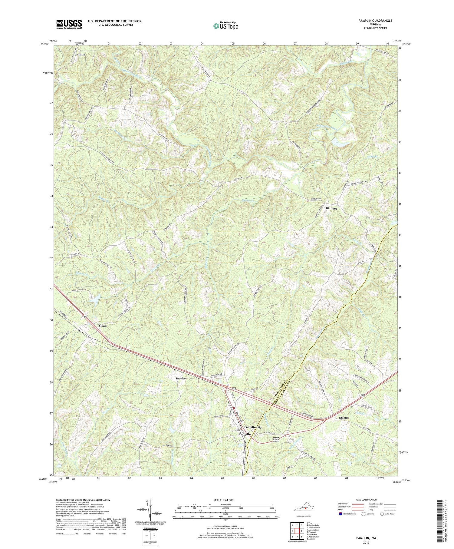
2019 topographic map quadrangle Pamplin in the state of Virginia. Scale: 1:24000. Based on the newly updated USGS 7.5' US Topo map series, this map is in the following counties: Appomattox, Prince Edward. The map contains contour data, water features, and other items you are used to seeing on USGS maps, but also has updated roads and other features. This is the next generation of topographic maps. Printed on high-quality waterproof paper with UV fade-resistant inks.
Quads adjacent to this one:
West: Appomattox
Northwest: Vera
North: Holiday Lake
Northeast: Andersonville
East: Prospect
Southeast: Abilene
South: Madisonville
Southwest: Red House
Contains the following named places: Appomattox River District, Bowler, Bowler Creek, Cedar Creek, Clover Hill District, Crane Creek, Fishpond Creek, Flood, Hixburg, Mount Pleasant Church, Pamplin, Pamplin Post Office, Pamplin Volunteer Fire Department and Emergency Medical Services, Pine Creek, Piney Ridge United Methodist Church, Poorhouse Creek, Rocks Church, Rough Creek, Shields, South Fork Appomattox River, Suanee Creek, Town of Pamplin City, Walkers Church, Wolf Creek, ZIP Code: 23958