MyTopo
Prospect Virginia US Topo Map
Couldn't load pickup availability
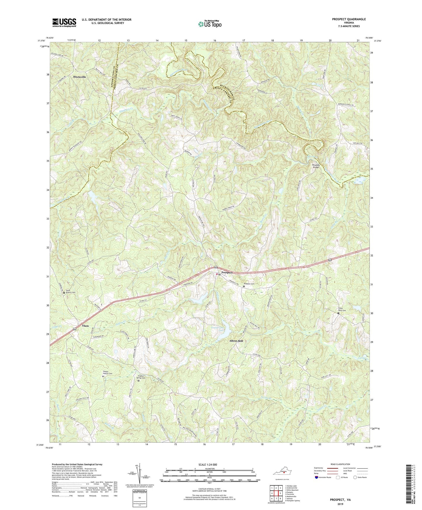
2019 topographic map quadrangle Prospect in the state of Virginia. Scale: 1:24000. Based on the newly updated USGS 7.5' US Topo map series, this map is in the following counties: Prince Edward, Buckingham, Appomattox. The map contains contour data, water features, and other items you are used to seeing on USGS maps, but also has updated roads and other features. This is the next generation of topographic maps. Printed on high-quality waterproof paper with UV fade-resistant inks.
Quads adjacent to this one:
West: Pamplin
Northwest: Holiday Lake
North: Andersonville
Northeast: Willis Mountain
East: Farmville
Southeast: Hampden Sydney
South: Abilene
Southwest: Madisonville
Contains the following named places: Allens Mill, Beazley Ford, Brisentine Pond, Brisentines Dam, Buffalo Creek Number One Dam, Cabin Branch, Calvary Church, Camp Branch, Carter Dam, District 601, Ducker Creek, Elam, First Rock School, Grand View Lake, Harris Creek, Hurtsville, Little Rock Cemetery, Little Rock Church, Olive Branch Cemetery, Olive Branch Church, Orange Dam, Peaks Church, Peaks School, Plum Creek, Prospect, Prospect Cemetery, Prospect Christian Academy, Prospect Methodist Church, Prospect Post Office, Prospect School, Prospect Volunteer Fire Department, Rattler Branch, Saint James Church, Saint Pauls Church, Sleepy Hollow Cemetery, Spring Branch, Sulphur Spring Cemetery, Sulphur Spring Church, Vaughans Creek, Venables Bridge, ZIP Code: 23960