
MyTopo
Providence Forge Virginia US Topo Map
Couldn't load pickup availability
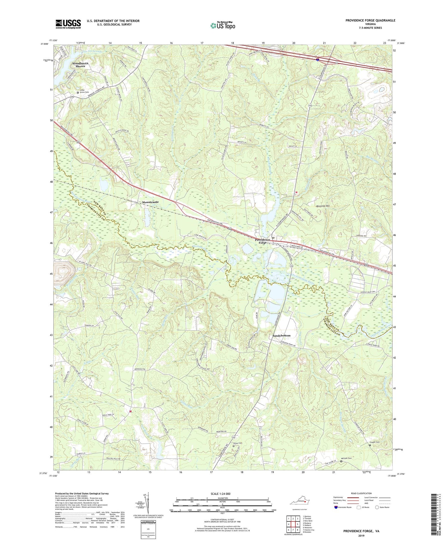
2019 topographic map quadrangle Providence Forge in the state of Virginia. Scale: 1:24000. Based on the newly updated USGS 7.5' US Topo map series, this map is in the following counties: New Kent, Charles City. The map contains contour data, water features, and other items you are used to seeing on USGS maps, but also has updated roads and other features. This is the next generation of topographic maps. Printed on high-quality waterproof paper with UV fade-resistant inks.
Quads adjacent to this one:
West: Roxbury
Northwest: Quinton
North: Tunstall
Northeast: New Kent
East: Walkers
Southeast: Brandon
South: Charles City
Southwest: Westover
Contains the following named places: Adkins Store, Allens Run, Bethany Church, Bradley Run, Cedar Grove Cemetery, Cedar Grove Church, Chapel Cemetery, Charles City Landfill, Charles City Volunteer Fire Department Station 1, Chickahominy Wastewater Treatment Plant, Collins Run, District 2, District 4, Dockman Swamp, Emmaus Church, Evans Evergreen Nursery, Heritage Public Library, Holly Landing, Jerdones Big Woods, Jones Run, Kent Lake, Little Elam Church, Menoah Cemetery, Minitree Branch, Minitree Hill, Mount Calvary Church, Mount Stirling Church, Mountcastle, New Kent Fire - Rescue Station 1 / Providence Forge Volunteer Fire - Rescue, Old Forge Pond, Old Forge Pond Dam, Oldhouse Landing, Olivet Church, Piney Branch, Possum Run, Potato Run, Providence Forge, Providence Forge Firefighters, Providence Forge Post Office, Providence Forge Presbyterian Church, Providence Forge Volunteer Rescue Squad, Roaches Corner, Rumley Marsh, Sandybottom, Schiminoe Creek, Stony Run, The Fellowship Church, Union Cemetery, Winns Landing, ZIP Code: 23140


