MyTopo
Quinby Inlet Virginia US Topo Map
Couldn't load pickup availability
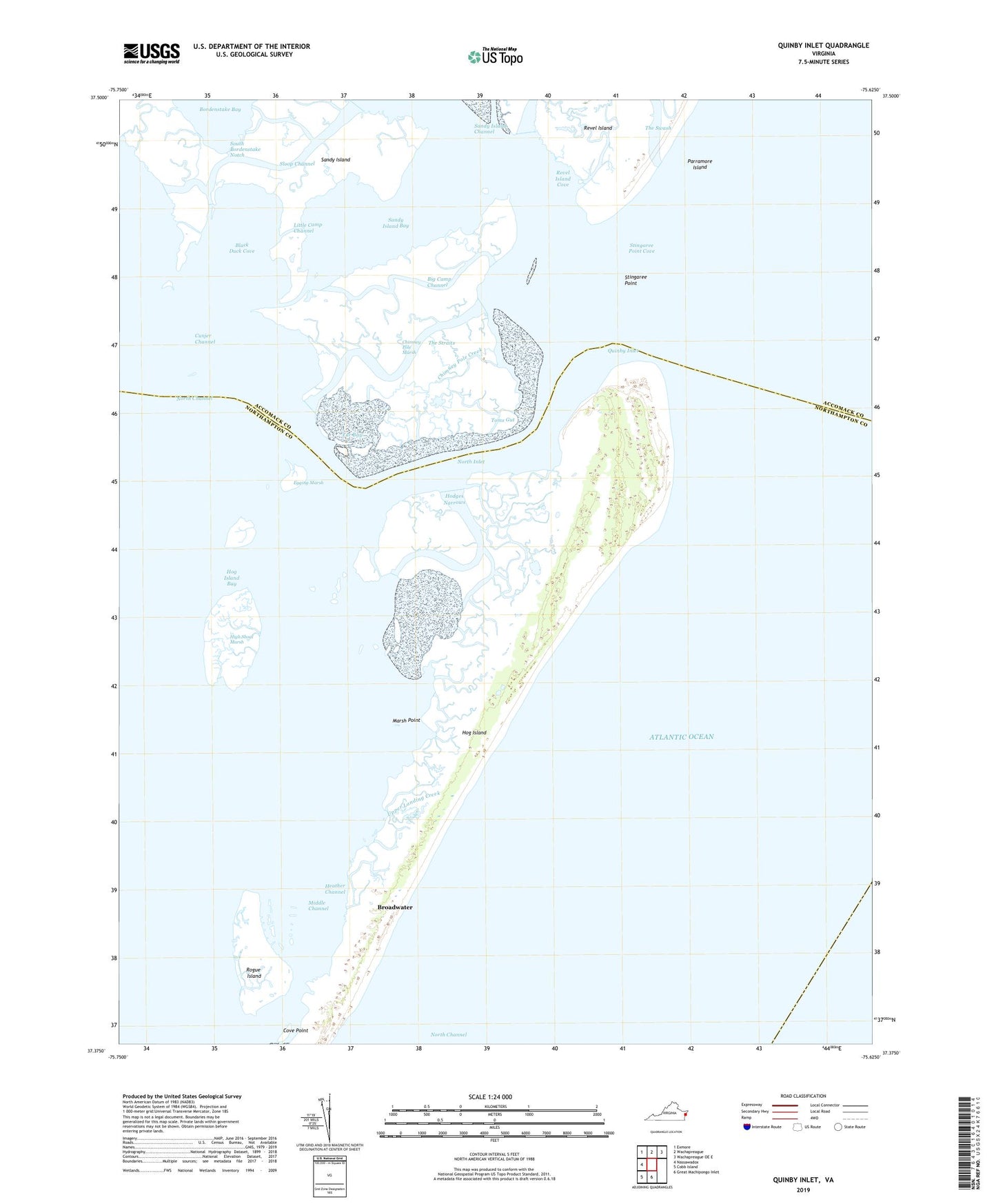
2019 topographic map quadrangle Quinby Inlet in the state of Virginia. Scale: 1:24000. Based on the newly updated USGS 7.5' US Topo map series, this map is in the following counties: Accomack, Northampton. The map contains contour data, water features, and other items you are used to seeing on USGS maps, but also has updated roads and other features. This is the next generation of topographic maps. Printed on high-quality waterproof paper with UV fade-resistant inks.
Quads adjacent to this one:
West: Nassawadox
Northwest: Exmore
North: Wachapreague
Northeast: Wachapreague OE E
South: Great Machipongo Inlet
Southwest: Cobb Island
Contains the following named places: Big Camp Channel, Black Duck Cove, Bordenstake Bay, Broadwater, Chimney Pole Creek, Chimney Pole Marsh, Cove Point, Cunjer Channel, Egging Marsh, Heather Channel, High Shoal Marsh, Hodges Narrows, Hog Island, Hog Island Light, Little Camp Channel, Marsh Point, Middle Channel, North Inlet, Quinby Inlet, Revel Creek, Revel Island, Revel Island Cove, Rogue Island, Sandy Island, Sandy Island Bay, Sandy Island Channel, Sloop Channel, South Bordenstake Notch, Stingaree Point, Stingaree Point Cove, Tar Bay, The Straits, Toms Gut, Upper Landing Creek, Wreck Island Creek