MyTopo
Radford South Virginia US Topo Map
Couldn't load pickup availability
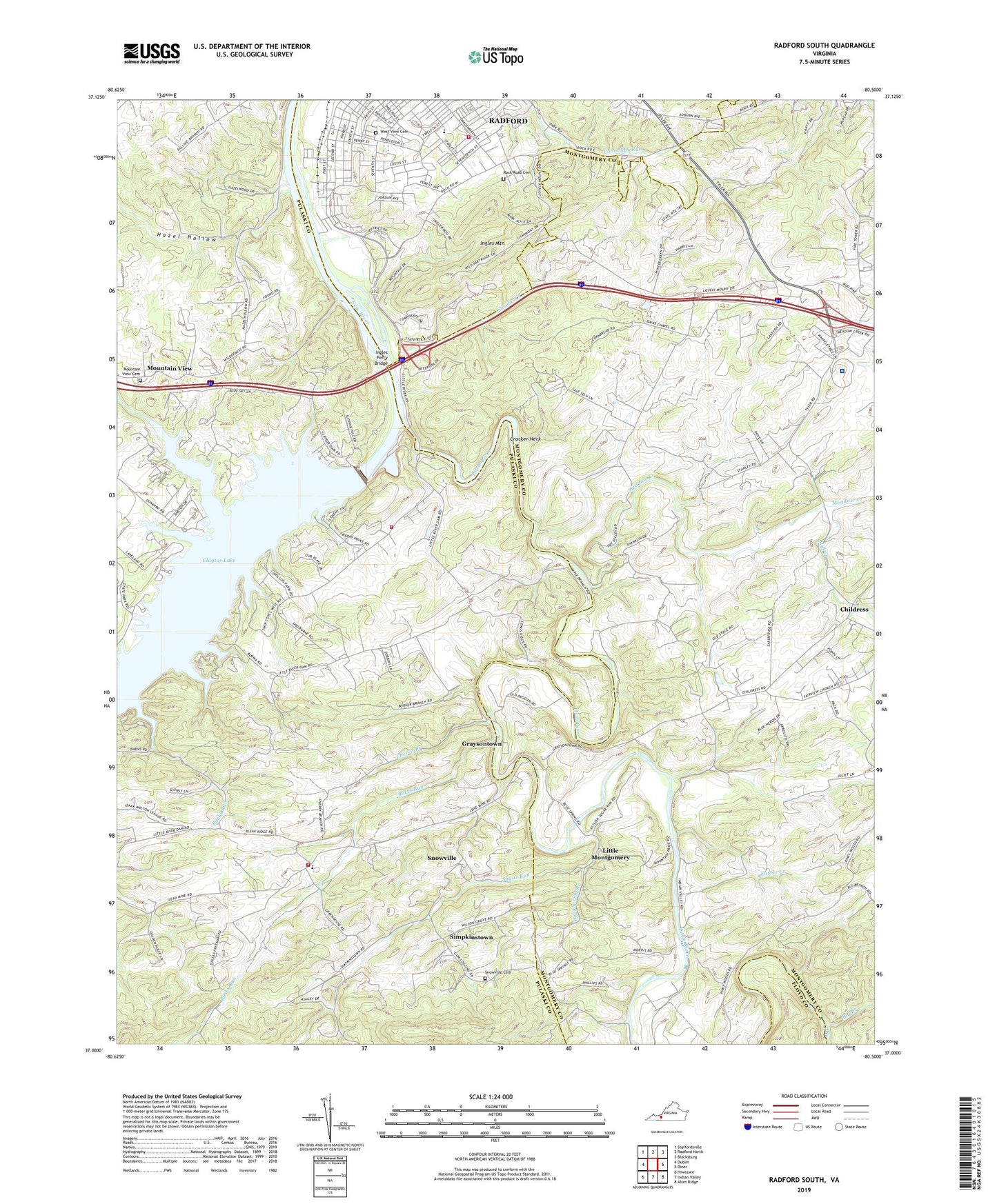
2022 topographic map quadrangle Radford South in the state of Virginia. Scale: 1:24000. Based on the newly updated USGS 7.5' US Topo map series, this map is in the following counties: Pulaski, Montgomery, Radford (city), Floyd. The map contains contour data, water features, and other items you are used to seeing on USGS maps, but also has updated roads and other features. This is the next generation of topographic maps. Printed on high-quality waterproof paper with UV fade-resistant inks.
Quads adjacent to this one:
West: Dublin
Northwest: Staffordsville
North: Radford North
Northeast: Blacksburg
East: Riner
Southeast: Alum Ridge
South: Indian Valley
Southwest: Hiwassee
This map covers the same area as the classic USGS quad with code o37080a5.
Contains the following named places: Bain Chapel, Baptist Tabernacle, Bethel Church, Bethel Elementary School, Big Branch, Burks Run, Carilion New River Valley Medical Center, Carilion Saint Albans Hospital of Christiansburg, Carter Street United Methodist Church, Center Mills, Cherry Branch, Childress, Church of God, City of Radford, Claytor Dam, Corner View Church, Cracker Neck, Cypress Grove Church, Dry School, Easter Creek, First Pentecostal Holiness Church, Forest Park, Fred Wygal Elementary School, Gethsemane Baptist Church, Graysontown, Graysontown Methodist Church, Hazel Hollow, Highland Hills, Ingles Ferry, Ingles Ferry Bridge, Ingles Mountain, Kuhn Barnett Elementary School, Laurel Hill Church, Little Montgomery, Little River, Little River Dam, Little River Reservoir, McHarg Elementary School, Meadow Creek, Mill Creek, Mount Airy Church, Mountain View, Mountain View Cemetery, Mountain View United Methodist Church, New Mount Olive Church, New Salem Church, New Town, Old Brick Church, Pentecost Church, Radford Christian Church, Radford Church of Christ, Radford Church of God, Radford Fire and Rescue Department, Radford Village, Regional Emergency Medical Services Station 3, Ridgefield, Riverview Park, Rock Road Cemetery, Simpkins School, Simpkins Village, Simpkinstown, Smithfield, Snowville, Snowville Cemetery, Snowville Census Designated Place, Snowville Church, Snowville Elementary School, Snowville Volunteer Fire Department Station 1 Headquarters, Snowville Volunteer Fire Department Station 2, Strouds Creek, Sugar Run, Sunset Village, West View Cemetery, Willow Woods, Wilson Grove Church, Wolf Spring Branch, Zion Hill Baptist Church, ZIP Code: 24141