MyTopo
Rawley Springs Virginia US Topo Map
Couldn't load pickup availability
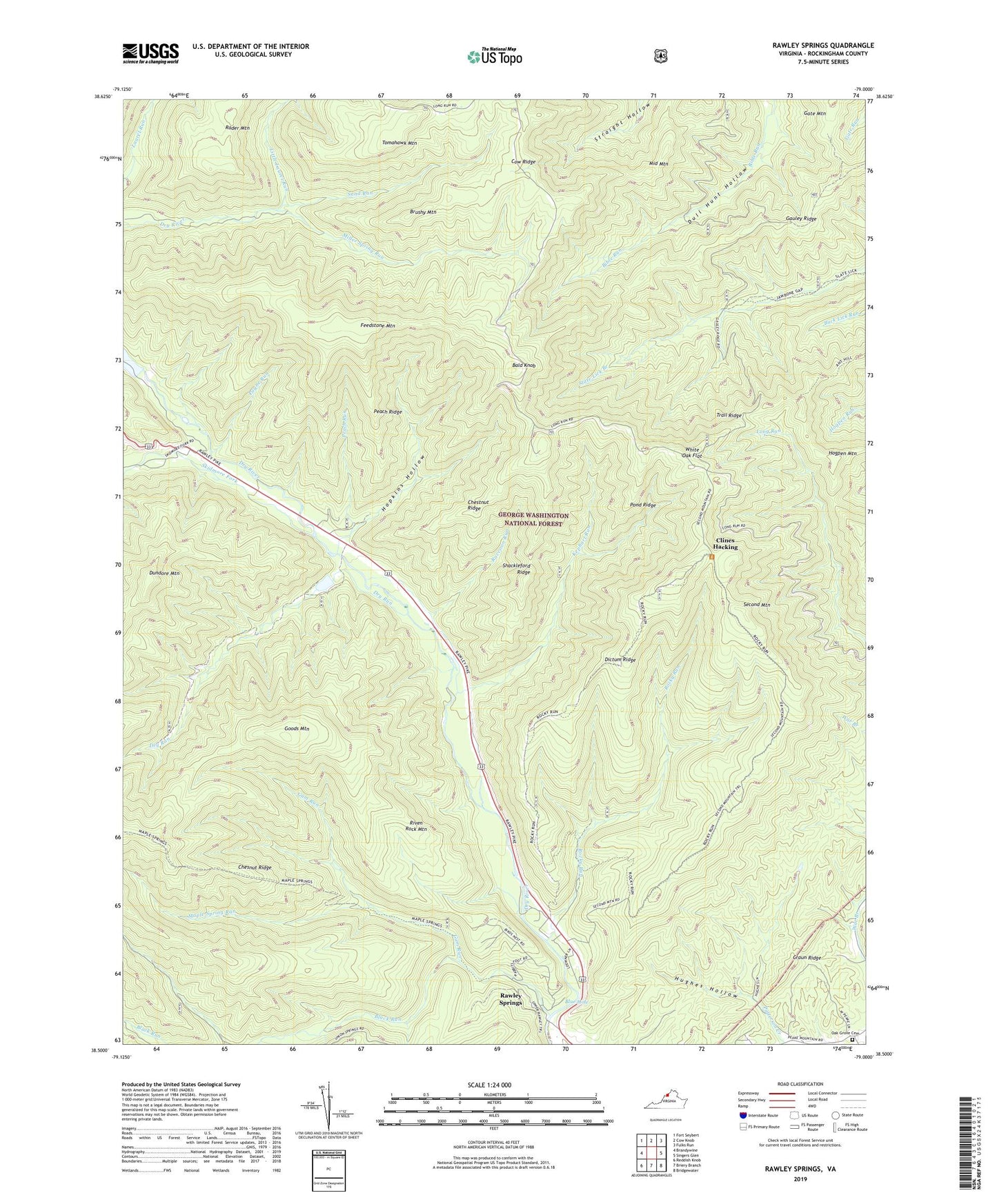
2019 topographic map quadrangle Rawley Springs in the state of Virginia. Scale: 1:24000. Based on the newly updated USGS 7.5' US Topo map series, this map is in the following counties: Rockingham. The map contains contour data, water features, and other items you are used to seeing on USGS maps, but also has updated roads and other features. This is the next generation of topographic maps. Printed on high-quality waterproof paper with UV fade-resistant inks.
Quads adjacent to this one:
West: Brandywine
Northwest: Fort Seybert
North: Cow Knob
Northeast: Fulks Run
East: Singers Glen
Southeast: Bridgewater
South: Briery Branch
Southwest: Reddish Knob
Contains the following named places: Bald Knob, Black Run, Blue Hole, Brushy Mountain, Chestnut Ridge, Clines Hacking, Cow Ridge, Craun Ridge, Dictum Ridge, Dictum Ridge Trail, Dry Run, Feedstone Mountain, Gauley Ridge, Goods Mountain, Gum Run, Harrisonburg Reservoir, Hogpen Mountain, Hopkins Hollow, Hughes Hollow, Kephart Run, Little Laurel Run, Lower North River Dam Number 82, Lower North River Number 22a Dam, Lower North River Site 82 Lake, Maple Spring Run, Middle Mountain, Miller Spring Run, Payne Run, Peach Ridge, Peach Run, Peake Pentecostal Church Cemetery, Pond Ridge, Raccoon Run, Rader Mountain Trail, Rawley Springs, Rawley Springs Post Office, Riven Rock Mountain, Riven Rock Picnic Area, Riven Rock Recreation Site, Rocky Run, Sand Run, Second Mountain, Second Mountain Trail, Shackleford Ridge, Skidmore Fork, Slate Springs Mountain Trail, Tomahawk Mountain, Trail Ridge, White Oak Flat, ZIP Code: 22831