MyTopo
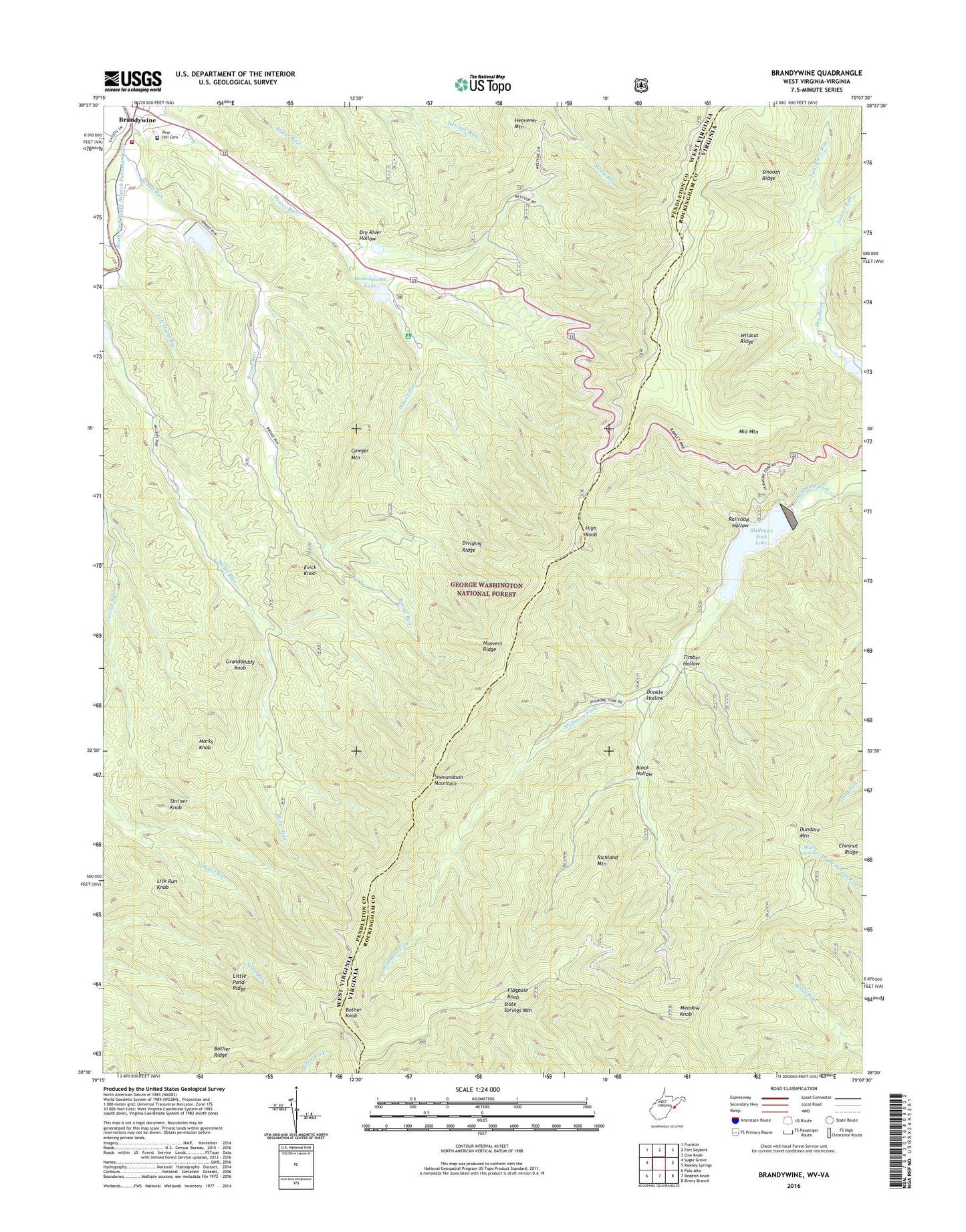
Brandywine West Virginia US Topo Map
Couldn't load pickup availability
Also explore the Brandywine Forest Service Topo of this same quad for updated USFS data
2023 topographic map quadrangle Brandywine in the states of West Virginia, Virginia. Scale: 1:24000. Based on the newly updated USGS 7.5' US Topo map series, this map is in the following counties: Pendleton, Rockingham. The map contains contour data, water features, and other items you are used to seeing on USGS maps, but also has updated roads and other features. This is the next generation of topographic maps. Printed on high-quality waterproof paper with UV fade-resistant inks.
Quads adjacent to this one:
West: Sugar Grove
Northwest: Franklin
North: Fort Seybert
Northeast: Cow Knob
East: Rawley Springs
Southeast: Briery Branch
South: Reddish Knob
This map covers the same area as the classic USGS quad with code o38079e2.
Contains the following named places: Bandywine Lake Campground, Block Hollow, Bother Knob, Bother Ridge, Bother Ridge Trail, Brandywine, Brandywine Census Designated Place, Brandywine Lake, Brandywine Recreation Area, Brandywine Run, Broad Run, Cedar Grove Church, Chestnut Ridge, Cowger Mountain, Dam Number 13, Dam Number 27, Dividing Ridge, Dry River Hollow, Dundore Mountain, Dunkle Hollow, Evick Knob, Flagpole Knob, Granddaddy Knob, Heavener Mountain, High Knob, Hoovers Ridge, Laurel Run, Left Hand Run, Lick Run Knob, Little Pond Ridge, Low Place Run, Lower North River Number 81c Dam, Maple Spring, Marks Knob, Martin Luther Church, Meadow Knob, Middle Mountain, Miller Run Trail, Pine Hill Cemetery, Railroad Hollow, Richland Mountain, Road Run Trail, Shenandoah Wildlife Management Area, Shriner Knob, Skidmore Fork Lake, Skidmore Fork Scenic Area, Slate Springs Mountain, Slate Springs Mountain Trail, Smooth Ridge, South Fork Structure Number 13 Dam, South Fork Structure Number 14 Dam, South Fork Structure Number 27 Dam, South Fork Volunteer Fire Department, Switzer Dam, Switzer Lake, Timber Hollow, Wildcat Ridge