MyTopo
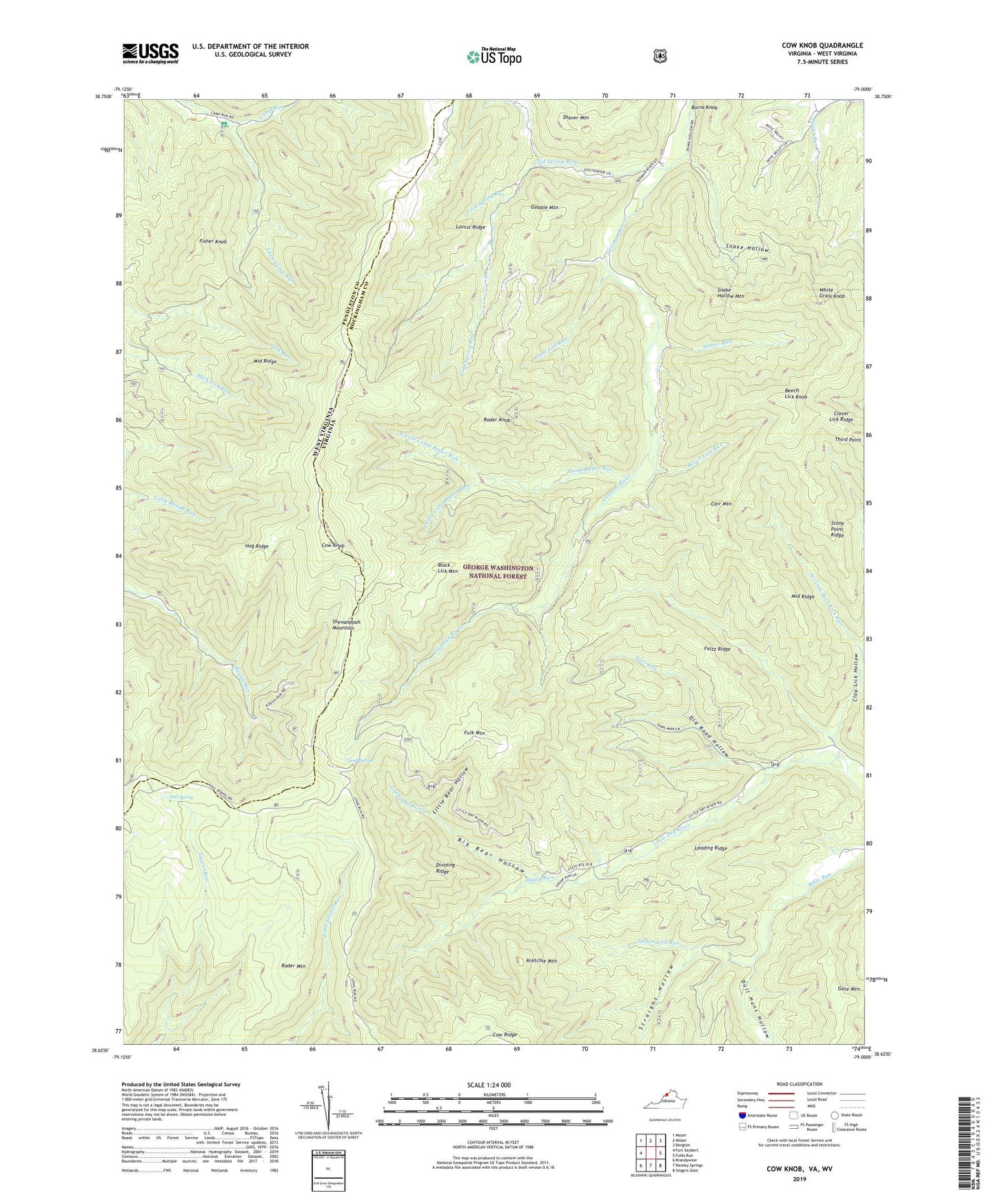
Cow Knob Virginia US Topo Map
Couldn't load pickup availability
Also explore the Cow Knob Forest Service Topo of this same quad for updated USFS data
2022 topographic map quadrangle Cow Knob in the states of Virginia, West Virginia. Scale: 1:24000. Based on the newly updated USGS 7.5' US Topo map series, this map is in the following counties: Rockingham, Pendleton. The map contains contour data, water features, and other items you are used to seeing on USGS maps, but also has updated roads and other features. This is the next generation of topographic maps. Printed on high-quality waterproof paper with UV fade-resistant inks.
Quads adjacent to this one:
West: Fort Seybert
Northwest: Mozer
North: Milam
East: Fulks Run
Southeast: Singers Glen
South: Rawley Springs
Southwest: Brandywine
Contains the following named places: Beech Lick Knob, Beech Lick Run, Big Bear Hollow, Black Lick Mountain, Buck Lick Run Trail, Burns Knob, Camp Rader Run, Carr Mountain, Carr Run, Clay Lick Hollow, Clover Lick Ridge, Cold Spring River, Cold Spring Run, Cow Knob, Dividing Ridge, Dull Hunt Hollow, Dull Hunt Trail, Feltz Ridge, Fisher Knob, Fulk Mountain, Gate Mountain, Gobble Mountain, Hall Spring, Hog Ridge, Kretchie Mountain, Leading Ridge, Lick Run Trail, Little Bear Hollow, Little Camp Run, Locust Ridge, Middle Ridge, North Fork Camp Rader Run, Old Road Hollow, Paint Lick Run, Rader Knob, Rader Mountain, Sand Spring, Seventy Buck Lick Run, Shaver Mountain, Snake Hollow, Snake Hollow Mountain, South Fork Camp Rader Run, Spruce Lick Run, Stony Point Ridge, Straight Hollow, Sugar Run, Sumac Run, Third Point, White Grass Knob, ZIP Code: 22820