MyTopo
Reddish Knob Virginia US Topo Map
Couldn't load pickup availability
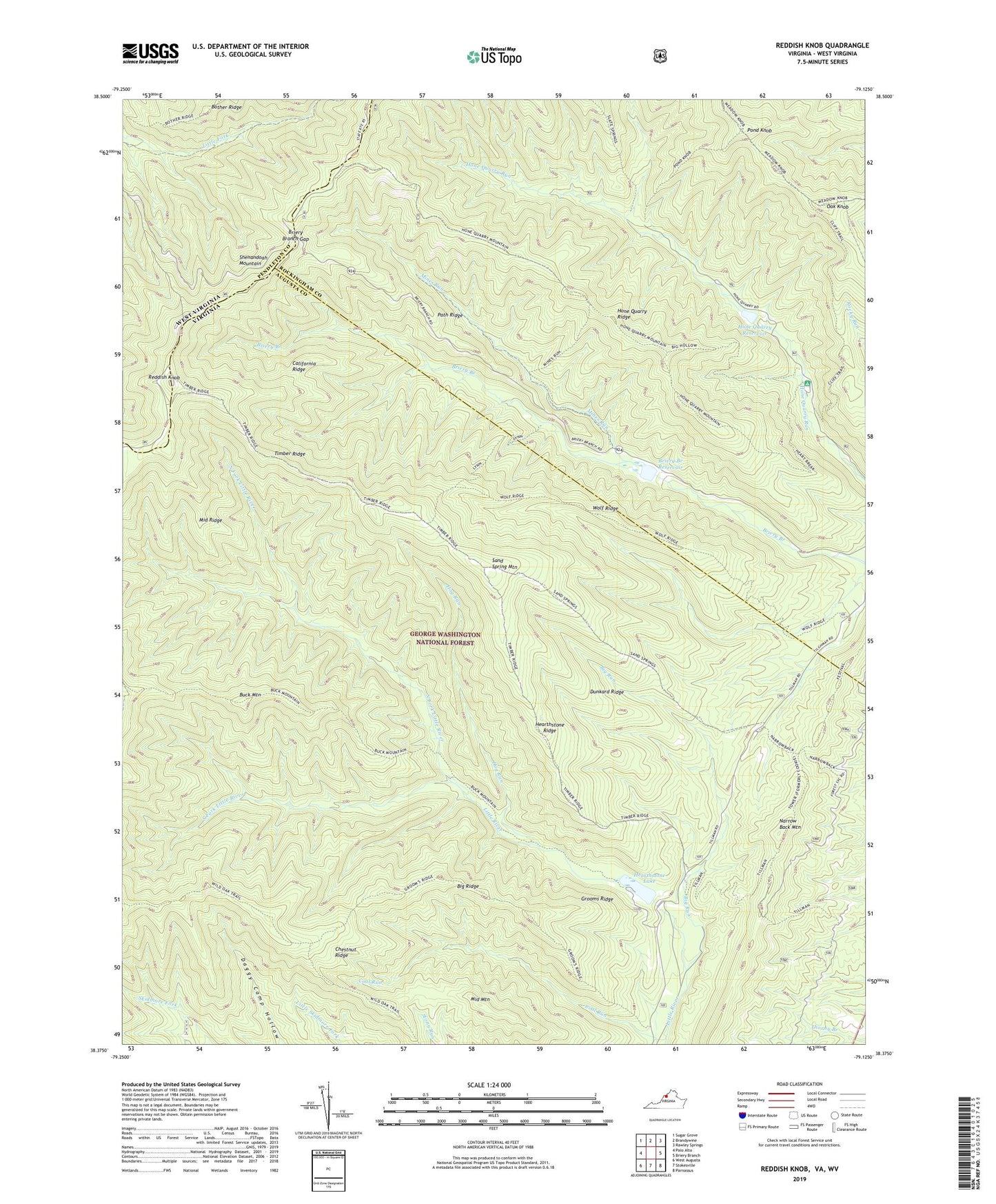
2019 topographic map quadrangle Reddish Knob in the states of Virginia, West Virginia. Scale: 1:24000. Based on the newly updated USGS 7.5' US Topo map series, this map is in the following counties: Augusta, Rockingham, Pendleton. The map contains contour data, water features, and other items you are used to seeing on USGS maps, but also has updated roads and other features. This is the next generation of topographic maps. Printed on high-quality waterproof paper with UV fade-resistant inks.
Quads adjacent to this one:
Northwest: Sugar Grove
North: Brandywine
Northeast: Rawley Springs
East: Briery Branch
Southeast: Parnassus
South: Stokesville
Southwest: West Augusta
Contains the following named places: Big Hollow Trail, Big Ridge, Big Run, Briery Branch Dam, Briery Branch Gap, Briery Branch Overlook, Briery Branch Reservoir, Buck Mountain, Buck Mountain Trail, California Ridge, California Ridge Trail, Chestnut Ridge Trail, Dunkard Ridge, Grooms Ridge, Grooms Ridge Trail, Hearthstone Lake, Hearthstone Ridge, Heiliger Kanzel Overlook, Hog Run, Hone Quarry Dam, Hone Quarry Recreation Site, Hone Quarry Reservoir, Hone Quarry Ridge, Hone Quarry Ridge Trail, Lower North River Number 78 Dam, Lower North River Number 83 Dam, Middle Mountain, Middle Ridge, Mines Run, Mines Run Trail, Narrow Back Trail, Narrow Buck Trail, North Fork Little River, Oak Knob, Path Ridge, Pond Knob, Reddish Knob, Sand Spring Mountain, Sand Spring Mountain Trail, Slate Springs Trail A, Slate Springs Trail AA, Slate Springs Trail B, South Fork Little River, Stony Run Overlook, Timber Ridge, Timber Ridge Trail, Upper North Number 77 Dam, WKCY-FM (Harrisonburg), Wolf Ridge, ZIP Codes: 22821, 22843