MyTopo
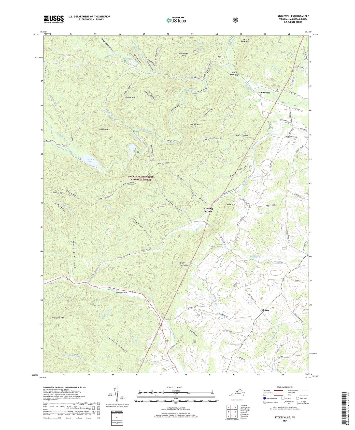
Stokesville Virginia US Topo Map
Couldn't load pickup availability
Also explore the Stokesville Forest Service Topo of this same quad for updated USFS data
2022 topographic map quadrangle Stokesville in the state of Virginia. Scale: 1:24000. Based on the newly updated USGS 7.5' US Topo map series, this map is in the following counties: Augusta. The map contains contour data, water features, and other items you are used to seeing on USGS maps, but also has updated roads and other features. This is the next generation of topographic maps. Printed on high-quality waterproof paper with UV fade-resistant inks.
Quads adjacent to this one:
West: West Augusta
North: Reddish Knob
Northeast: Briery Branch
East: Parnassus
Southeast: Staunton
South: Churchville
Southwest: Elliott Knob
This map covers the same area as the classic USGS quad with code o38079c2.
Contains the following named places: Barger Pond, Bear Draft, Bear Draft Trail, Bear Trap Farm, Broad Run, Buck Hill, Camp Flather, Coal Run, Daggy Camp Hollow, Delta Springs Farm, Echols Field, Elk Run Church, Elkhorn Lake, Elkhorn Mountain, Flat Run, Grindstone Mountain, Hankey Mountain, Hankey Mountain Trail, Haywood Hollow, Jennings Gap, Jennings Gap Dairy, Little North Mountain, Little River, Little Skidmore Fork, Little Skidmore Trail, Lookout Mountain, Lookout Mountain Trail, Muddy Hollow, North River Campground, North River District, North River Gap, North River Gorge Trail, North River Picnic Area, Paynes Chapel, Shaffer Hollow, Skidmore Fork, Staunton Dam, Staunton Reservoir, Stillhouse Run, Stokesville, Stony Run, Stoutameyer Branch, Stover, Stribling Springs, Swoope Run, Todd Lake, Todd Lake Camp Site, Todd Lake Recreation Area, Trimble Mountain, Tunnel Hollow, Union Church, Upper North River Number 10 Dam, Upper North River Number 76 Dam, White Oak Draft, White Oak Draft Trail, White Oak Run, Whites Store, Wilson Hollow