MyTopo
Parnassus Virginia US Topo Map
Couldn't load pickup availability
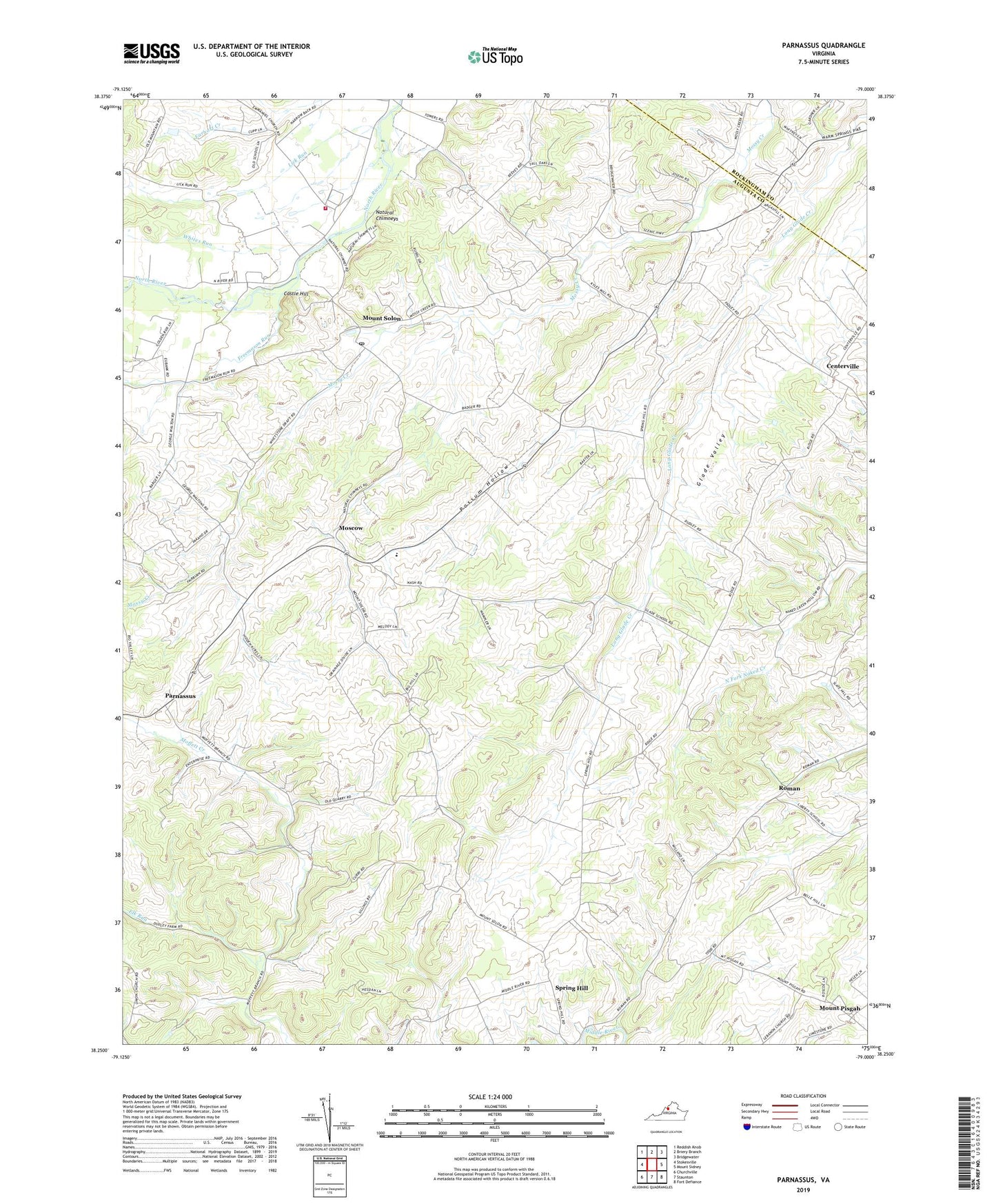
2022 topographic map quadrangle Parnassus in the state of Virginia. Scale: 1:24000. Based on the newly updated USGS 7.5' US Topo map series, this map is in the following counties: Augusta, Rockingham. The map contains contour data, water features, and other items you are used to seeing on USGS maps, but also has updated roads and other features. This is the next generation of topographic maps. Printed on high-quality waterproof paper with UV fade-resistant inks.
Quads adjacent to this one:
West: Stokesville
Northwest: Reddish Knob
North: Briery Branch
Northeast: Bridgewater
East: Mount Sidney
Southeast: Fort Defiance
South: Staunton
Southwest: Churchville
This map covers the same area as the classic USGS quad with code o38079c1.
Contains the following named places: Castle Hill, Centerville, Elk Run, Emmanuel Church, Freemason Run, Gardner's Dairy and Poultry Farm, Glade Valley, Hidden Acres Farm, Hillview Farm, Lebanon Church, Lick Run, Michaels Poultry Farm, Moscow, Mossy Creek, Mossy Creek Church, Mossy Creek Poultry Farm, Mount Olivet Church, Mount Pisgah, Mount Solon, Mount Solon Church, Mount Solon Post Office, Mount Solon Volunteer Fire and Rescue Squad Company 21 Rescue 21, Mount Solon Volunteer Rescue Squad, Natural Chimneys, Natural Chimneys Regional Park, North River Elementary School, Parnassus, Possum Hollow, Roman, Saint Pauls Church, Spring Hill, Towers, Weaver Brothers Dairy, Whites Run