MyTopo
Richardsville Virginia US Topo Map
Couldn't load pickup availability
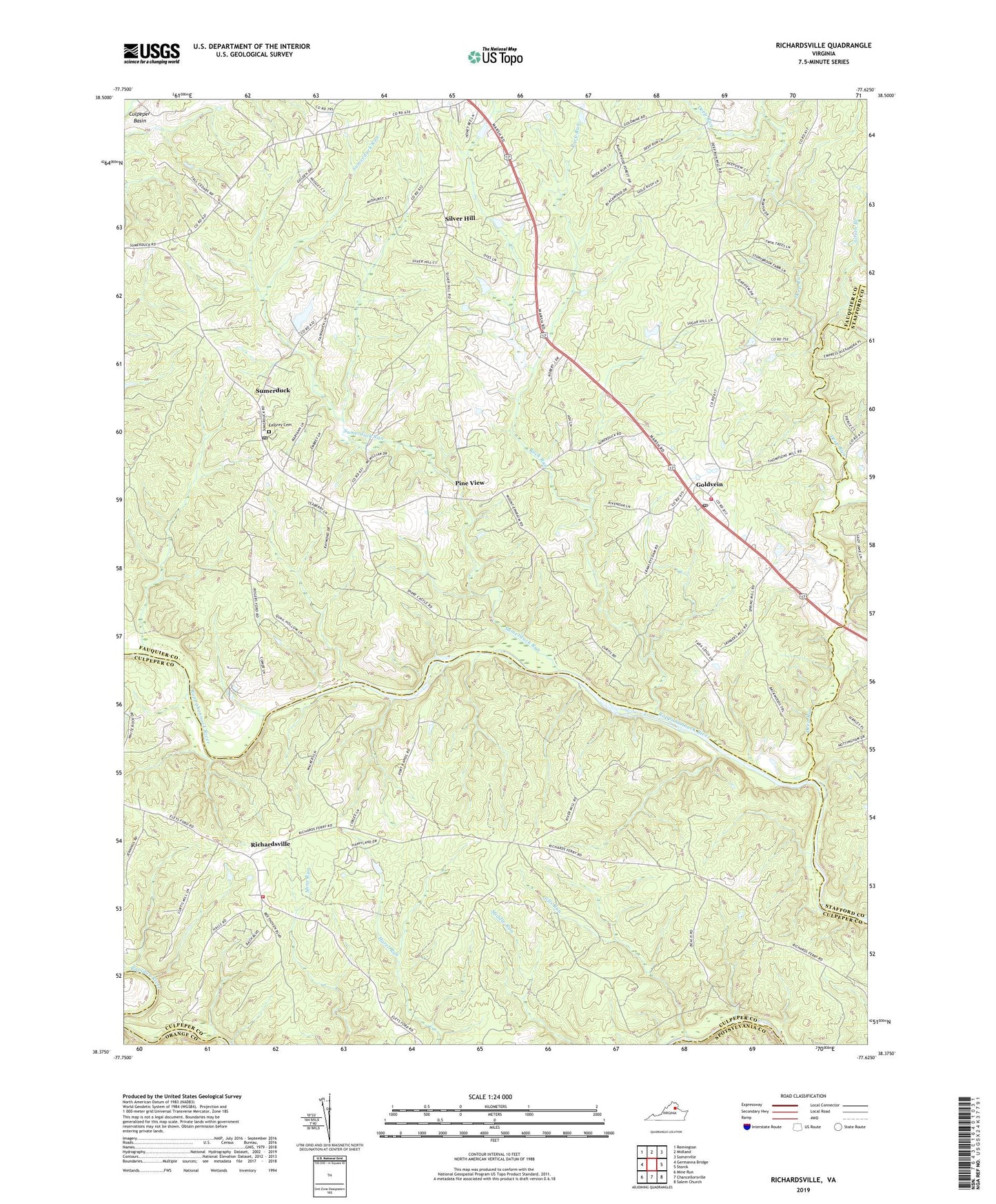
2019 topographic map quadrangle Richardsville in the state of Virginia. Scale: 1:24000. Based on the newly updated USGS 7.5' US Topo map series, this map is in the following counties: Fauquier, Culpeper, Stafford, Orange, Spotsylvania. The map contains contour data, water features, and other items you are used to seeing on USGS maps, but also has updated roads and other features. This is the next generation of topographic maps. Printed on high-quality waterproof paper with UV fade-resistant inks.
Quads adjacent to this one:
West: Germanna Bridge
Northwest: Remington
North: Midland
Northeast: Somerville
East: Storck
Southeast: Salem Church
South: Chancellorsville
Southwest: Mine Run
Contains the following named places: Alcotti Run, Camp Happyland, Clevers Oak Church, Deep Run, Deerfield Estates, Embrey Cemetery, Embrey Church, Flat Run, Gills Run, Golden Hills, Goldvein, Goldvein Baptist Church, Goldvein Post Office, Goldvein School, Goldvein Volunteer Fire and Rescue Company 8, Green Branch, Grove Baptist Church, Grove Churches, Oakland Church, Oders Corner, Pine Branch, Pine View, Queens Guard, Richardsville, Richardsville South, Richardsville United Methodist Church, Richardsville Volunteer Fire and Rescue, Rock Run, Sherwood Estates, Silver Hill, Silver Hill Baptist Church, Sumerduck, Sumerduck Post Office, Sumerduck Run, Thompsons Mill, Union Church, ZIP Codes: 22720, 22736, 22742