
MyTopo
Shacklefords Virginia US Topo Map
Couldn't load pickup availability
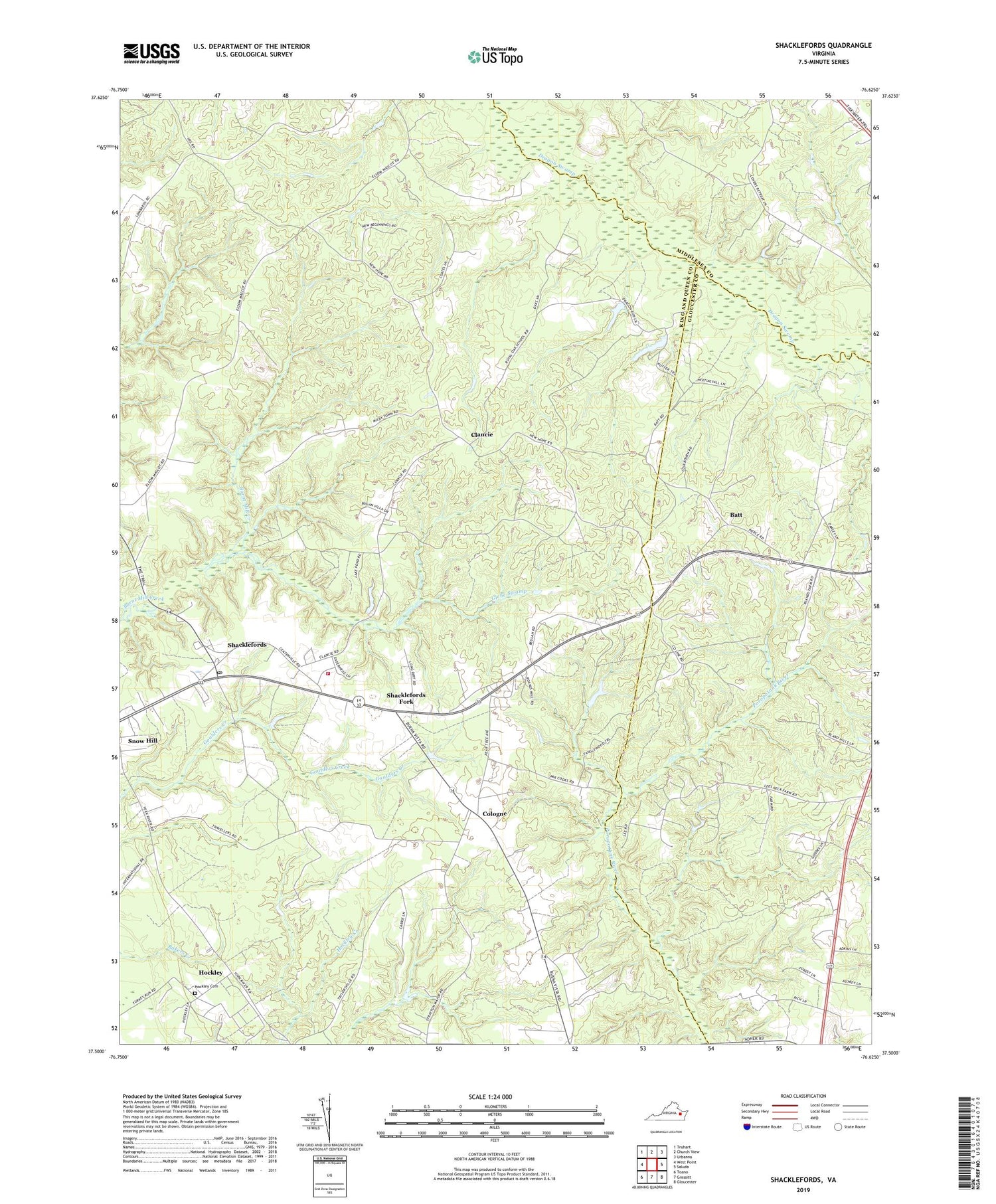
2019 topographic map quadrangle Shacklefords in the state of Virginia. Scale: 1:24000. Based on the newly updated USGS 7.5' US Topo map series, this map is in the following counties: King and Queen, Gloucester, Middlesex. The map contains contour data, water features, and other items you are used to seeing on USGS maps, but also has updated roads and other features. This is the next generation of topographic maps. Printed on high-quality waterproof paper with UV fade-resistant inks.
Quads adjacent to this one:
West: West Point
Northwest: Truhart
North: Church View
Northeast: Urbanna
East: Saluda
Southeast: Gloucester
South: Gressitt
Southwest: Toano
Contains the following named places: Batt, Beulah Church, Beulahland, Buena Vista District, Clancie, Cologne, Dutton, Escoe Brook Church, Glebe Swamp, Hockley, Hockley Cemetery, Lower King and Queen Volunteer Fire Department - Shacklefords Station, New Hope Church, New Hope Memorial Church, Owl Trap, Poroporone Church, Prospect School, Royal Oak School, Shacklefords, Shacklefords Fork, Shacklefords Post Office, Shanghai District, Snow Hill, Toms Hill School, Union Prospect Church, York Academy, ZIP Code: 23156


