MyTopo
Truhart Virginia US Topo Map
Couldn't load pickup availability
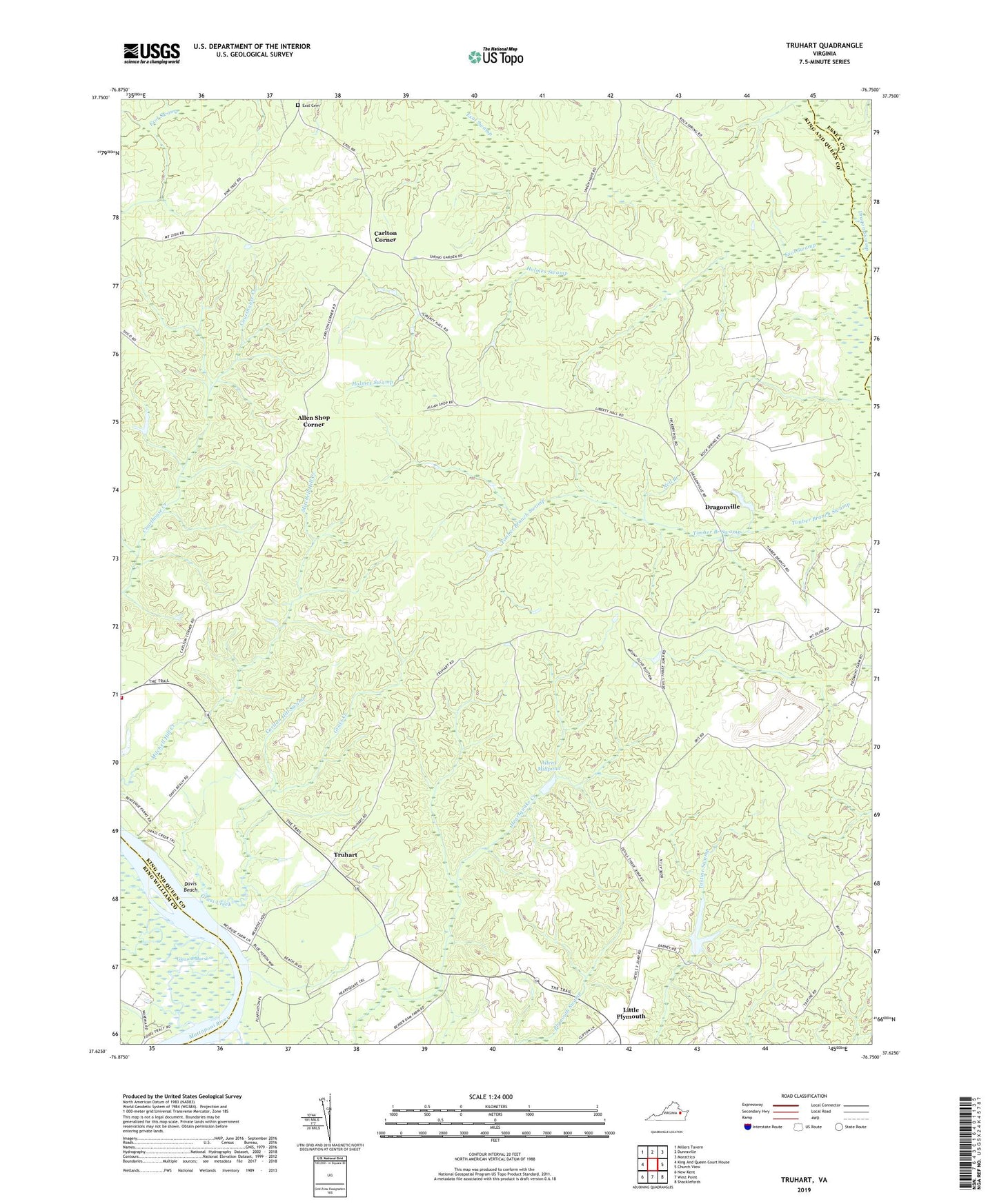
2022 topographic map quadrangle Truhart in the state of Virginia. Scale: 1:24000. Based on the newly updated USGS 7.5' US Topo map series, this map is in the following counties: King and Queen, King William, Essex, Middlesex. The map contains contour data, water features, and other items you are used to seeing on USGS maps, but also has updated roads and other features. This is the next generation of topographic maps. Printed on high-quality waterproof paper with UV fade-resistant inks.
Quads adjacent to this one:
West: King And Queen Court House
Northwest: Millers Tavern
North: Dunnsville
Northeast: Morattico
East: Church View
Southeast: Shacklefords
South: West Point
Southwest: New Kent
This map covers the same area as the classic USGS quad with code o37076f7.
Contains the following named places: Allen Shop Corner, Allens Mill Dam, Allens Millpond, Carlton Corner, Carlton Hill Swamp, Central King and Queen Volunteer Fire Department, Davis Beach, Dragonville, Exol Cemetery, Exol Swamp, Grass Creek, Holmes Swamp, King and Queen Landfill, Little Plymouth, Lower King and Queen Church, Melrose Landing, Nell Branch, Normans Dam, Second Mount Olive Church, Stevensville District, Townsend Dam, Truhart, ZIP Codes: 23085, 23091