MyTopo
Church View Virginia US Topo Map
Couldn't load pickup availability
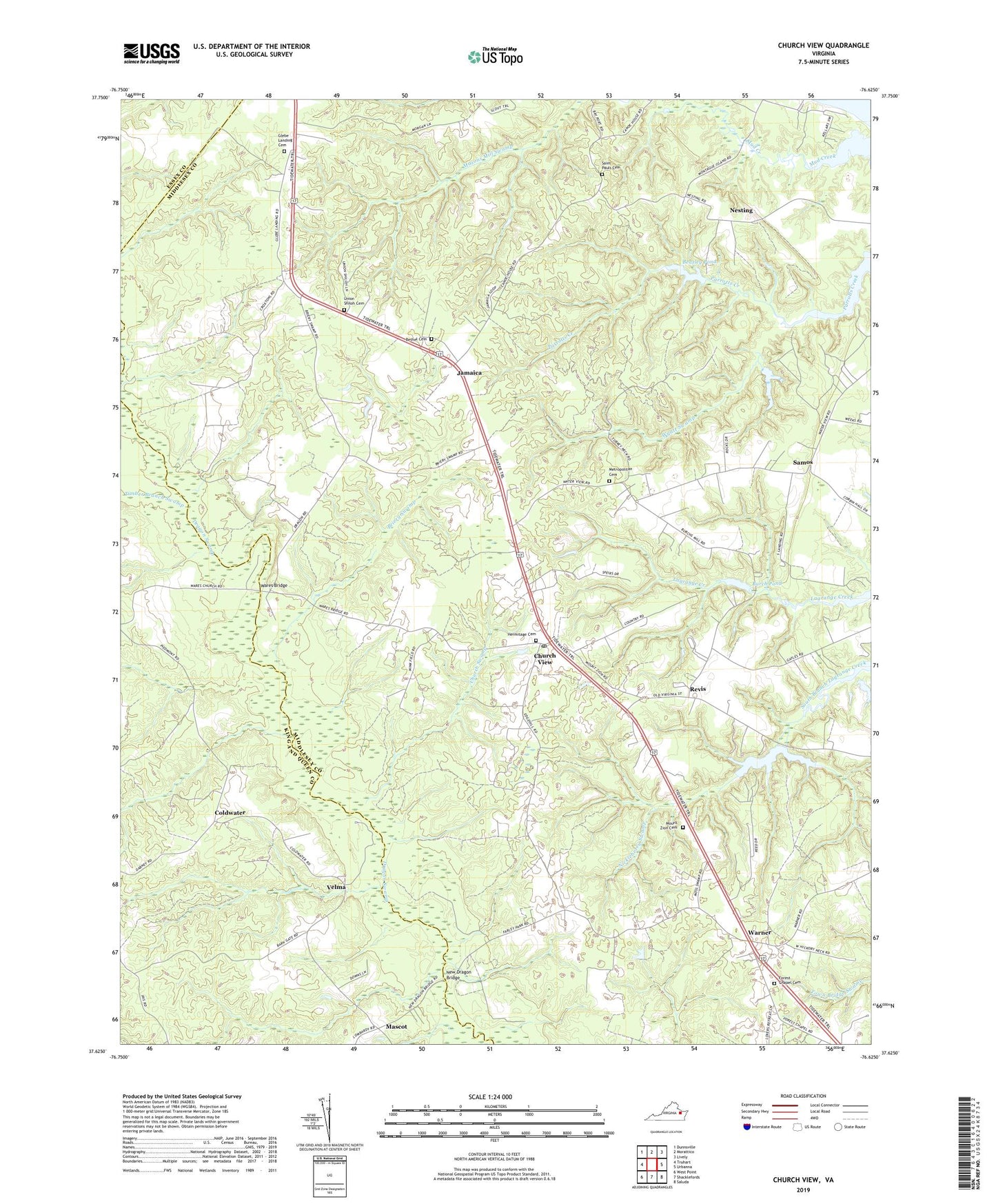
2022 topographic map quadrangle Church View in the state of Virginia. Scale: 1:24000. Based on the newly updated USGS 7.5' US Topo map series, this map is in the following counties: Middlesex, King and Queen, Essex. The map contains contour data, water features, and other items you are used to seeing on USGS maps, but also has updated roads and other features. This is the next generation of topographic maps. Printed on high-quality waterproof paper with UV fade-resistant inks.
Quads adjacent to this one:
West: Truhart
Northwest: Dunnsville
North: Morattico
Northeast: Lively
East: Urbanna
Southeast: Saluda
South: Shacklefords
Southwest: West Point
This map covers the same area as the classic USGS quad with code o37076f6.
Contains the following named places: Beazley Dam, Beazley Pond, Bethel Cemetery, Bethel Church, Briery Swamp, Burch Mill Dam, Burch Pond, Church Swamp, Church View, Church View Post Office, Coldwater, Farley Park Corner, Forest Chapel, Forest Chapel Cemetery, Glebe Landing Cemetery, Glebe Landing Church, Hermitage Cemetery, Hermitage Church, Hilliard Pond, Hilliards Dam, Jamaica, Jamaica District, Mascot, Metropolitan Cemetery, Metropolitan Church, Mount Zion, Mount Zion Cemetery, Mount Zion Church, Nesting, New Dragon Bridge, Nickleberry Swamp, Revis, Royal Oak School, Saint Pauls Cemetery, Saint Pauls Church, Samos, The Punchbowl, Timber Branch Swamp, Union Grove School, Union Shiloh Cemetery, Union Shiloh Church, Velma, Virginia Motor Speedway, Wares Bridge, Warner, Whiteoak School, Wyatt Swamp, ZIP Codes: 23032, 23079, 23108