MyTopo
Simeon Virginia US Topo Map
Couldn't load pickup availability
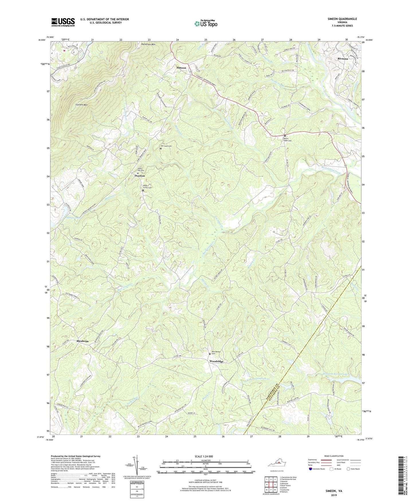
2019 topographic map quadrangle Simeon in the state of Virginia. Scale: 1:24000. Based on the newly updated USGS 7.5' US Topo map series, this map is in the following counties: Albemarle, Fluvanna. The map contains contour data, water features, and other items you are used to seeing on USGS maps, but also has updated roads and other features. This is the next generation of topographic maps. Printed on high-quality waterproof paper with UV fade-resistant inks.
Quads adjacent to this one:
West: Alberene
Northwest: Charlottesville West
North: Charlottesville East
Northeast: Keswick
East: Boyd Tavern
Southeast: Palmyra
South: Scottsville
Southwest: Esmont
Contains the following named places: Ash Lawn, Ash Lawn Cemetery, Ashmere, Blenheim, Blenheim Estate, Brookhill, Carroll Creek, Carters Mountain, Colle, Fluvanna Ruritan Lake, Henderson Creek, Houchins Creek, Jacobs Creek, Jumping Branch, Lee Jones Creek, Massey Creek, Middle Oak Church, Milton Hills, Monticello Fire Rescue Station 11, Monticello High School, Morven, Mount Air Church, Mount Eagle Cemetery, Mount Eagle Church, New Bethel Cemetery, Olympic Dam, Olympic Lake, Overton, Overton School, Patterson Mountain, Paul H Cale Elementary School, Quarry Creek, Rivanna Census Designated Place, Rose Hill, Rose Hill Church, Saint Lukes Episcopal Church, Simeon, Simeon School, Simeon Winery, Slate Hill Cemetery, Slate Hill Church, Tandem Friends School, Verdant Lawn, Wake Forest Cemetery, Wake Forest Church, WHTJ-TV (Charlottesville), Winston Creek, Woodridge, Woodridge School, WUVA-FM (Charlottesville), WVIR-TV (Charlottesville)