MyTopo
Keswick Virginia US Topo Map
Couldn't load pickup availability
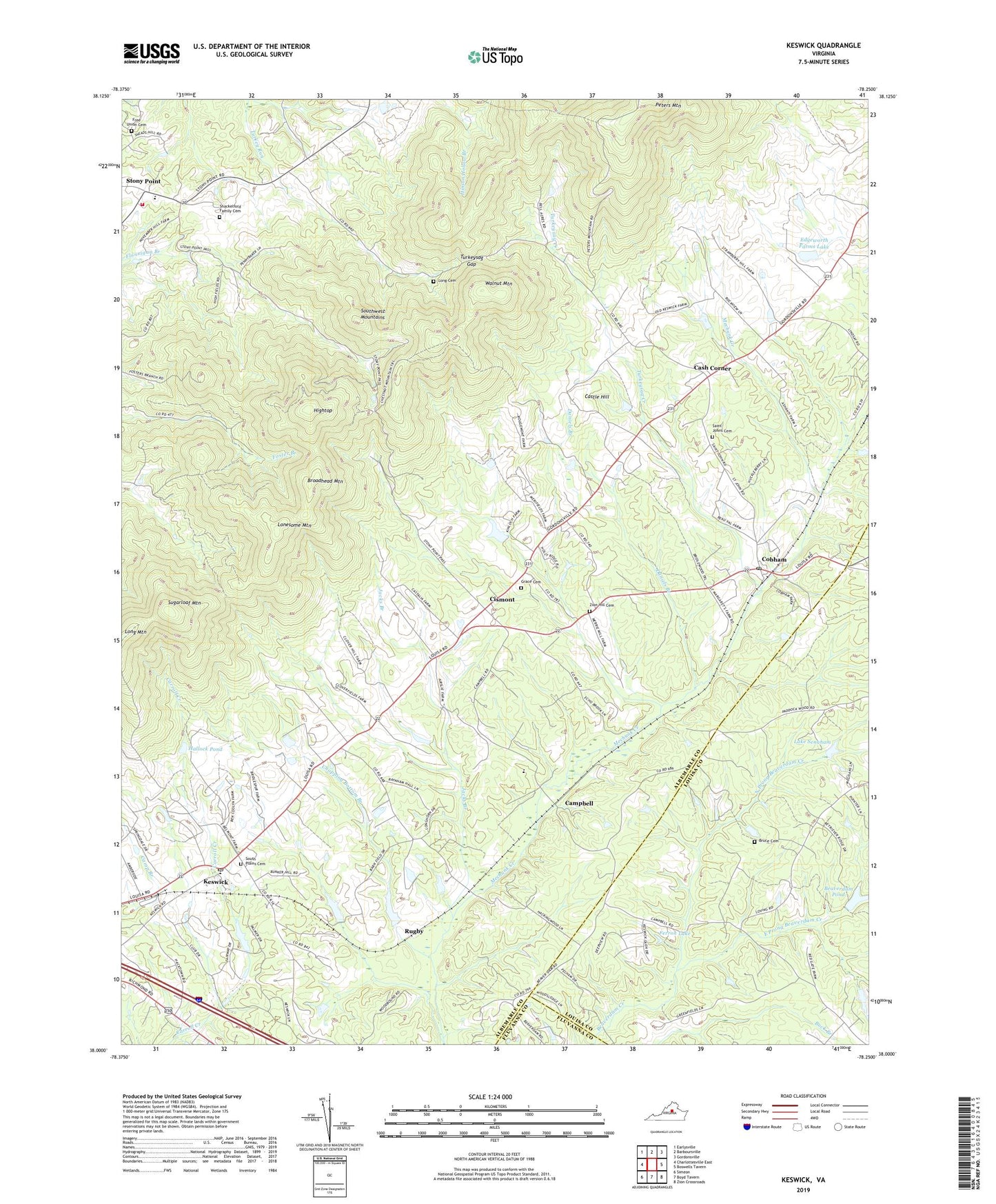
2022 topographic map quadrangle Keswick in the state of Virginia. Scale: 1:24000. Based on the newly updated USGS 7.5' US Topo map series, this map is in the following counties: Albemarle, Louisa, Fluvanna. The map contains contour data, water features, and other items you are used to seeing on USGS maps, but also has updated roads and other features. This is the next generation of topographic maps. Printed on high-quality waterproof paper with UV fade-resistant inks.
Quads adjacent to this one:
West: Charlottesville East
Northwest: Earlysville
North: Barboursville
Northeast: Gordonsville
East: Boswells Tavern
Southeast: Zion Crossroads
South: Boyd Tavern
Southwest: Simeon
This map covers the same area as the classic USGS quad with code o38078a3.
Contains the following named places: All Saints Episcopal Chapel, Babgy Memorial Church, Beaver Dam, Beaverdam Pond, Belvoir, Ben Coolyn, Bridle Spur, Broadhead Mountain, Bruce Cemetery, Campbell, Cash Corner, Castilia, Castle Hill, Chopping Bottom Branch, Cismont, Cismont Manor, Cismont School, Clover Hill, Cobham, Cobham Park, Cobham Post Office, Daniels Branch, East Prong Beaverdam Creek, Edgeworth, Edgeworth Farms Dam, Edgeworth Farms Lake, Everettsville, Ferron Dam, Ferron Lake, Findowrie, Free Union Cemetery, Free Union Church, Grace Cemetery, Hallock Dam, Hallock Pond, Hightop, Jacks Branch, Keswick, Keswick Census Designated Place, Keswick Country Club, Keswick Hunt Club, Keswick Post Office, Keswick School, Lake Senaham, Little Keswick School, Lonesome Mountain, Long Cemetery, Long Mountain, Merrie Mill, North Prong Beaverdam Creek, Oakland School, Old Keswick, Piedmont Church, Poorhouse Farm, Preddy Creek Church, Rivanna District, Rosena, Rugby, Saint Andrews Chapel, Saint Johns Cemetery, Saint Johns Church, Shackelford Family Cemetery, South Plains Cemetery, South Plains Church, Southwest Mountains, Stony Point, Stony Point Elementary School, Stony Point Volunteer Fire Company, Stony Point Volunteer Fire Company Station 6, Sugarloaf Mountain, Tall Oaks, Turkeysag Creek, Turkeysag Gap, Virginia Farms, Walkers Parish Church, Walnut Mountain, Zion Hill Cemetery, Zion Hill Church, ZIP Code: 22947