MyTopo
South Boston Virginia US Topo Map
Couldn't load pickup availability
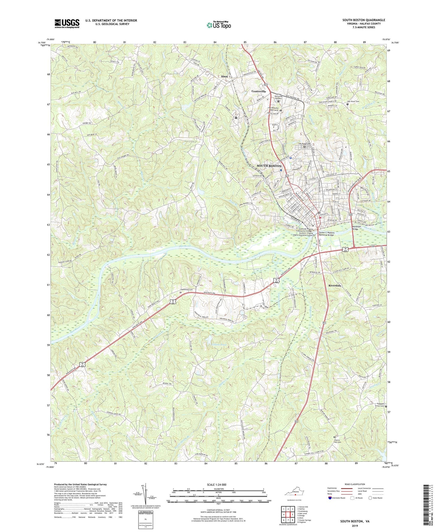
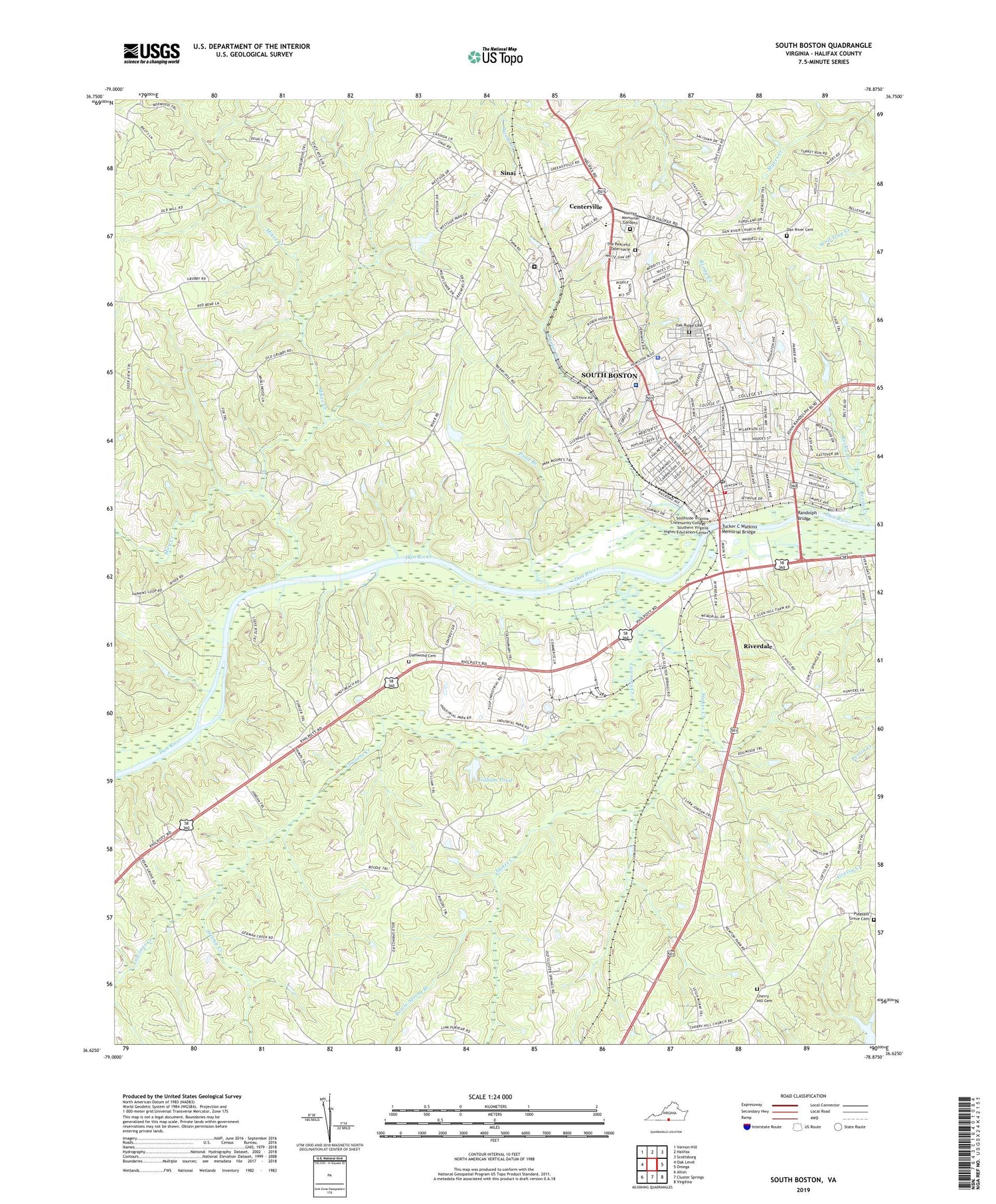
2019 topographic map quadrangle South Boston in the state of Virginia. Scale: 1:24000. Based on the newly updated USGS 7.5' US Topo map series, this map is in the following counties: Halifax. The map contains contour data, water features, and other items you are used to seeing on USGS maps, but also has updated roads and other features. This is the next generation of topographic maps. Printed on high-quality waterproof paper with UV fade-resistant inks.
Quads adjacent to this one:
West: Oak Level
Northwest: Vernon Hill
North: Halifax
Northeast: Scottsburg
East: Omega
Southeast: Virgilina
South: Cluster Springs
Southwest: Alton
Contains the following named places: Bell Chapel, Berry Hill Church, Bowle Spring Branch, Bowle Spring School, Bruce Pond, C H Friend Elementary School, Cage Dam, Carrington Memorial Library, Centerville, Centerville Baptist Church, Centerville Christian School, Centerville Shopping Center, Cherry Hill Cemetery, Cherry Hill Church, Church of God, City of South Boston, Cluster Springs Early Learning Center, Coleman School, Dan River Bethel Church, Dan River Cemetery, Dan River Church, Deliverance Church, District 8, Ebenezer Church, Faith Church, Faith Community Church, First Baptist Church, First Presbyterian Church, Fordland Estates, Gilliam Dam, Gilliam Pond, Glenwood Cemetery, Glenwood Church, Halifax Correctional Unit 23, Halifax Country Club, Halifax County Fairgrounds, Halifax County High School, Halifax County Middle School, Halifax County Rescue Squad, Halifax County-South Boston Industrial Park, Halifax Memorial Gardens, Halifax Regional Hospital, Halifax Square Shopping Center, Highland Hills, Hubbs Mill Plaza Shopping Center, Jerimy Creek, Kingdom Hall of Jehovahs Witnesses, Lawsons Creek, Loves Shop, Main Street Church, Marsailles, McCanless Memorial Church, McGhaulin and Mays Dam, Memorial Church, Mikes Creek, Miry Creek, Mount Olive Church, Oak Hill Estates, Oak Ridge Cemetery, Pentecostal Holiness Church, Pleasant Grove Cemetery, Pleasant Grove Church, Pond Branch, Poplar Creek, Powell Dam, Randolph Bridge, Reedy Creek, Riverdale, Riverdale Census Designated Place, Rocky Branch, Saint Paschals Church, Second Baptist Church, Sinai, Sinai Industrial Park, South Boston, South Boston City Hall, South Boston Elementary School, South Boston Fire Department, South Boston Hospital, South Boston Medical Heliport, South Boston Police Department, South Boston Post Office, South Boston Public School, South Boston Water Works, South of Dan Elementary School, Stokes Creek, The Peaceful Tabernacle, The Woodview, Town of South Boston, Trinity Church, Trinity Episcopal Church, Tucker C Watkins Memorial Bridge, Washington - Coleman Early Learning Center, Washington School, West View Church, Westside Village, WHLF-AM (South Boston), Williams Dam, Woodlawn Park, ZIP Code: 24592