MyTopo
Omega Virginia US Topo Map
Couldn't load pickup availability
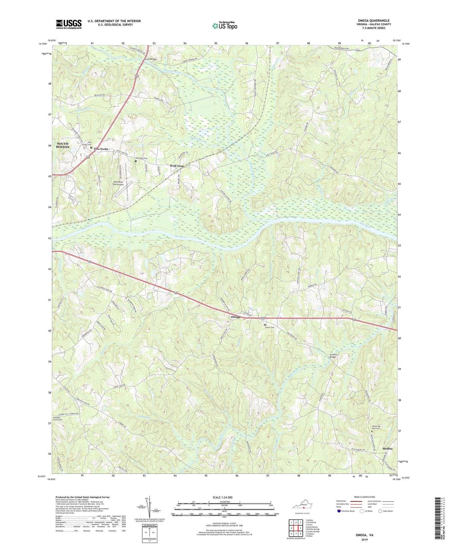
2022 topographic map quadrangle Omega in the state of Virginia. Scale: 1:24000. Based on the newly updated USGS 7.5' US Topo map series, this map is in the following counties: Halifax. The map contains contour data, water features, and other items you are used to seeing on USGS maps, but also has updated roads and other features. This is the next generation of topographic maps. Printed on high-quality waterproof paper with UV fade-resistant inks.
Quads adjacent to this one:
West: South Boston
Northwest: Halifax
North: Scottsburg
Northeast: Clover
East: Buffalo Springs
Southeast: Nelson
South: Virgilina
Southwest: Cluster Springs
This map covers the same area as the classic USGS quad with code o36078f7.
Contains the following named places: Banister River, Banister River Wildlife Management Area, Centerville, Chatman Branch, Clardie Creek, Dan River View Church, Dan River Wildlife Management Area, District 5, Ebenezer Cemetery, Ebenezer Church, Edmunds Dam, Five Forks, Five Forks Baptist Church, Five Forks Cemetery, Forkland Mission Church, Gibson Creek, Grace Cemetery, Grace Church, Grassy Creek, Griffins Bridge, Hilly Creek, Hudson Branch, Hyco Landing, Jeter Chapel, Larkin Branch, Lick Branch, Moffett, Mount Cana Church, Myers Creek, Omega, Pensions Branch, Perras Creek Wildlife Management Area, Perrin Creek, Revelation Church, South Boston Quarry, South Boston Speedway, Terrell Branch, Terrys Bridge, White Oak Fork Cemetery, White Oak Fork Church, White Oak Fork School, William M Tuck Airport, Wilson Dam, Wolf Trap, Wolf Trap Creek, Wolftrap Wildlife Management Area, Woods Creek, WSBV-AM (South Boston)