MyTopo
Virgilina Virginia US Topo Map
Couldn't load pickup availability
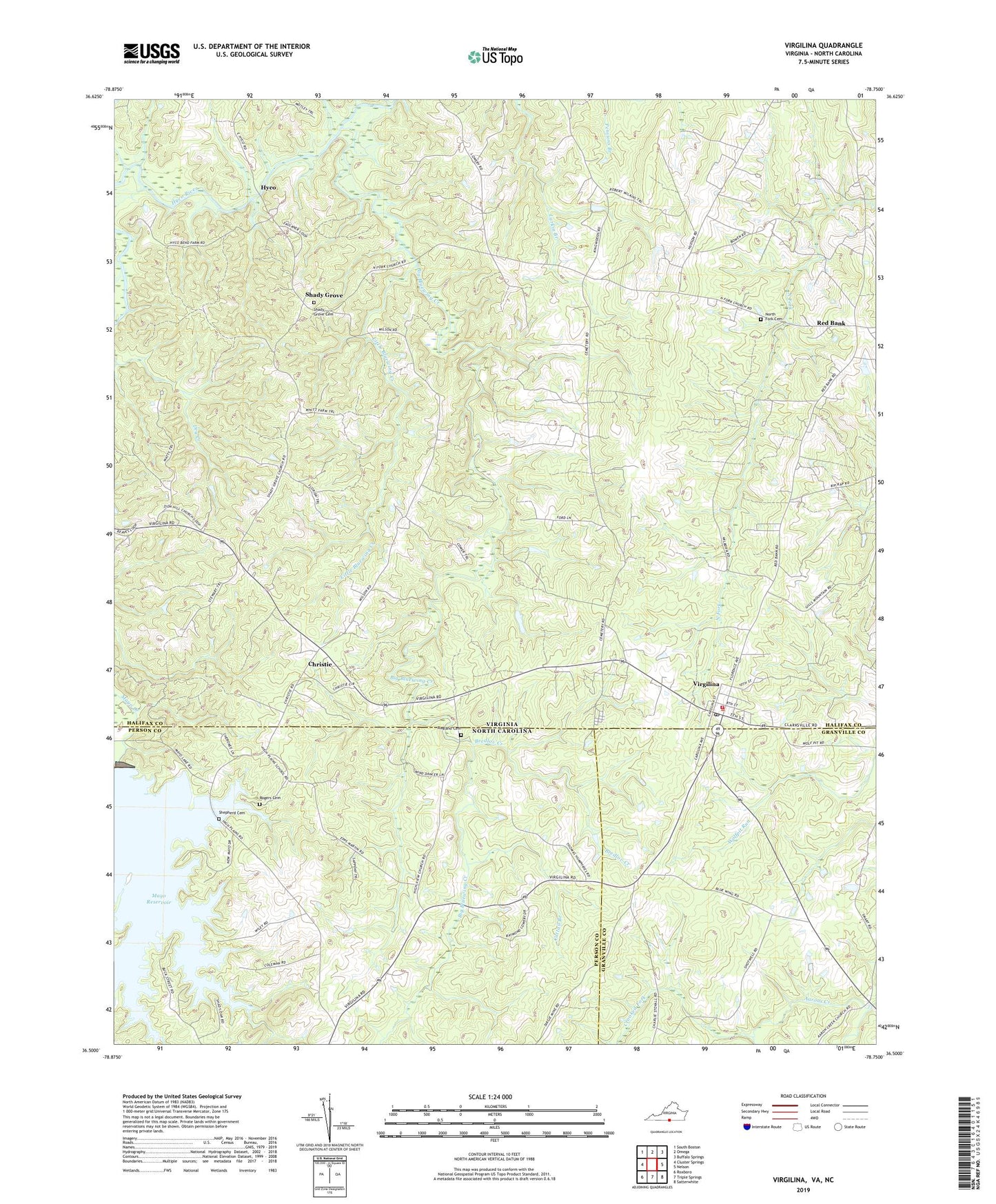
2022 topographic map quadrangle Virgilina in the states of Virginia, North Carolina. Scale: 1:24000. Based on the newly updated USGS 7.5' US Topo map series, this map is in the following counties: Halifax, Person, Granville. The map contains contour data, water features, and other items you are used to seeing on USGS maps, but also has updated roads and other features. This is the next generation of topographic maps. Printed on high-quality waterproof paper with UV fade-resistant inks.
Quads adjacent to this one:
West: Cluster Springs
Northwest: South Boston
North: Omega
Northeast: Buffalo Springs
East: Nelson
Southeast: Satterwhite
South: Triple Springs
Southwest: Roxboro
This map covers the same area as the classic USGS quad with code o36078e7.
Contains the following named places: Big Bluewing Creek, Bluewing Church, Bluewing Creek, Bredlov Creek, Calvary Baptist Church, Cattail Branch, Christie, Crooked Fork, Davis Mill, District 7, Elijah Grove Church, First Baptist Church of Virgilina, Florence Avenue Church, High Plain School, High View Baptist Church, Hyco, Hyco School, Larrys Store, Little Bluewing Creek, North Fork Cemetery, North Fork Church, Ragland Cemetery, Red Bank, Rogers Cemetery, Shady Grove, Shady Grove Cemetery, Shady Grove United Methodist Church, Shepherd Cemetery, Town of Virgilina, Virgilina, Virgilina Elementary School, Virgilina Post Office, Virgilina Volunteer Fire Department, Wall Mine School, Zion Hill Baptist Church, Zion Hill School, ZIP Code: 24598