MyTopo
Timberville Virginia US Topo Map
Couldn't load pickup availability
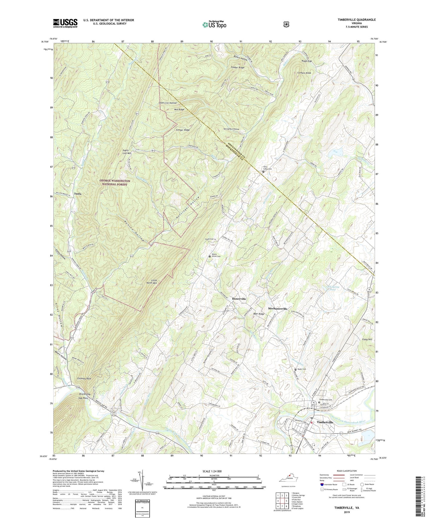
2019 topographic map quadrangle Timberville in the state of Virginia. Scale: 1:24000. Based on the newly updated USGS 7.5' US Topo map series, this map is in the following counties: Rockingham, Shenandoah. The map contains contour data, water features, and other items you are used to seeing on USGS maps, but also has updated roads and other features. This is the next generation of topographic maps. Printed on high-quality waterproof paper with UV fade-resistant inks.
Quads adjacent to this one:
West: Fulks Run
North: Orkney Springs
Northeast: Conicville
East: New Market
Southeast: Tenth Legion
South: Broadway
Southwest: Singers Glen
Contains the following named places: Antioch Church, Baer Ridge, Bethel Church, Billers Hollow, Brocks Gap, Calvary Church, Chimney Rock, Cold Spring Pond, Cook Lick Hollow, Cootes Store, Corkers Knob, Cowger Ridge, Crossroad Church, Eaton Hollow, Foley Hill, Fort Run, Gap Rock, Getz Corner, Honey Run, Honeyville, Hottinger Hollow, Kipps Gap, Kline Hollow, Mechanicsville, Middle Ridge, Moore Hollow, Moores Store, Mount Olivet Cemetery, Mount Olivet Church, Newport Church, Orebaugh School, Plains District, Plains Elementary School, Radar Church, Rader Cemetery, Riverside Gardens, Riverview Baptist Church, Runion Creek, Runion Creek School, Runion Hollow, Sager Field, Saint Johns Church, Saint Lukes Cemetery, Saint Lukes Church, Showalters Orchard And Greenhouse, Sours Run, Spring Run Hollow, Supin Lick Mountain, Timber Ridge, Timberville, Timberville Cemetery, Timberville Municipal Building, Timberville Police Department, Timberville Post Office, Timberville Volunteer Fire Department, Town of Timberville, Tunis, Turley Creek, Turner Run, Tusing Run, WSIG-FM (Mount Jackson), ZIP Codes: 22815, 22853