MyTopo
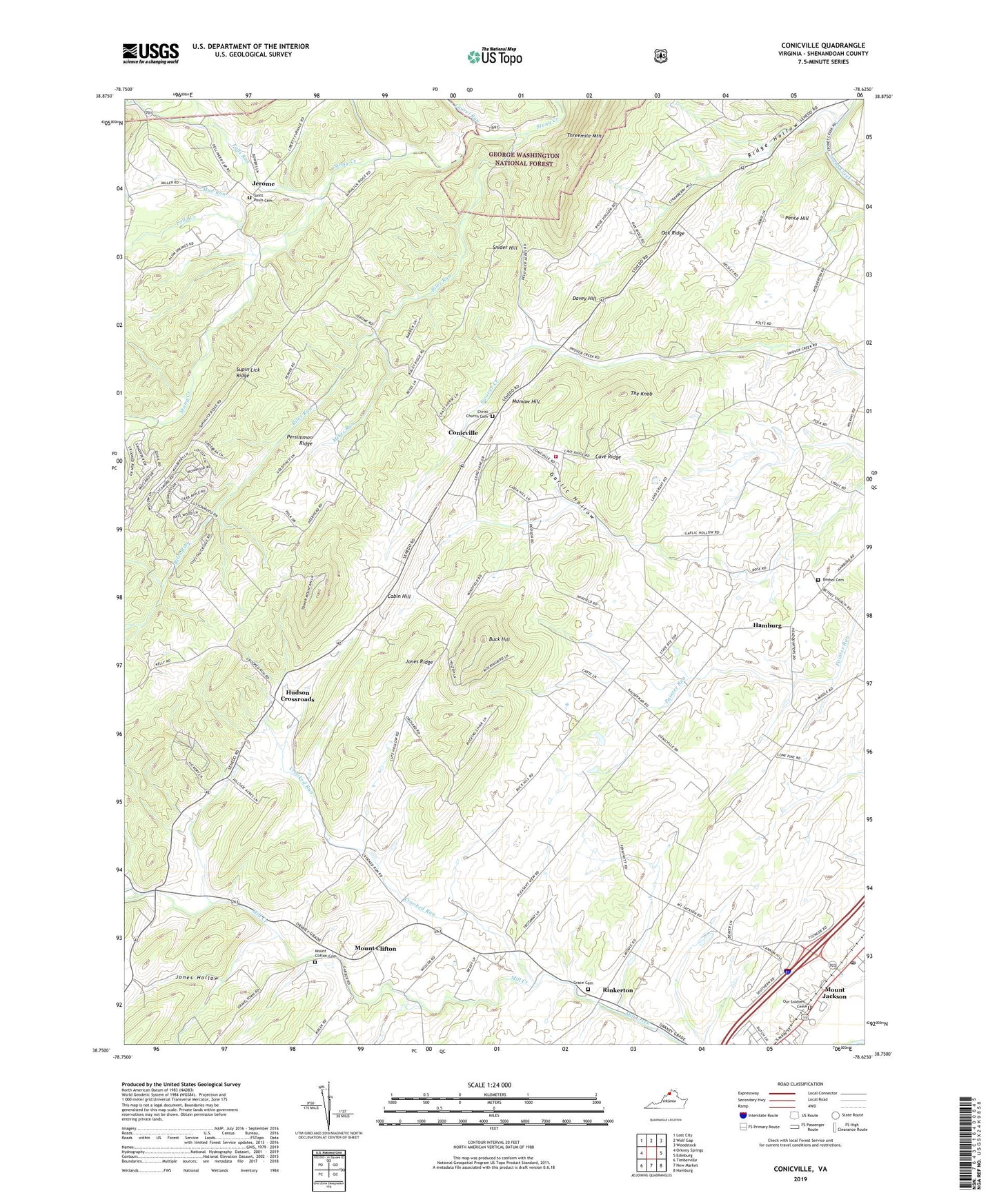
Conicville Virginia US Topo Map
Couldn't load pickup availability
Also explore the Conicville Forest Service Topo of this same quad for updated USFS data
2022 topographic map quadrangle Conicville in the state of Virginia. Scale: 1:24000. Based on the newly updated USGS 7.5' US Topo map series, this map is in the following counties: Shenandoah. The map contains contour data, water features, and other items you are used to seeing on USGS maps, but also has updated roads and other features. This is the next generation of topographic maps. Printed on high-quality waterproof paper with UV fade-resistant inks.
Quads adjacent to this one:
West: Orkney Springs
Northwest: Lost City
North: Wolf Gap
Northeast: Woodstock
East: Edinburg
Southeast: Hamburg
South: New Market
Southwest: Timberville
This map covers the same area as the classic USGS quad with code o38078g6.
Contains the following named places: Bethel Church, Bethel Lutheran Cemetery, Buck Hill, Cabin Hill, Cave Ridge, Christ Church, Christ Reformed Church Cemetery, Conicville, Crooked Run, Crossroads Baptist Bible Church, Davey Hill, Dellinger Gap, District 2, Falls Run, Foltz Creek, Garlic Hollow, Grace Cemetery, Grace Church, Hamburg, Hudson Crossroads, Jerome, Jones Hollow, Jones Ridge, Laurel Run, Mikes Run, Mount Clifton, Mount Clifton Cemetery, Mount Clifton Census Designated Place, Mount Jackson Post Office, Mud Run, Mumaw Hill, Oak Ridge, Old Iron Furnace, Otterbein Chapel, Our Soldiers Cemetery, Pence Hill, Persimmon Ridge, Pleasant View Church, Ridge Hollow, Riles Run, Rinkerton, Saint Jacobs Church, Saint Johns Church, Saint Pauls Lutheran Church, Saint Pauls Lutheran Church Cemetery, Shenandoah County Fire and Rescue Station 13 - Conicville Volunteer Fire Department, Snider Hill, Straight Run, The Knob, Zion Church, ZIP Codes: 22824, 22842