MyTopo
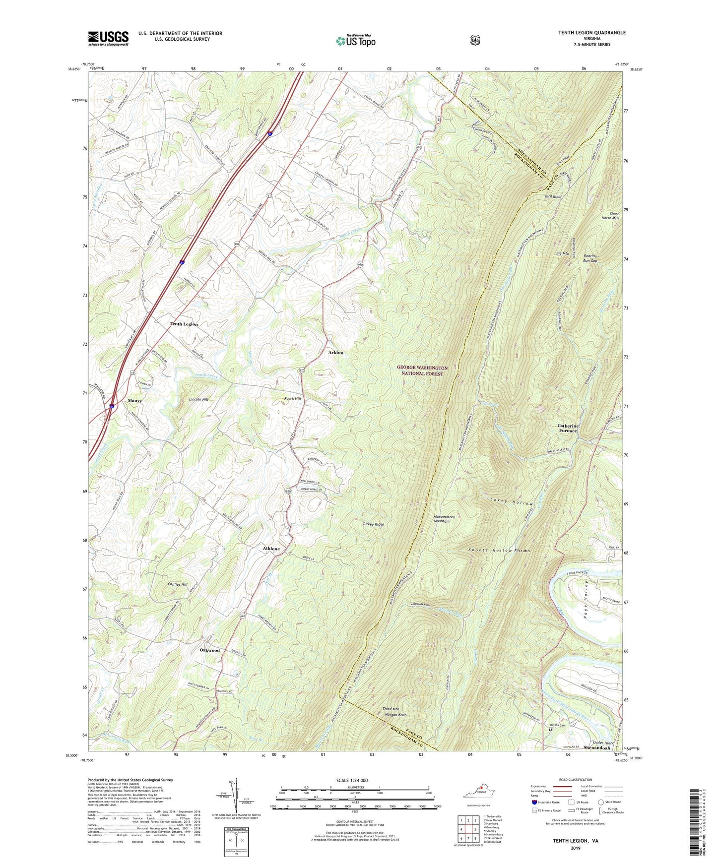
Tenth Legion Virginia US Topo Map
Couldn't load pickup availability
Also explore the Tenth Legion Forest Service Topo of this same quad for updated USFS data
2022 topographic map quadrangle Tenth Legion in the state of Virginia. Scale: 1:24000. Based on the newly updated USGS 7.5' US Topo map series, this map is in the following counties: Rockingham, Page, Shenandoah. The map contains contour data, water features, and other items you are used to seeing on USGS maps, but also has updated roads and other features. This is the next generation of topographic maps. Printed on high-quality waterproof paper with UV fade-resistant inks.
Quads adjacent to this one:
West: Broadway
Northwest: Timberville
North: New Market
Northeast: Hamburg
East: Stanley
Southeast: Elkton East
South: Elkton West
Southwest: Harrisonburg
This map covers the same area as the classic USGS quad with code o38078e6.
Contains the following named places: Arkton, Athlone, Bethlehem Church, Big Mountain, Bird Knob, Camp Fair Haven, Catherine Furnace, Concord Church, Endless Caverns, Endless Caverns Campgrounds, Fairview Church, Koontz Hollow, Lincoln Hill, Lokey Hollow, Mauzy, Morgan Knob, Morgan Run, Mountain Valley Church, Oakwood, Phillips Hill, Pitt Spring, Pitt Spring Run, Rinaca Cemetery, Roaring Run, Roaring Run Gap, Roark Hill, Saint Pauls Church, Short Horse Mountain, Tenth Legion, Third Mountain, Trinity Church, Turkey Ridge, War Branch, WHSV-TV (Harrisonburg), WSVA-TV, ZIP Code: 22849