MyTopo
Broadway Virginia US Topo Map
Couldn't load pickup availability
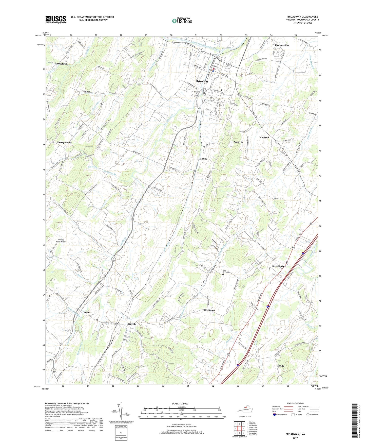
2022 topographic map quadrangle Broadway in the state of Virginia. Scale: 1:24000. Based on the newly updated USGS 7.5' US Topo map series, this map is in the following counties: Rockingham. The map contains contour data, water features, and other items you are used to seeing on USGS maps, but also has updated roads and other features. This is the next generation of topographic maps. Printed on high-quality waterproof paper with UV fade-resistant inks.
Quads adjacent to this one:
West: Singers Glen
Northwest: Fulks Run
North: Timberville
Northeast: New Market
East: Tenth Legion
Southeast: Elkton West
South: Harrisonburg
Southwest: Bridgewater
This map covers the same area as the classic USGS quad with code o38078e7.
Contains the following named places: Bethel Church, Broadway, Broadway Emergency Squad, Broadway High School, Broadway Municipal Building, Broadway Police Department, Broadway Post Office, Broadway Volunteer Fire Company, Brock Creek, Buttermilk Creek, Cedar Run, Cedar Run Church, Cherry Grove, Daphna, Daphna Creek, Dry Fork, Edom, Fellowship Church, Harrisonburg Men's Diversion Center, Hightown, J Frank Hillyard Middle School, Joes Creek, John C Myers Elementary School, Lacey Spring, Lacey Spring Elementary School, Lacey Spring Post Office, Lindale Church, Linville, Linville - Edom Elementary School, Linville Census Designated Place, Linville Creek, Linville Creek Bridge, Linville Creek Church, Linville Post Office, Linville-Edom Airport, Mayland, Melrose Caverns, Mount Tabor Church, Mountain Run, Pine Grove Cemetery, Pine Grove Church, Pleasant View Church, Round Hill, Simmers Hollow, State Prison Camp Number 8, Tide Spring, Tide Spring Branch, Town of Broadway, Trissel Church, Turleytown, WBTX-AM (Broadway-Timberville), West Fork Linville Creek, Zenda, Zion Church, ZIP Code: 22834


