MyTopo
Urbanna Virginia US Topo Map
Couldn't load pickup availability
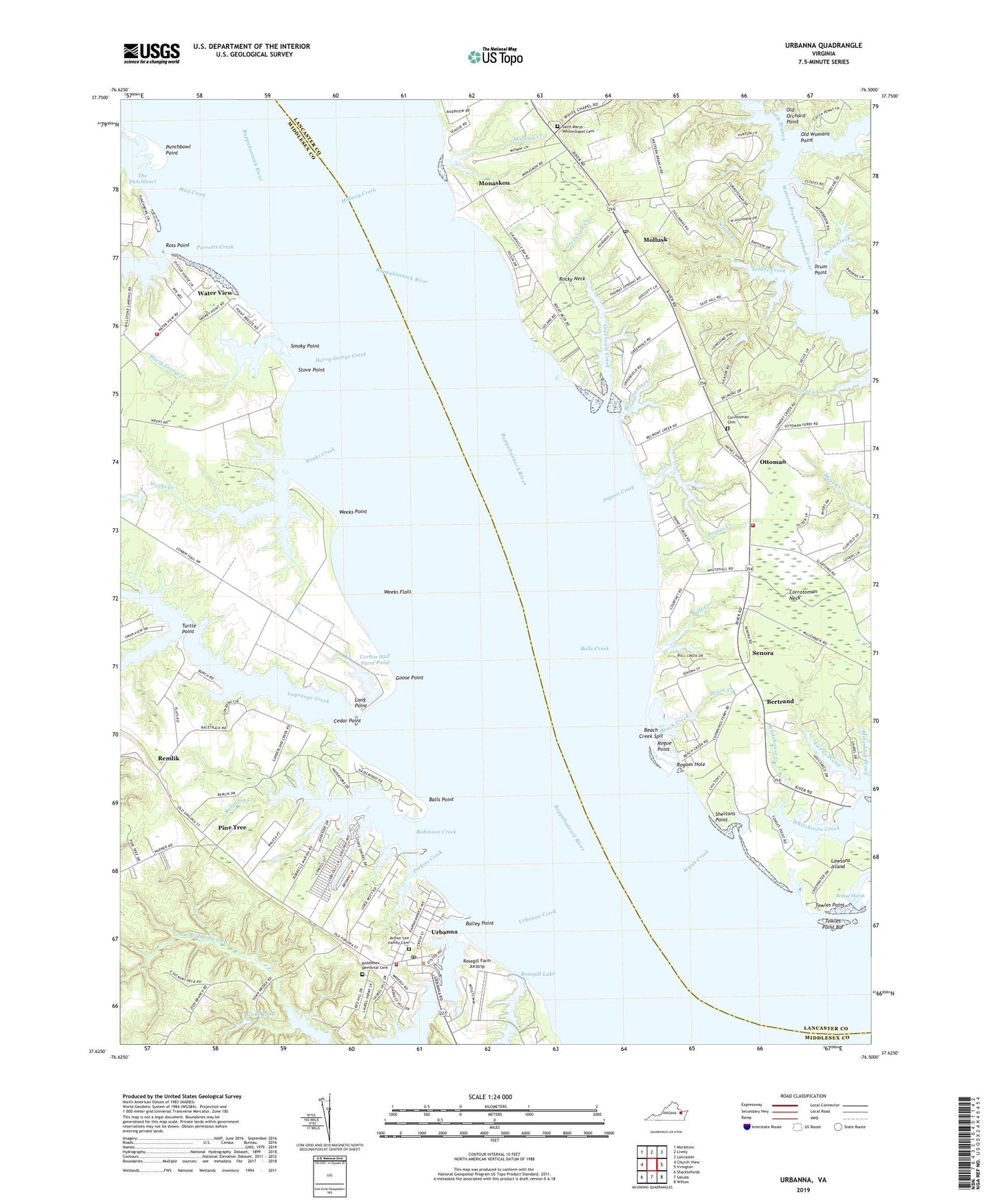
2019 topographic map quadrangle Urbanna in the state of Virginia. Scale: 1:24000. Based on the newly updated USGS 7.5' US Topo map series, this map is in the following counties: Middlesex, Lancaster. The map contains contour data, water features, and other items you are used to seeing on USGS maps, but also has updated roads and other features. This is the next generation of topographic maps. Printed on high-quality waterproof paper with UV fade-resistant inks.
Quads adjacent to this one:
West: Church View
Northwest: Morattico
North: Lively
Northeast: Lancaster
East: Irvington
Southeast: Wilton
South: Saluda
Southwest: Shacklefords
Contains the following named places: Arthur Lee Family Cemetery, Bailey Point, Balls Point, Beach Creek, Beach Creek Spit, Belmont Creek, Bertrand, Bertrand School, Bridge Marsh, Bulls Creek, Cedar Point, Central Middlesex Volunteer Rescue Squad, Chewnings Point Ferry, Corbin Hall Farm Dam, Corbin Hall Farm Pond, Corrotoman Church, Corrotoman Neck, Corrottoman Cemetery, Davis Creek, District 1, Drum Point, Ewells Prong, Glebe Pond, Glebe Swamp, Goose Point, Greenvale, Greenvale Creek, Greenvale Creek Marina, Harry George Creek, Hartsville Church, Hartsville School, Lagrange Creek, Lawsons Island, Lebannon Church, Little Branch, Locklies Landing, Long Point, Lower Rosegill Lake Dam, Middlesex Memorial Cemetery, Middlesex Volunteer Fire Department, Midway Creek, Millenbeck Prong, Mollusk, Mollusk Post Office, Monaskon, Monaskon Landing, Mud Creek, New Mollusk School, Northampton County Department of Emergency Medical Service, Old Orchard Point, Old Womans Point, Ottoman, Parrotts Creek, Paynes Creek, Perkins Creek, Pine Grove School, Pine Tree, Punchbowl Point, Queen Esther Baptist Church, Remlik, Remlik Pilgrim Church, Robinson Creek, Rocky Neck, Rogue Point, Rogues Hole, Rosegill Farm Airstrip, Rosegill Lake, Rosegill Upper Dam, Ross Point, Saint Marys White Chapel, Saint Marys Whitechapel Cemetery, Senior Creek, Senora, Sheltons Point, Smoky Point, South Branch Lagrange Creek, Stove Point, The Punchbowl, Towles Point, Towles Point Bar, Town Bridge Pond, Town Bridge Pond Dam, Town Bridge Swamp, Town of Urbanna, Turtle Point, Upper Lancaster Volunteer Fire Department Station 2, Upper Middlesex Volunteer Fire Department, Urbanna, Urbanna Creek, Urbanna Historic District, Urbanna Post Office, Urbanna Wharf, Valley Queen Church, Virginian Landing, Water View, Weeks Creek, Weeks Flats, Weeks Point, White Chapel District, Wyatt Creek, ZIP Codes: 23175, 23180