MyTopo
Lancaster Virginia US Topo Map
Couldn't load pickup availability
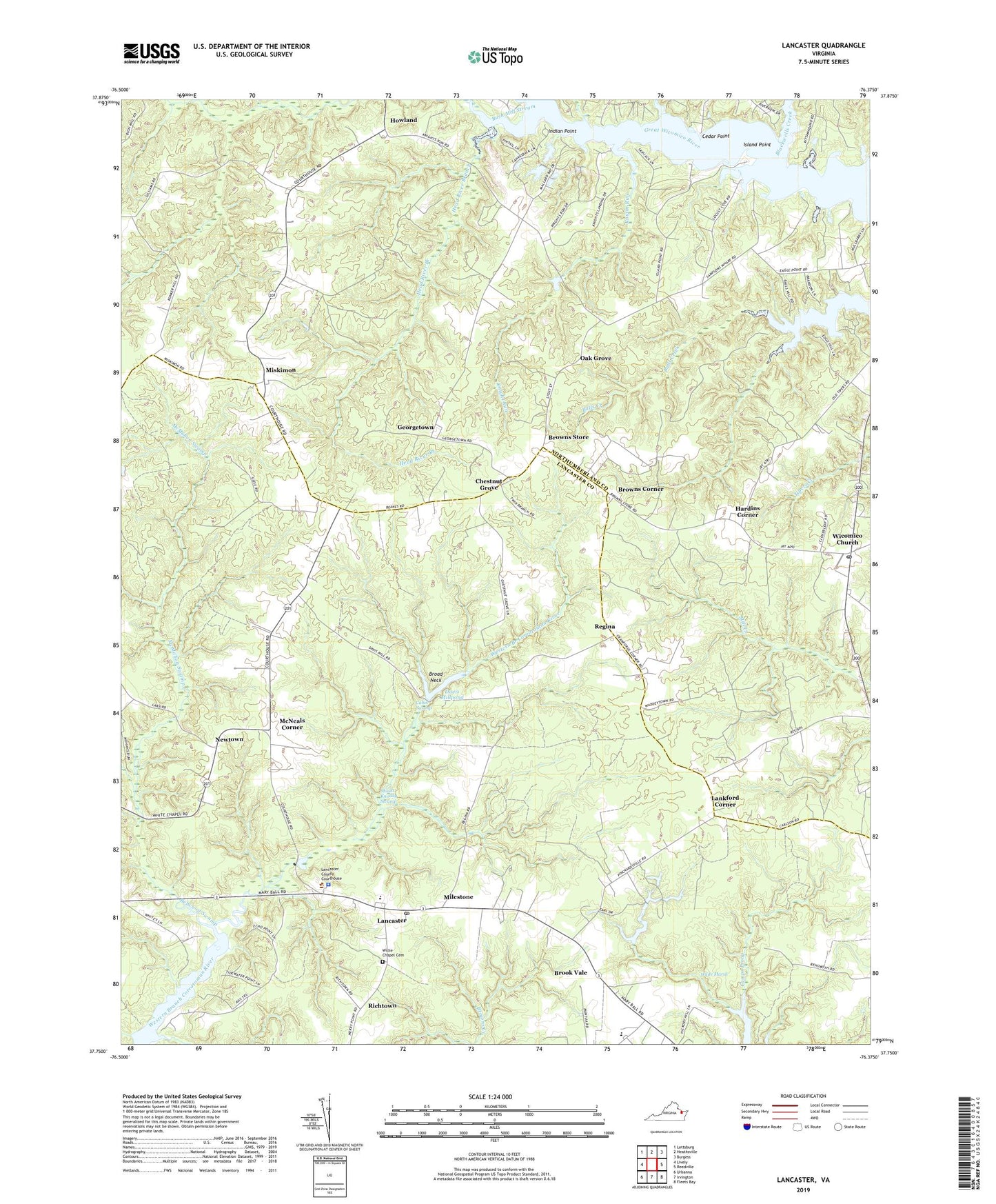
2022 topographic map quadrangle Lancaster in the state of Virginia. Scale: 1:24000. Based on the newly updated USGS 7.5' US Topo map series, this map is in the following counties: Lancaster, Northumberland. The map contains contour data, water features, and other items you are used to seeing on USGS maps, but also has updated roads and other features. This is the next generation of topographic maps. Printed on high-quality waterproof paper with UV fade-resistant inks.
Quads adjacent to this one:
West: Lively
Northwest: Lottsburg
North: Heathsville
Northeast: Burgess
East: Reedville
Southeast: Fleets Bay
South: Irvington
Southwest: Urbanna
This map covers the same area as the classic USGS quad with code o37076g4.
Contains the following named places: Beanes Corners, Beanes Mill, Belwood Swamp, Betz Landing, Blackwells Creek, Booker T Washington School, Broad Neck, Brook Vale, Brook Vale High School, Browns Corner, Browns Store, Bush Mill Stream, Cabin Swamp, Callahan Swamp, Camp Kittamaqund, Cedar Point, Cedar Point Landing, Chestnut Grove, Chestnut Grove School, Cooper Landing, Davis Mill, Davis Millpond, Deep Landing, District 2, District 3, First Baptist Church, Georgetown, Hardins Corner, Head River Branch, Howland, Howland Chapel School, Indian Point, Indian Point Landing, Island Point, Knight Run, Lancaster, Lancaster Census Designated Place, Lancaster County Emergency Medical Services, Lancaster County Sheriff's Office, Lancaster Court House Historic District, Lancaster High School, Lancaster Post Office, Lancaster Primary School, Lankford Corner, Mantua District, McMahon Swamp, McNeals Corner, Milestone, Miskimon, Miskimon Lookout Tower, Mooreland Church, Morning Star Church, Mount Knoddy Swamp, New Lancaster School, Newtown, Northumberland County, Oak Grove, Providence Church, Regina, Richtown, Sampsons Wharf, Smyrna Church, Trinity Episcopal Church, Twin Branch Milldam, Twin Branch Millpond, White Marsh, White Marsh Campground, White Marsh Church, Wicomico Church, Wicomico Church Post Office, Wicomico School, Willie Chapel, Willie Chapel Cemetery


