
MyTopo
Almota Washington US Topo Map
Couldn't load pickup availability
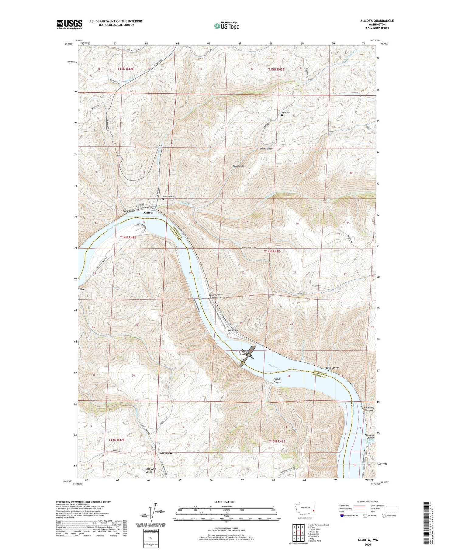
2020 topographic map quadrangle Almota in the state of Washington. Scale: 1:24000. Based on the newly updated USGS 7.5' US Topo map series, this map is in the following counties: Whitman, Garfield. The map contains contour data, water features, and other items you are used to seeing on USGS maps, but also has updated roads and other features. This is the next generation of topographic maps. Printed on high-quality waterproof paper with UV fade-resistant inks.
Quads adjacent to this one:
West: Wades Bar
Northwest: Little Penawawa Creek
North: Wilcox
Northeast: Colfax South
East: Ewartsville
Southeast: Granite Point
South: Kirby
Southwest: Gould City
Contains the following named places: Almota, Almota Creek, Boyer Marina, Buck Canyon, Davis Bar, Devils Slide, Hungate Grade, Illia Landing, Interior, Little Almota Creek, Log Cabin Island, Lower Granite Dam Heliport, Lower Granite Lake, Lower Granite Lake Dam, Lower Granite State Airport, MacMurry Canyon, Mayview, Moys Cemetery, Moys Grade, Offield Canyon, Offield Landing, Operation Fish Run, Port Almota, Spalding Cemetery, Stine Gulch, Thorn Thicket Creek, Wawawai, Wawawai Bay, Wawawai Landing, Whitman Community Hospital Heliport


