MyTopo
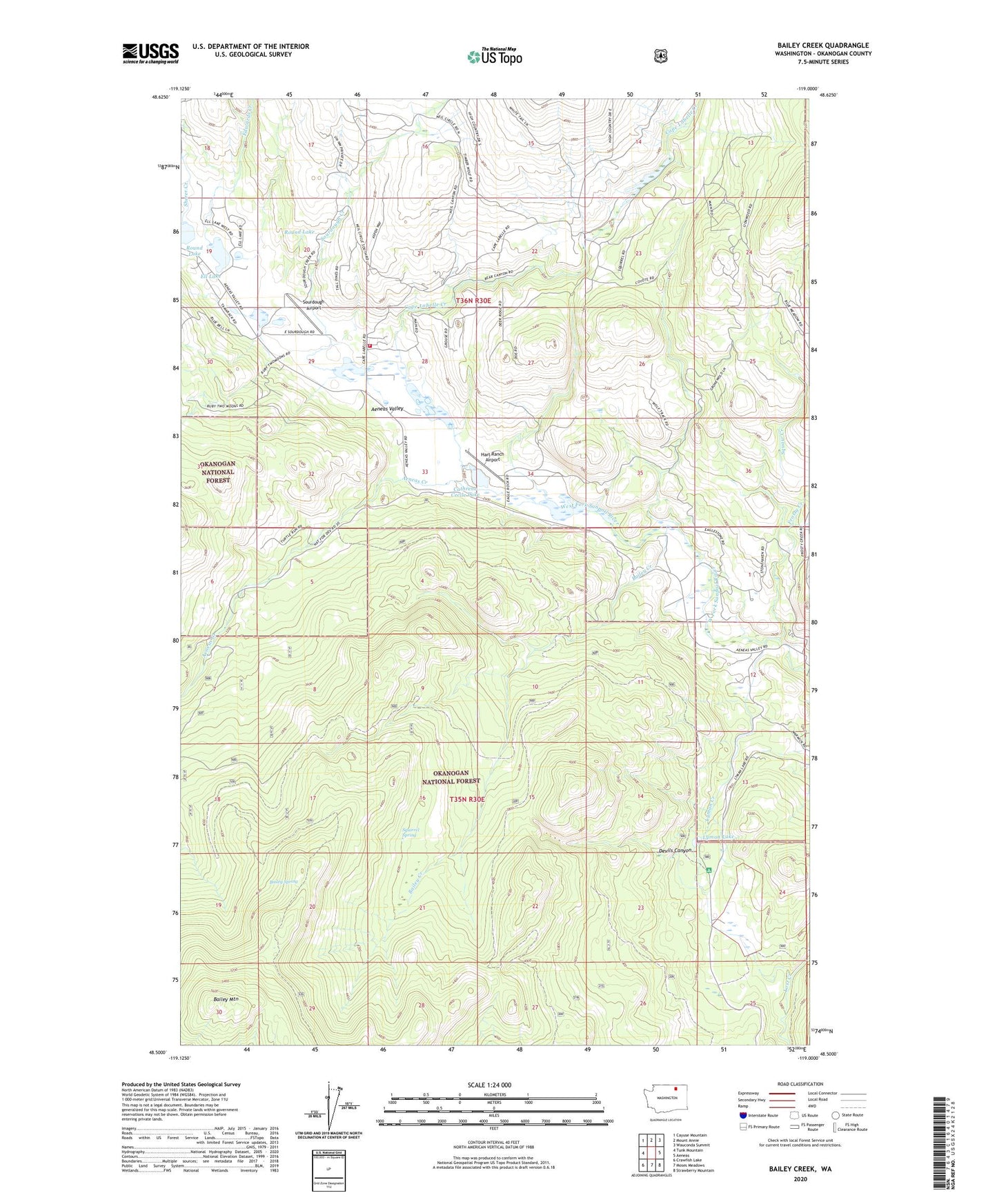
Bailey Creek Washington US Topo Map
Couldn't load pickup availability
Also explore the Bailey Creek Forest Service Topo of this same quad for updated USFS data
2023 topographic map quadrangle Bailey Creek in the state of Washington. Scale: 1:24000. Based on the newly updated USGS 7.5' US Topo map series, this map is in the following counties: Okanogan. The map contains contour data, water features, and other items you are used to seeing on USGS maps, but also has updated roads and other features. This is the next generation of topographic maps. Printed on high-quality waterproof paper with UV fade-resistant inks.
Quads adjacent to this one:
West: Tunk Mountain
Northwest: Cayuse Mountain
North: Mount Annie
Northeast: Wauconda Summit
East: Aeneas
Southeast: Strawberry Mountain
South: Moses Meadows
Southwest: Crawfish Lake
This map covers the same area as the classic USGS quad with code o48119e1.
Contains the following named places: Aeneas Creek, Aeneas Guard Station, Bailey Creek, Bailey Mountain, Bailey Spring, Cape Labelle Creek, Cathrene Cecile Lake, Devils Canyon, Edwards Creek, Ell Lake, Frosty Creek, Hart Ranch Airport, Lost Lake, Lyman Creek, Okanogan County Fire District 16 Arenas Valley, Round Lake, Sourdough Airport, Sourdough Creek, Squaw Creek, Squirrel Spring