MyTopo
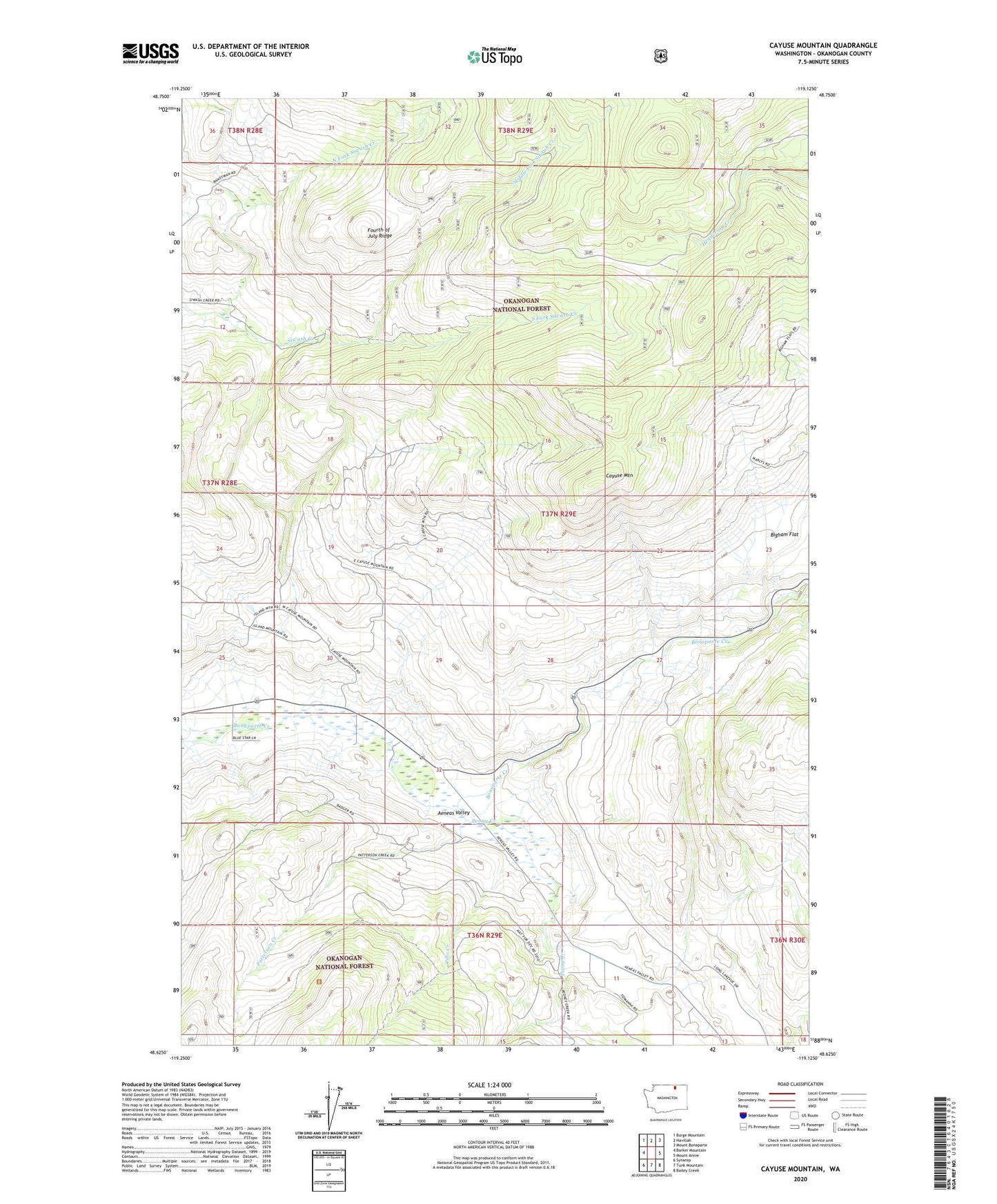
Cayuse Mountain Washington US Topo Map
Couldn't load pickup availability
Also explore the Cayuse Mountain Forest Service Topo of this same quad for updated USFS data
2023 topographic map quadrangle Cayuse Mountain in the state of Washington. Scale: 1:24000. Based on the newly updated USGS 7.5' US Topo map series, this map is in the following counties: Okanogan. The map contains contour data, water features, and other items you are used to seeing on USGS maps, but also has updated roads and other features. This is the next generation of topographic maps. Printed on high-quality waterproof paper with UV fade-resistant inks.
Quads adjacent to this one:
West: Barker Mountain
Northwest: Burge Mountain
North: Havillah
Northeast: Mount Bonaparte
East: Mount Annie
Southeast: Bailey Creek
South: Tunk Mountain
Southwest: Synarep
This map covers the same area as the classic USGS quad with code o48119f2.
Contains the following named places: Aeneas Valley, Bigham Flat, Cayuse Mountain, Cole Creek, Leese, Middle Fork Siwash Creek, North Fork Siwash Creek, North Fork Trail, Patterson Creek, Peony Creek, South Fork Siwash Creek, Sunny Slope Grange Hall