MyTopo
Bald Knob Washington US Topo Map
Couldn't load pickup availability
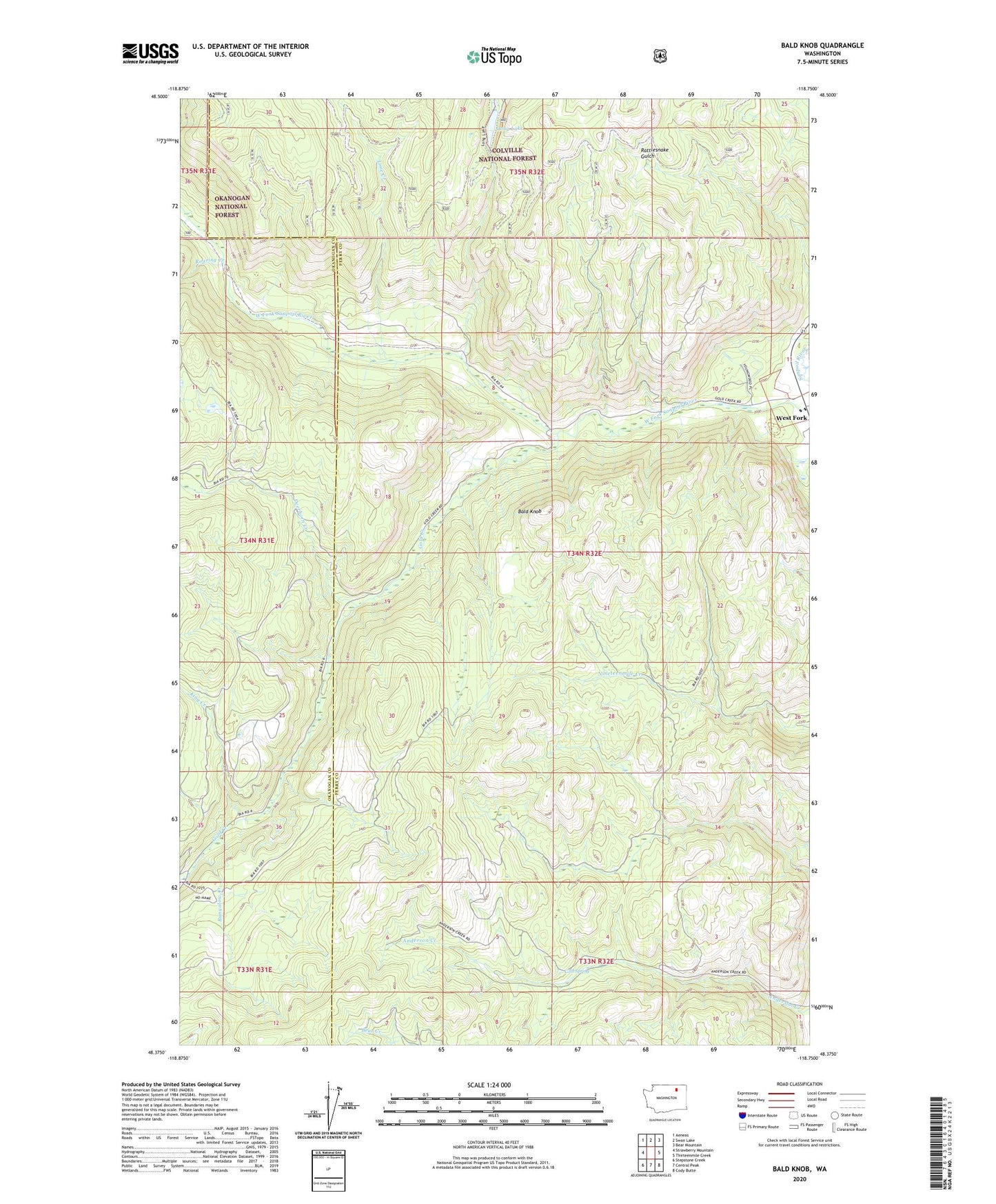
2020 topographic map quadrangle Bald Knob in the state of Washington. Scale: 1:24000. Based on the newly updated USGS 7.5' US Topo map series, this map is in the following counties: Ferry, Okanogan. The map contains contour data, water features, and other items you are used to seeing on USGS maps, but also has updated roads and other features. This is the next generation of topographic maps. Printed on high-quality waterproof paper with UV fade-resistant inks.
Quads adjacent to this one:
West: Strawberry Mountain
Northwest: Aeneas
North: Swan Lake
Northeast: Bear Mountain
East: Thirteenmile Creek
Southeast: Cody Butte
South: Central Peak
Southwest: Stepstone Creek
Contains the following named places: Bald Knob, Bungalow Creek, Bungalow Mine, Cold Spring, Deerhorn Creek, Gold Creek, King Creek, Lime Creek, Long Lake, Long Lake Campground, Rattlesnake Road, Roaring Creek, Swan Lake Trail, West Fork